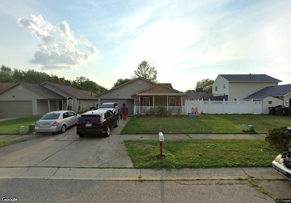
2010 Monarch Dr Middletown, OH 45044
Greenfields NeighborhoodEstimated Value: $223,416 - $247,000
3
Beds
3
Baths
1,271
Sq Ft
$188/Sq Ft
Est. Value
About This Home
This home is located at 2010 Monarch Dr, Middletown, OH 45044 and is currently estimated at $238,354, approximately $187 per square foot. 2010 Monarch Dr is a home located in Butler County with nearby schools including Mayfield Elementary School, Highview 6th Grade Center, and Middletown Middle School.
Ownership History
Date
Name
Owned For
Owner Type
Purchase Details
Closed on
Dec 8, 2017
Sold by
Mohamad Mohamad Ahmed
Bought by
Willis Teresia Tio
Current Estimated Value
Home Financials for this Owner
Home Financials are based on the most recent Mortgage that was taken out on this home.
Original Mortgage
$135,000
Interest Rate
4%
Mortgage Type
Land Contract Argmt. Of Sale
Purchase Details
Closed on
Sep 25, 2017
Sold by
Wells Fargo Bank Na
Bought by
Mohamad Mohamad Ahmed
Purchase Details
Closed on
Aug 1, 2017
Sold by
Bonelli Lawrence and Bonelli Lawrence R
Bought by
Wells Fargo Bank Na
Purchase Details
Closed on
Feb 24, 2006
Sold by
Wilson Maryjeane C
Bought by
Bonelli Lawrence R
Home Financials for this Owner
Home Financials are based on the most recent Mortgage that was taken out on this home.
Original Mortgage
$129,862
Interest Rate
6.22%
Mortgage Type
FHA
Purchase Details
Closed on
Mar 14, 2005
Sold by
Adkins Mark D and Adkins Teddra
Bought by
Wilson Maryjeane C
Home Financials for this Owner
Home Financials are based on the most recent Mortgage that was taken out on this home.
Original Mortgage
$102,000
Interest Rate
5.7%
Mortgage Type
Purchase Money Mortgage
Purchase Details
Closed on
Oct 12, 2001
Sold by
Adkins Mark D and Adkins Teddra
Bought by
Adkins Mark D and Adkins Teddra
Home Financials for this Owner
Home Financials are based on the most recent Mortgage that was taken out on this home.
Original Mortgage
$96,000
Interest Rate
6.92%
Mortgage Type
Purchase Money Mortgage
Purchase Details
Closed on
Nov 5, 1996
Sold by
Howard Matthew D
Bought by
Adkins Herman R and Adkins Nelda
Home Financials for this Owner
Home Financials are based on the most recent Mortgage that was taken out on this home.
Original Mortgage
$106,000
Interest Rate
7.8%
Mortgage Type
New Conventional
Purchase Details
Closed on
Apr 1, 1993
Purchase Details
Closed on
Jan 1, 1993
Create a Home Valuation Report for This Property
The Home Valuation Report is an in-depth analysis detailing your home's value as well as a comparison with similar homes in the area
Home Values in the Area
Average Home Value in this Area
Purchase History
| Date | Buyer | Sale Price | Title Company |
|---|---|---|---|
| Willis Teresia Tio | $140,000 | None Available | |
| Mohamad Mohamad Ahmed | $85,000 | Boston National Title | |
| Wells Fargo Bank Na | $74,000 | None Available | |
| Bonelli Lawrence R | $132,000 | None Available | |
| Wilson Maryjeane C | $127,500 | -- | |
| Adkins Mark D | -- | Midland Title Security Inc | |
| Adkins Herman R | $103,000 | -- | |
| -- | $85,500 | -- | |
| -- | $15,000 | -- |
Source: Public Records
Mortgage History
| Date | Status | Borrower | Loan Amount |
|---|---|---|---|
| Closed | Willis Teresia Tio | $135,000 | |
| Previous Owner | Bonelli Lawrence R | $129,862 | |
| Previous Owner | Wilson Maryjeane C | $102,000 | |
| Previous Owner | Adkins Mark D | $96,000 | |
| Previous Owner | Adkins Herman R | $106,000 |
Source: Public Records
Tax History Compared to Growth
Tax History
| Year | Tax Paid | Tax Assessment Tax Assessment Total Assessment is a certain percentage of the fair market value that is determined by local assessors to be the total taxable value of land and additions on the property. | Land | Improvement |
|---|---|---|---|---|
| 2024 | $3,210 | $60,560 | $6,480 | $54,080 |
| 2023 | $3,190 | $58,540 | $6,480 | $52,060 |
| 2022 | $2,511 | $42,120 | $6,480 | $35,640 |
| 2021 | $2,416 | $42,120 | $6,480 | $35,640 |
| 2020 | $2,517 | $42,120 | $6,480 | $35,640 |
| 2019 | $2,394 | $33,030 | $7,150 | $25,880 |
| 2018 | $2,139 | $33,030 | $7,150 | $25,880 |
| 2017 | $2,087 | $33,030 | $7,150 | $25,880 |
| 2016 | $2,179 | $33,030 | $7,150 | $25,880 |
| 2015 | $2,148 | $33,030 | $7,150 | $25,880 |
| 2014 | $1,836 | $33,030 | $7,150 | $25,880 |
| 2013 | $1,836 | $30,750 | $7,150 | $23,600 |
Source: Public Records
Map
Nearby Homes
- 1919 Greenfield Dr
- 2010 Waynedale Ct
- 2033 Jackson Ln
- 1811 Waynebrook Dr
- 3717 Ellis Way
- 4079 Bonita Dr Unit 4079
- 1808 Waynebrook Dr
- 2128 Lamberton St
- 3610 Roosevelt Blvd
- 1605 Lamberton St
- 1933 Sheffield St
- 4205 Helton Dr
- 2225 Sheffield St
- 3814 Lewis St
- 1804 Fernwood St
- 2212 Fernwood St
- 1728 Fernwood St
- 1030 Jackson Ln
- 3218 Keays Ave
- 1012 Jackson Ln