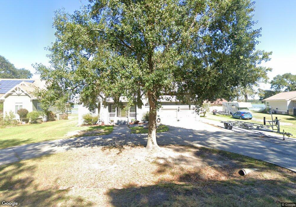
2010 Rock Fish Rd Moncks Corner, SC 29461
Estimated Value: $517,000 - $790,195
3
Beds
3
Baths
2,287
Sq Ft
$293/Sq Ft
Est. Value
About This Home
This home is located at 2010 Rock Fish Rd, Moncks Corner, SC 29461 and is currently estimated at $669,299, approximately $292 per square foot. 2010 Rock Fish Rd is a home located in Berkeley County with nearby schools including Foxbank Elementary School, Berkeley Middle School, and Berkeley High School.
Ownership History
Date
Name
Owned For
Owner Type
Purchase Details
Closed on
Apr 30, 2024
Sold by
Kiessling John A
Bought by
Kiessling John A and Kiessling Donna M
Current Estimated Value
Purchase Details
Closed on
Mar 19, 2021
Sold by
Kiessling Donna M
Bought by
Kiessling John A
Home Financials for this Owner
Home Financials are based on the most recent Mortgage that was taken out on this home.
Original Mortgage
$349,080
Interest Rate
3.05%
Mortgage Type
VA
Purchase Details
Closed on
Sep 18, 2014
Sold by
Davis Don Kenny and Davis Betty M
Bought by
Kiessling John A and Kiessling Donna M
Home Financials for this Owner
Home Financials are based on the most recent Mortgage that was taken out on this home.
Original Mortgage
$400,000
Interest Rate
4.2%
Mortgage Type
VA
Create a Home Valuation Report for This Property
The Home Valuation Report is an in-depth analysis detailing your home's value as well as a comparison with similar homes in the area
Home Values in the Area
Average Home Value in this Area
Purchase History
| Date | Buyer | Sale Price | Title Company |
|---|---|---|---|
| Kiessling John A | -- | None Listed On Document | |
| Kiessling John A | -- | Weeks & Irvine Llc | |
| Kiessling John A | $400,000 | -- |
Source: Public Records
Mortgage History
| Date | Status | Borrower | Loan Amount |
|---|---|---|---|
| Previous Owner | Kiessling John A | $349,080 | |
| Previous Owner | Kiessling John A | $400,000 |
Source: Public Records
Tax History Compared to Growth
Tax History
| Year | Tax Paid | Tax Assessment Tax Assessment Total Assessment is a certain percentage of the fair market value that is determined by local assessors to be the total taxable value of land and additions on the property. | Land | Improvement |
|---|---|---|---|---|
| 2025 | $2,110 | $489,825 | $186,931 | $302,894 |
| 2024 | $2,013 | $19,593 | $7,477 | $12,116 |
| 2023 | $2,013 | $19,593 | $7,477 | $12,116 |
| 2022 | $6,817 | $17,038 | $8,098 | $8,940 |
| 2021 | $2,042 | $16,320 | $7,731 | $8,594 |
| 2020 | $2,031 | $16,325 | $7,731 | $8,594 |
| 2019 | $2,016 | $16,325 | $7,731 | $8,594 |
| 2018 | $1,844 | $14,196 | $6,400 | $7,796 |
| 2017 | $1,725 | $14,196 | $6,400 | $7,796 |
| 2016 | $1,768 | $14,200 | $6,400 | $7,800 |
| 2015 | $1,623 | $14,200 | $6,400 | $7,800 |
| 2014 | $1,246 | $12,520 | $6,030 | $6,490 |
| 2013 | -- | $12,520 | $6,030 | $6,490 |
Source: Public Records
Map
Nearby Homes
- 1807 Perch Rd
- 1813 Albert Storm Ave
- 0 Point Comfort Rd Unit 24030382
- 0 Point Comfort Rd Unit 24030383
- 0 Point Comfort Rd Unit 24028043
- 1305 Old Rice Mill Rd
- 1811 Teal Rd
- 1401 Churchill Rd
- 1613 Westminister Way
- 1713 Pimlico Blvd
- 1019 Live Oak Ave
- 1004 Magnolia Ln
- 121 Crawdad Ct
- 118 Rice Hope Dr
- 214 Osprey Dr
- 211 Osprey Dr
- 153 Willow Brook Way
- 245 Oglethorpe Cir
- 264 Oglethorpe Cir
- 200 Oglethorpe Cir
- 2012 Rock Fish Rd
- 2008 Rock Fish Rd
- 2014 Rock Fish Rd
- 2013 Rock Fish Rd
- 2011 Rock Fish Rd
- 2016 Rock Fish Rd
- 2004 Rock Fish Rd
- 2009 Rock Fish Rd
- 2015 Rock Fish Rd
- 2018 Rock Fish Rd
- 2005 Rock Fish Rd
- 2010 Albert Storm Ave
- 2002 Rock Fish Rd
- 2008 Albert Storm Ave
- 2102 Albert Storm Ave
- 2003 Rock Fish Rd
- 2012 Albert Storm Ave
- 2114 Albert Storm Ave
- 2106 Albert Storm Ave
- 2000 Rock Fish Rd