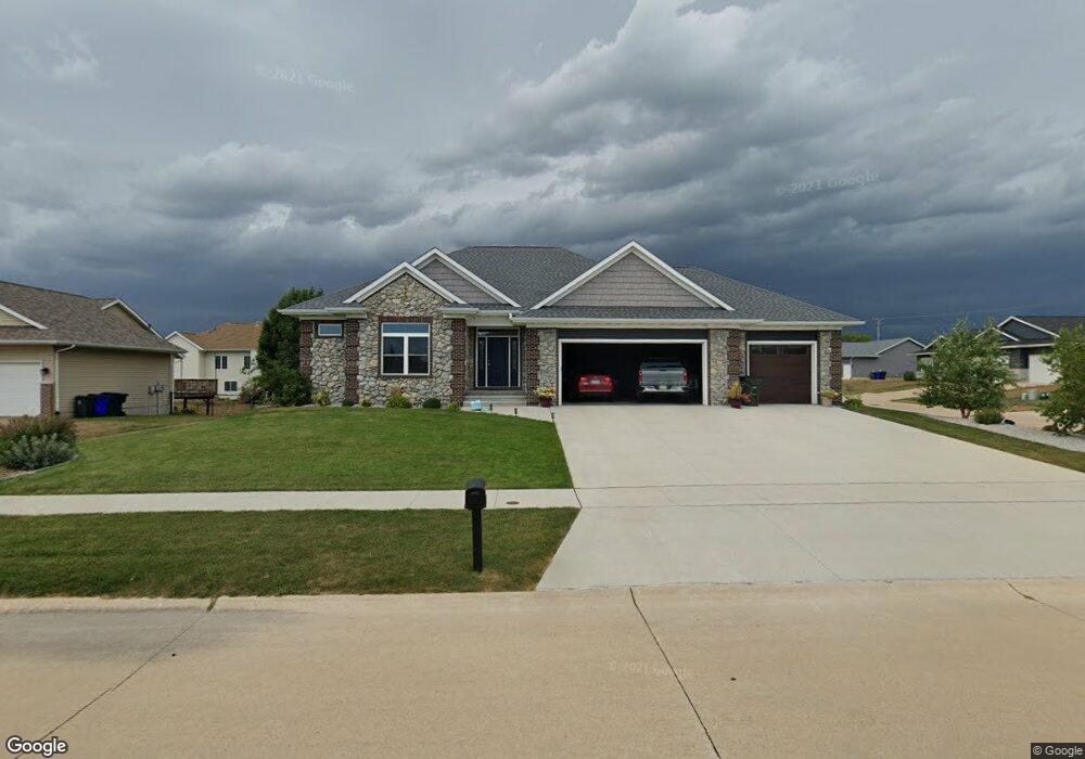
2010 Taft Dr SW Cedar Rapids, IA 52404
Estimated Value: $333,000 - $548,000
4
Beds
4
Baths
1,802
Sq Ft
$266/Sq Ft
Est. Value
About This Home
This home is located at 2010 Taft Dr SW, Cedar Rapids, IA 52404 and is currently estimated at $479,442, approximately $266 per square foot. 2010 Taft Dr SW is a home with nearby schools including Prairie Heights Elementary School, Prairie View Elementary School, and Prairie Crest Elementary School.
Ownership History
Date
Name
Owned For
Owner Type
Purchase Details
Closed on
Jul 7, 2022
Sold by
Whitters Todd W and Whitters Kimberly A
Bought by
Severson Patrick M and Severson Maggie M
Current Estimated Value
Home Financials for this Owner
Home Financials are based on the most recent Mortgage that was taken out on this home.
Original Mortgage
$380,000
Outstanding Balance
$361,527
Interest Rate
5.09%
Mortgage Type
New Conventional
Estimated Equity
$117,915
Purchase Details
Closed on
Mar 9, 2018
Sold by
Sevig Development Lc
Bought by
Whitters Todd W and Whitters Kimberly A
Create a Home Valuation Report for This Property
The Home Valuation Report is an in-depth analysis detailing your home's value as well as a comparison with similar homes in the area
Home Values in the Area
Average Home Value in this Area
Purchase History
| Date | Buyer | Sale Price | Title Company |
|---|---|---|---|
| Severson Patrick M | $510,000 | None Listed On Document | |
| Whitters Todd W | $46,000 | None Available |
Source: Public Records
Mortgage History
| Date | Status | Borrower | Loan Amount |
|---|---|---|---|
| Open | Severson Patrick M | $380,000 |
Source: Public Records
Tax History Compared to Growth
Tax History
| Year | Tax Paid | Tax Assessment Tax Assessment Total Assessment is a certain percentage of the fair market value that is determined by local assessors to be the total taxable value of land and additions on the property. | Land | Improvement |
|---|---|---|---|---|
| 2025 | $9,716 | $519,700 | $79,200 | $440,500 |
| 2024 | $9,390 | $523,200 | $79,200 | $444,000 |
| 2023 | $9,390 | $523,200 | $79,200 | $444,000 |
| 2022 | $9,052 | $432,700 | $72,000 | $360,700 |
| 2021 | $8,830 | $425,500 | $64,800 | $360,700 |
| 2020 | $8,830 | $396,400 | $60,000 | $336,400 |
| 2019 | $946 | $42,200 | $42,200 | $0 |
| 2018 | $920 | $42,200 | $42,200 | $0 |
| 2017 | $1,004 | $46,400 | $46,400 | $0 |
| 2016 | $1,004 | $46,400 | $46,400 | $0 |
| 2015 | $1,000 | $46,440 | $46,440 | $0 |
| 2014 | $1,000 | $6,946 | $6,946 | $0 |
| 2013 | $142 | $6,946 | $6,946 | $0 |
Source: Public Records
Map
Nearby Homes
- 6614 Scarlet Rose Cir SW
- 1410 Scarlet Sage Dr SW
- 1719 Prairie Rose Dr SW
- 5810 Bethpage Cir SW
- 6612 Artesa Bell Dr SW
- 7113 Chenango Ln SW
- 6812 Artesa Bell Dr SW
- 7006 Colpepper Dr SW
- Lot 6 College Farms 5th Addition SW
- 5112 Scenic View Ct SW
- Lot 2
- Tbd Old River Rd SW
- 4240 Briar Ridge Ct
- 51 Oklahoma Ave SW
- 5655 Deerwood St SW
- 6620 Preston Terrace Ct SW
- 3728 Sunshine St SW
- 62 Oklahoma Ave SW
- 5610 Briarwood St SW
- 0 41st Avenue Dr SW Unit 202507355
- 2002 Taft Dr SW
- 6400 Hoover Trail Rd SW
- 1919 Hoover Trail Cir SW
- 1913 Hoover Trail Cir SW
- 6325 Hoover Trail Rd SW
- 6403 Grant Ct SW
- 1912 Taft Dr SW
- 1907 Hoover Trail Cir SW
- 6407 Hoover Trail Rd SW
- 6409 Grant Ct SW
- 6313 Hoover Trail Rd SW
- 1906 Taft Dr SW
- 6308 Hoover Trail Rd SW
- 1901 Hoover Trail Cir SW
- 6402 Grant Ct SW
- 6413 Hoover Trail Rd SW
- 6416 Hoover Trail Rd SW
- 1908 Hoover Trail Cir SW
- 6413 Grant Ct SW
- 6408 Grant Ct SW