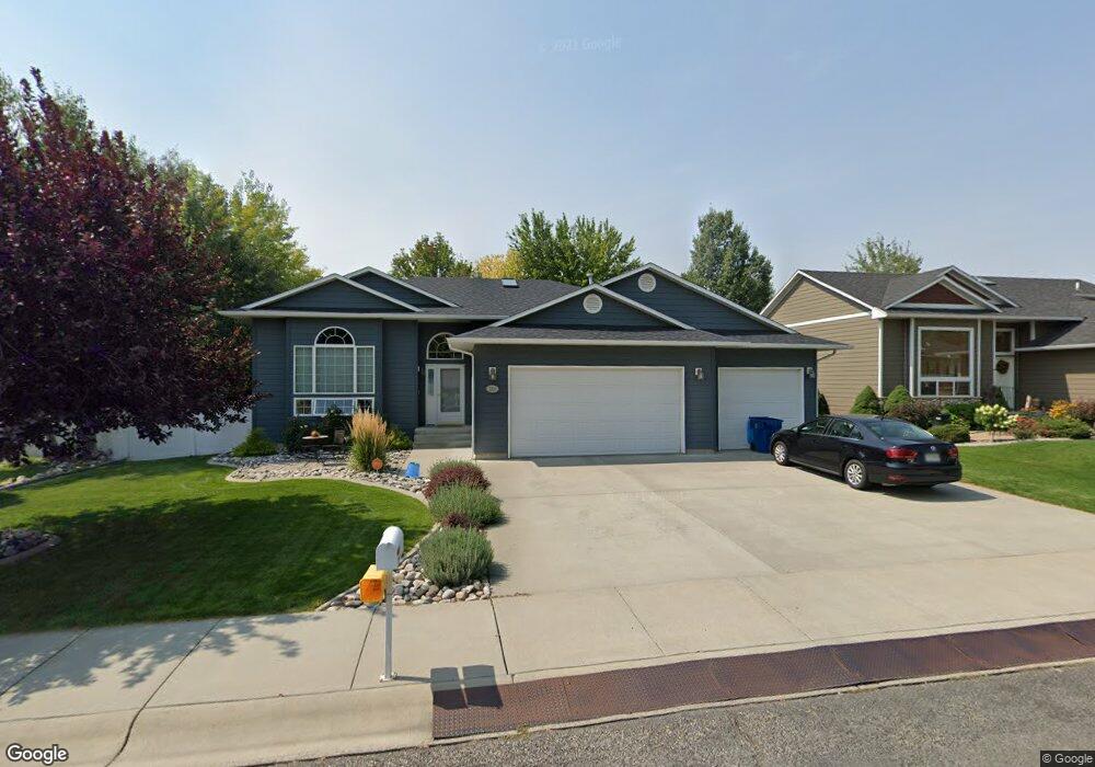
2010 Tanner Ln Billings, MT 59102
North Central Billings NeighborhoodEstimated Value: $402,000 - $473,000
4
Beds
3
Baths
2,345
Sq Ft
$189/Sq Ft
Est. Value
About This Home
This home is located at 2010 Tanner Ln, Billings, MT 59102 and is currently estimated at $442,429, approximately $188 per square foot. 2010 Tanner Ln is a home located in Yellowstone County with nearby schools including Arrowhead School, Ben Steele Middle School, and Billings West High School.
Ownership History
Date
Name
Owned For
Owner Type
Purchase Details
Closed on
Apr 23, 2012
Sold by
Bulley Peter B and Bulley Lori Ann
Bought by
Newrones Roland and Newrones Molly
Current Estimated Value
Home Financials for this Owner
Home Financials are based on the most recent Mortgage that was taken out on this home.
Original Mortgage
$256,405
Outstanding Balance
$177,018
Interest Rate
3.9%
Mortgage Type
New Conventional
Estimated Equity
$265,411
Purchase Details
Closed on
May 5, 2006
Sold by
Monk Johnson Edward W and Monk Johnson Ruth
Bought by
Bulley Peter B and Bulley Lori Ann
Home Financials for this Owner
Home Financials are based on the most recent Mortgage that was taken out on this home.
Original Mortgage
$190,000
Interest Rate
6.3%
Mortgage Type
New Conventional
Create a Home Valuation Report for This Property
The Home Valuation Report is an in-depth analysis detailing your home's value as well as a comparison with similar homes in the area
Home Values in the Area
Average Home Value in this Area
Purchase History
| Date | Buyer | Sale Price | Title Company |
|---|---|---|---|
| Newrones Roland | -- | None Available | |
| Bulley Peter B | -- | None Available |
Source: Public Records
Mortgage History
| Date | Status | Borrower | Loan Amount |
|---|---|---|---|
| Open | Newrones Roland | $256,405 | |
| Previous Owner | Bulley Peter B | $190,000 |
Source: Public Records
Tax History Compared to Growth
Tax History
| Year | Tax Paid | Tax Assessment Tax Assessment Total Assessment is a certain percentage of the fair market value that is determined by local assessors to be the total taxable value of land and additions on the property. | Land | Improvement |
|---|---|---|---|---|
| 2025 | $4,037 | $462,200 | $81,460 | $380,740 |
| 2024 | $4,037 | $414,100 | $78,715 | $335,385 |
| 2023 | $4,016 | $414,100 | $78,715 | $335,385 |
| 2022 | $3,443 | $309,700 | $62,974 | $246,726 |
| 2021 | $3,257 | $309,700 | $0 | $0 |
| 2020 | $3,325 | $302,300 | $0 | $0 |
| 2019 | $3,175 | $302,300 | $0 | $0 |
| 2018 | $3,163 | $295,800 | $0 | $0 |
| 2017 | $3,070 | $295,800 | $0 | $0 |
| 2016 | $2,898 | $280,200 | $0 | $0 |
| 2015 | $2,799 | $280,200 | $0 | $0 |
| 2014 | $2,397 | $126,511 | $0 | $0 |
Source: Public Records
Map
Nearby Homes
- 2020 Swanson Ln
- 3720 Parkhill Dr
- 3865 Avenue C
- 1818 Tiburon Ln
- 1747 Tiburon Ln
- 1713 Tiburon Ln
- 3743 Hayden Dr
- 2213 Westfield Dr
- 2301 Elsa Dr
- 4044 Backwoods Dr
- 3654 Donna Dr
- TBD Rimrock Rd
- 4342 Rangeview Dr
- 3928 Audubon Way
- 3441 Poly Dr Unit 19
- 3441 Poly Dr Unit 15
- 2510 Zimmerman Trail
- 2280 Ridgewood Ln S
- 3935 Pine Cove Rd
- 2786 Zimmerman Trail
- 1830 Tanner Dr
- 2030 Tanner Ln
- 1998 Tanner Ln
- 2011 Country Manor Blvd
- 2031 Country Manor Blvd
- 1999 Country Manor Blvd
- 3865 Parkhill Dr
- 2050 Tanner Ln
- 1968 Tanner Ln
- 1969 Country Manor Blvd
- 2061 Tanner Ln
- 3884 Fairmeadow Dr
- 3864 Parkhill Dr
- 1938 Tanner Ln
- 3854 Fairmeadow Dr
- 3894 Fairmeadow Dr
- 1939 Country Manor Blvd
- 3854 Parkhill Dr
- 3926 Parkhill Dr
- 3845 Parkhill Dr