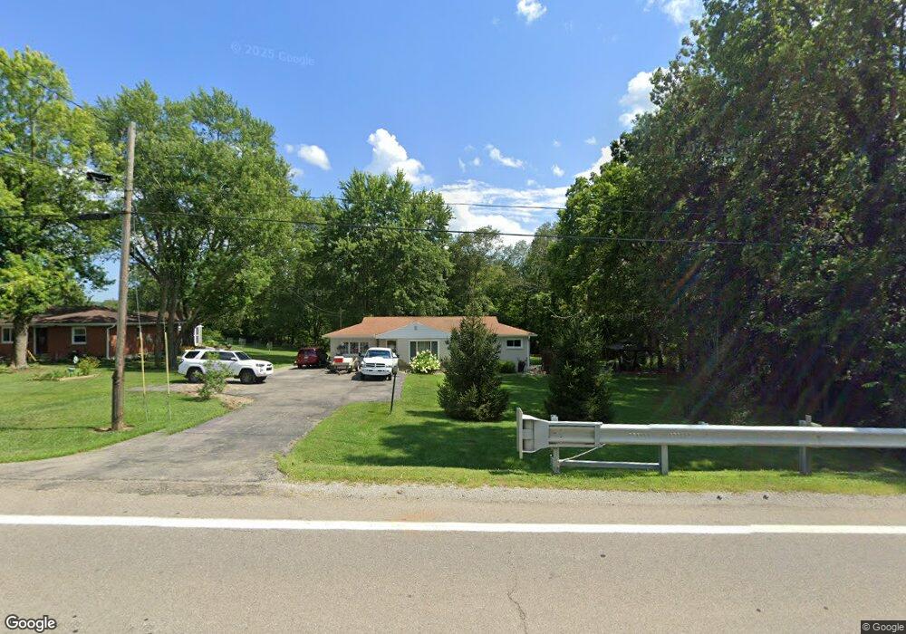
2010 U S 42 Lebanon, OH 45036
Estimated Value: $243,000 - $324,000
3
Beds
1
Bath
1,352
Sq Ft
$209/Sq Ft
Est. Value
About This Home
This home is located at 2010 U S 42, Lebanon, OH 45036 and is currently estimated at $282,888, approximately $209 per square foot. 2010 U S 42 is a home located in Warren County with nearby schools including Bowman Primary School, Berry Intermediate School, and Donovan Elementary School.
Ownership History
Date
Name
Owned For
Owner Type
Purchase Details
Closed on
Aug 5, 2016
Sold by
Schappacher Leonard and Schappacher Sherry A
Bought by
Hines Andrea and Hines Dylan
Current Estimated Value
Purchase Details
Closed on
Jan 9, 2012
Sold by
Federal Home Loan Mortgage Corporation
Bought by
Schappacher Leonard and Schappacher Sherry A
Home Financials for this Owner
Home Financials are based on the most recent Mortgage that was taken out on this home.
Original Mortgage
$48,000
Interest Rate
3.91%
Mortgage Type
Future Advance Clause Open End Mortgage
Purchase Details
Closed on
Jul 1, 2011
Sold by
Sams Troy D
Bought by
Federal Home Loan Mortgage Corporation
Purchase Details
Closed on
Dec 6, 1995
Sold by
Niblack Rita
Bought by
Sams Troy D
Home Financials for this Owner
Home Financials are based on the most recent Mortgage that was taken out on this home.
Original Mortgage
$76,000
Interest Rate
7.52%
Mortgage Type
New Conventional
Purchase Details
Closed on
Dec 31, 1990
Sold by
Steininger Steininger and Steininger Rita
Bought by
Niblack Niblack and Niblack Rita
Purchase Details
Closed on
Feb 2, 1987
Sold by
Steininger Steininger and Steininger Gordon
Bought by
Steininger Steininger and Steininger Rita
Create a Home Valuation Report for This Property
The Home Valuation Report is an in-depth analysis detailing your home's value as well as a comparison with similar homes in the area
Home Values in the Area
Average Home Value in this Area
Purchase History
| Date | Buyer | Sale Price | Title Company |
|---|---|---|---|
| Hines Andrea | $145,000 | Attorney | |
| Schappacher Leonard | $70,000 | Prodigy Title | |
| Federal Home Loan Mortgage Corporation | $73,334 | None Available | |
| Sams Troy D | $80,000 | -- | |
| Niblack Niblack | $57,400 | -- | |
| Steininger Steininger | -- | -- |
Source: Public Records
Mortgage History
| Date | Status | Borrower | Loan Amount |
|---|---|---|---|
| Previous Owner | Schappacher Leonard | $48,000 | |
| Previous Owner | Sams Troy D | $76,000 |
Source: Public Records
Tax History Compared to Growth
Tax History
| Year | Tax Paid | Tax Assessment Tax Assessment Total Assessment is a certain percentage of the fair market value that is determined by local assessors to be the total taxable value of land and additions on the property. | Land | Improvement |
|---|---|---|---|---|
| 2024 | $2,965 | $69,450 | $25,440 | $44,010 |
| 2023 | $2,428 | $50,753 | $12,313 | $38,440 |
| 2022 | $2,398 | $50,754 | $12,313 | $38,441 |
| 2021 | $2,265 | $50,754 | $12,313 | $38,441 |
| 2020 | $2,215 | $41,944 | $10,175 | $31,770 |
| 2019 | $2,227 | $41,944 | $10,175 | $31,770 |
| 2018 | $2,027 | $41,944 | $10,175 | $31,770 |
| 2017 | $2,164 | $39,897 | $9,828 | $30,069 |
| 2016 | $2,445 | $39,897 | $9,828 | $30,069 |
| 2015 | $2,503 | $39,897 | $9,828 | $30,069 |
| 2014 | $2,451 | $37,290 | $9,180 | $28,100 |
| 2013 | $2,037 | $41,310 | $10,170 | $31,140 |
Source: Public Records
Map
Nearby Homes
- 2240 Bone Rd
- 826 W Turtlecreek Union Rd
- 378 Natalie Ln
- 1273 Weathervane Way
- 1304 Weathervane Way
- 295 Countryside Dr
- 256 Countryside Dr
- 1234 Chestnut Ct
- 504 Cherry Hill Ln
- 3606 Acadia Ln
- 3675 Silver Queen Ct
- A Ohio 63
- B Ohio 63
- 3756 Silver Queen Ct
- 3699 Avalon Trail
- 3866 Silver Queen Ct
- 504 Creekside Ln
- Kingsmark Plan at Creekside Landing - Prestige
- Mayfair II Plan at Creekside Landing - Prestige
- Lionsworth Plan at Creekside Landing - Prestige
- 2010 N Us Route 42
- 2010 S Us Route 42
- 2010 S Us Route 42
- 2010 Route 42
- 2000 U S 42
- 2000 S Us Route 42
- 2040 S Us Route 42
- 1986 S Us Route 42
- 1970 S Us Route 42
- 2054 S Us Route 42
- 1954 U S 42
- 1954 S Us Route 42
- 2069 Us-42
- 2055 S Us Route 42
- 2069 S Us Route 42
- 2069 S State Route 42
- 2069 U S 42
- 1997 S Us Route 42
- 1997 S U S 42
- 1942 U S 42