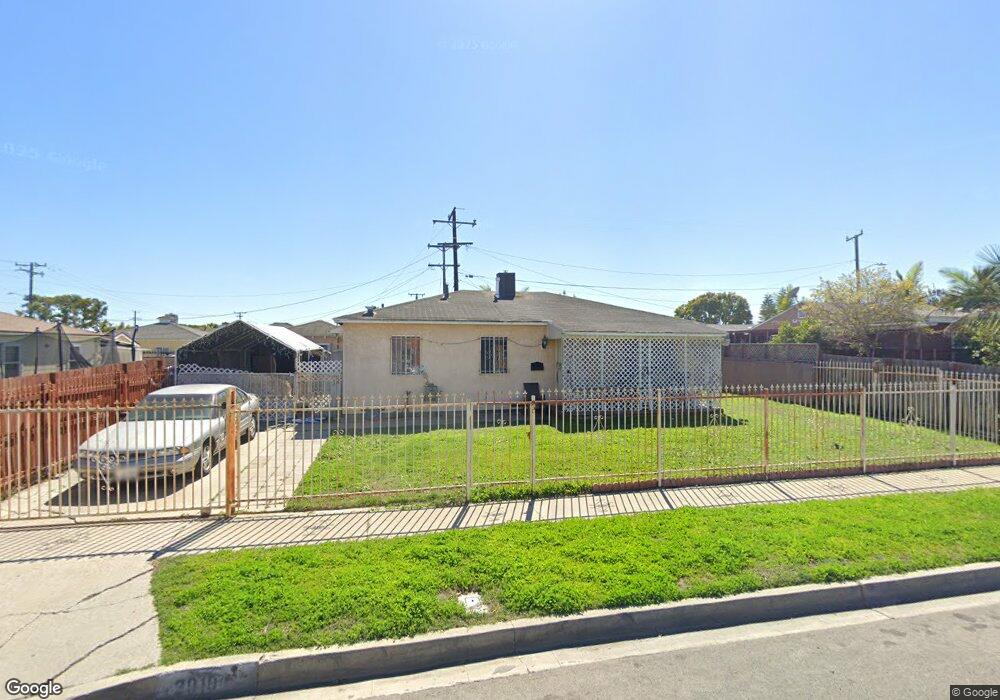
2010 W 132nd St Los Angeles, CA 90059
Estimated Value: $577,010 - $744,000
3
Beds
1
Bath
962
Sq Ft
$667/Sq Ft
Est. Value
About This Home
This home is located at 2010 W 132nd St, Los Angeles, CA 90059 and is currently estimated at $641,253, approximately $666 per square foot. 2010 W 132nd St is a home located in Los Angeles County with nearby schools including McKinley Elementary School, Enterprise Middle School, and Centennial High School.
Ownership History
Date
Name
Owned For
Owner Type
Purchase Details
Closed on
Dec 11, 2024
Sold by
Brooks Hazel Lee
Bought by
2010 West 132Nd Street Family Revocable Livin and Brooks
Current Estimated Value
Purchase Details
Closed on
Jun 21, 2007
Sold by
Brooks Hazel L
Bought by
Brooks Willie
Home Financials for this Owner
Home Financials are based on the most recent Mortgage that was taken out on this home.
Original Mortgage
$544,185
Interest Rate
6%
Mortgage Type
Reverse Mortgage Home Equity Conversion Mortgage
Purchase Details
Closed on
Sep 11, 1995
Sold by
Johnson Curtis and Johnson Elizabeth
Bought by
Brooks Willie
Home Financials for this Owner
Home Financials are based on the most recent Mortgage that was taken out on this home.
Original Mortgage
$109,200
Interest Rate
7.8%
Create a Home Valuation Report for This Property
The Home Valuation Report is an in-depth analysis detailing your home's value as well as a comparison with similar homes in the area
Home Values in the Area
Average Home Value in this Area
Purchase History
| Date | Buyer | Sale Price | Title Company |
|---|---|---|---|
| 2010 West 132Nd Street Family Revocable Livin | -- | None Listed On Document | |
| Brooks Willie | -- | Lenders Choice Title Company | |
| Brooks Willie | $115,000 | California Counties Title Co |
Source: Public Records
Mortgage History
| Date | Status | Borrower | Loan Amount |
|---|---|---|---|
| Previous Owner | Brooks Willie | $544,185 | |
| Previous Owner | Brooks Willie | $109,200 |
Source: Public Records
Tax History Compared to Growth
Tax History
| Year | Tax Paid | Tax Assessment Tax Assessment Total Assessment is a certain percentage of the fair market value that is determined by local assessors to be the total taxable value of land and additions on the property. | Land | Improvement |
|---|---|---|---|---|
| 2025 | $3,972 | $191,010 | $91,519 | $99,491 |
| 2024 | $3,972 | $187,266 | $89,725 | $97,541 |
| 2023 | $3,975 | $183,595 | $87,966 | $95,629 |
| 2022 | $3,770 | $179,996 | $86,242 | $93,754 |
| 2021 | $3,477 | $176,467 | $84,551 | $91,916 |
| 2019 | $3,675 | $171,236 | $82,045 | $89,191 |
| 2018 | $3,583 | $167,880 | $80,437 | $87,443 |
| 2016 | $3,349 | $161,363 | $77,314 | $84,049 |
| 2015 | $3,216 | $158,940 | $76,153 | $82,787 |
| 2014 | $3,166 | $155,828 | $74,662 | $81,166 |
Source: Public Records
Map
Nearby Homes
- 2006 N Belhaven Ave
- 1813 W 134th St
- 12929 S Central Ave
- 1918 W Piru St
- 2030 N Salinas Ave
- 825 Sweetbay Ln
- 1716 W Piru St
- 1619 W 136th St
- 1417 W Stockwell St
- 1202 E 127th St
- 13323 Mckinley Ave
- 2203 N Slater Ave
- 12824 Mckinley Ave
- 13308 Traub Ave
- 810 W 133rd St
- 1242 W 134th St
- 1302 W 132nd St
- 633 E 136th St
- 14003 S Nestor Ave
- 1201 W 138th St
- 2118 N Bahama Ave
- 2119 N Central Ave
- 2113 N Central Ave
- 2114 N Bahama Ave
- 2109 N Central Ave
- 2110 N Bahama Ave
- 2007 W 132nd St
- 2103 W 132nd St
- 2001 W 132nd St
- 2105 N Central Ave
- 2106 N Bahama Ave
- 2107 W 132nd St
- 2119 N Bahama Ave
- 2111 W 132nd St
- 2113 N Bahama Ave
- 2101 N Central Ave
- 2102 N Bahama Ave
- 2109 N Bahama Ave
- 13109 S Central Ave
- 2115 W 132nd St