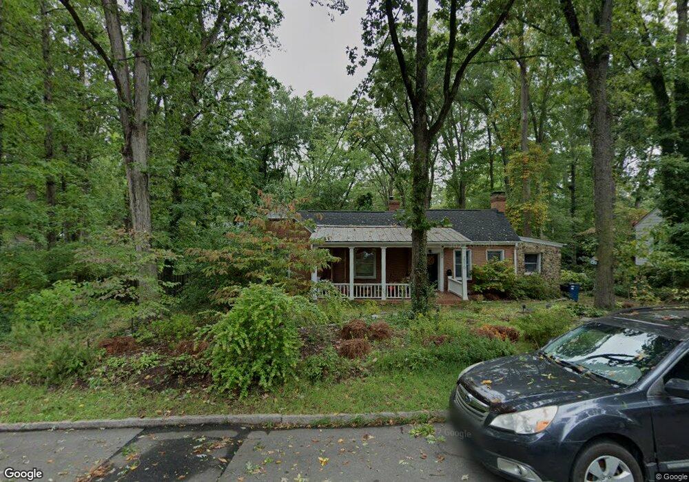
2010 Wilson St Durham, NC 27705
Watts Hospital-Hillandale NeighborhoodEstimated Value: $554,000 - $678,000
About This Home
This home is located at 2010 Wilson St, Durham, NC 27705 and is currently estimated at $603,580, approximately $358 per square foot. 2010 Wilson St is a home located in Durham County with nearby schools including E K Powe Elementary, W.G. Pearson Elementary School, and Brogden Middle.
Ownership History
We collect this data history from publicly available records. To have your information removed, we recommend requesting removal directly through your county’s website.
Purchase Details
Home Financials for this Owner
Home Financials are based on the most recent Mortgage that was taken out on this home.Purchase Details
Home Financials for this Owner
Home Financials are based on the most recent Mortgage that was taken out on this home.Home Values in the Area
Average Home Value in this Area
Purchase History
We collect this data history from publicly available records. To have your information removed, we recommend requesting removal directly through your county’s website.
| Date | Buyer | Sale Price | Title Company |
|---|---|---|---|
| $210,000 | None Available | ||
| $150,000 | Fidelity National Title Ins |
Mortgage History
We collect this data history from publicly available records. To have your information removed, we recommend requesting removal directly through your county’s website.
| Date | Status | Borrower | Loan Amount |
|---|---|---|---|
| Open | $168,000 | ||
| Previous Owner | $120,000 |
Tax History
We collect this data history from publicly available records. To have your information removed, we recommend requesting removal directly through your county’s website.
| Year | Tax Paid | Tax Assessment Tax Assessment Total Assessment is a certain percentage of the fair market value that is determined by local assessors to be the total taxable value of land and additions on the property. | Land | Improvement |
|---|---|---|---|---|
| 2025 | $5,519 | $556,731 | $354,375 | $202,356 |
| 2024 | $5,117 | $366,853 | $121,050 | $245,803 |
| 2023 | $4,805 | $366,853 | $121,050 | $245,803 |
| 2022 | $4,695 | $366,853 | $121,050 | $245,803 |
| 2021 | $4,673 | $366,853 | $121,050 | $245,803 |
| 2020 | $4,563 | $366,853 | $121,050 | $245,803 |
| 2019 | $4,563 | $366,853 | $121,050 | $245,803 |
| 2018 | $4,352 | $320,837 | $60,525 | $260,312 |
| 2017 | $4,320 | $320,837 | $60,525 | $260,312 |
| 2016 | $4,174 | $320,837 | $60,525 | $260,312 |
| 2015 | $3,740 | $270,154 | $54,701 | $215,453 |
| 2014 | $3,740 | $270,154 | $54,701 | $215,453 |
Map
- 1106 9th St
- 2131 Sunset Ave
- 1407 Clarendon St
- 1804 Sunset Ave
- 1905 Wagoner St
- 1806 Maryland Ave
- 1808 Maryland Ave
- 1909 Wagoner St
- 1717 W Club Blvd
- 1713 W Club Blvd
- 1409 Sedgefield St
- 1308 Sedgefield St Unit A
- 919 Sedgefield St
- 2303 Englewood Ave
- 1811 Forest Rd
- 1210 Berkeley St
- 1019 Sedgefield St
- 1406 W Club Blvd Unit A&B
- 1708 Forest Rd
- 1000 Clarendon St
- 2008 Wilson St
- 2014 Wilson St
- 2011 Pershing St
- 2009 Pershing St
- 2016 Wilson St
- 2013 Pershing St
- 2007 Pershing St
- 2015 Pershing St
- 2011 Wilson St
- 2013 Wilson St
- 1405 Maryland Ave
- 2009 Wilson St
- 2018 Wilson St
- 2017 Pershing St
- 2015 Wilson St
- 1407 Maryland Ave
- 2007 Wilson St
- 2005 Wilson St
- 2017 Wilson St
- 1409 Maryland Ave
Ask me questions while you tour the home.