
Seller's Agent in 2025
Dan Dhaenens
Windermere Valley
(509) 991-7349
1 in this area
125 Total Sales
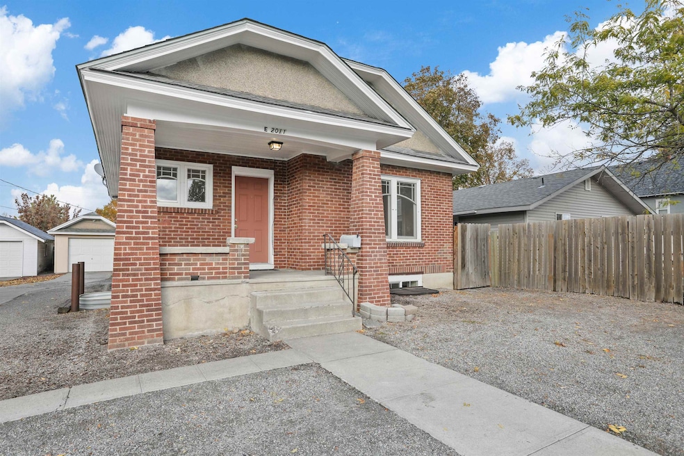
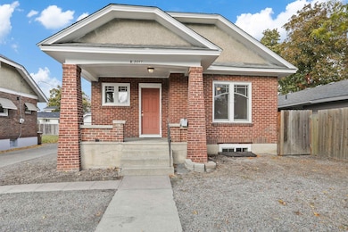
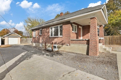
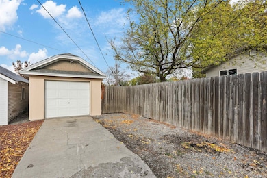
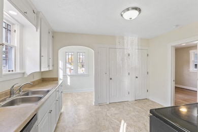
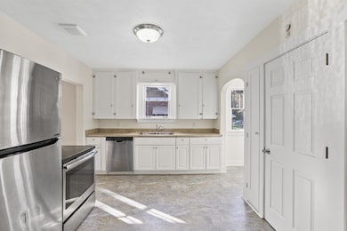
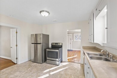
A classic brick Craftsman with 4 bedrooms and 2 bathrooms has all the charm of bygone days, but with beautifully updated kitchen with eating nook, pantry, and newer stainless appliances. Original hardwood floors in this turnkey home! Gas heat and AC for the warm summers. Two bedrooms on main floor, and two large egress bedrooms in basement. Newer roof (2008), and updated wiring. New interior paint, and new paint on exterior trim. Sizable single car garage and fenced backyard. Close proximity to Gonzaga University, SCC and Chief Garry park is just down the street.
| Date | Type | Sale Price | Title Company |
|---|---|---|---|
| Warranty Deed | $330,000 | Wfg National Title | |
| Interfamily Deed Transfer | -- | None Available | |
| Warranty Deed | $61,000 | Transnation Title |
| Date | Status | Loan Amount | Loan Type |
|---|---|---|---|
| Open | $324,022 | FHA | |
| Closed | $12,960 | FHA |
| Date | Event | Price | List to Sale | Price per Sq Ft |
|---|---|---|---|---|
| 12/12/2025 12/12/25 | Sold | $330,000 | +1.5% | $188 / Sq Ft |
| 11/18/2025 11/18/25 | Pending | -- | -- | -- |
| 11/12/2025 11/12/25 | Price Changed | $325,000 | -5.8% | $185 / Sq Ft |
| 10/23/2025 10/23/25 | For Sale | $345,000 | -- | $197 / Sq Ft |
| Year | Tax Paid | Tax Assessment Tax Assessment Total Assessment is a certain percentage of the fair market value that is determined by local assessors to be the total taxable value of land and additions on the property. | Land | Improvement |
|---|---|---|---|---|
| 2025 | $2,214 | $225,500 | $70,000 | $155,500 |
| 2024 | $2,214 | $222,600 | $65,000 | $157,600 |
| 2023 | $2,100 | $215,800 | $65,000 | $150,800 |
| 2022 | $1,489 | $214,200 | $65,000 | $149,200 |
| 2021 | $1,279 | $106,890 | $13,390 | $93,500 |
| 2020 | $1,183 | $95,190 | $13,390 | $81,800 |
| 2019 | $1,043 | $86,890 | $13,390 | $73,500 |
| 2018 | $1,143 | $81,860 | $11,860 | $70,000 |
| 2017 | $1,065 | $77,660 | $11,860 | $65,800 |
| 2016 | $1,026 | $73,160 | $11,860 | $61,300 |
| 2015 | $993 | $69,260 | $11,860 | $57,400 |
| 2014 | -- | $69,870 | $13,770 | $56,100 |
| 2013 | -- | $0 | $0 | $0 |
Seller's Agent in 2025
Dan Dhaenens
Windermere Valley
(509) 991-7349
1 in this area
125 Total Sales
Buyer's Agent in 2025
Rich Mickey
Deese Real Estate
(509) 999-2020
3 in this area
41 Total Sales
Source: Spokane Association of REALTORS®
MLS Number: 202525876
APN: 35093.3111
Disclaimer: Certain information contained herein is derived from information provided by parties other than Homes.com. All information provided is deemed reliable, but is not guaranteed to be accurate and should be independently verified.
![]() Based on information submitted to the MLS GRID. All data is obtained from various sources and may not have been verified by broker or MLS GRID. Supplied Open House Information is subject to change without notice. All information should be independently reviewed and verified for accuracy. Properties may or may not be listed by the office/agent presenting the information. Some IDX listings have been excluded from this website. IDX information is provided exclusively for personal, non-commercial use, and may not be used for any purpose other than to identify prospective properties consumers may be interested in purchasing.Information is deemed reliable but not guaranteed.
Based on information submitted to the MLS GRID. All data is obtained from various sources and may not have been verified by broker or MLS GRID. Supplied Open House Information is subject to change without notice. All information should be independently reviewed and verified for accuracy. Properties may or may not be listed by the office/agent presenting the information. Some IDX listings have been excluded from this website. IDX information is provided exclusively for personal, non-commercial use, and may not be used for any purpose other than to identify prospective properties consumers may be interested in purchasing.Information is deemed reliable but not guaranteed.
Based on information submitted to the MLS GRID
Ask me questions while you tour the home.