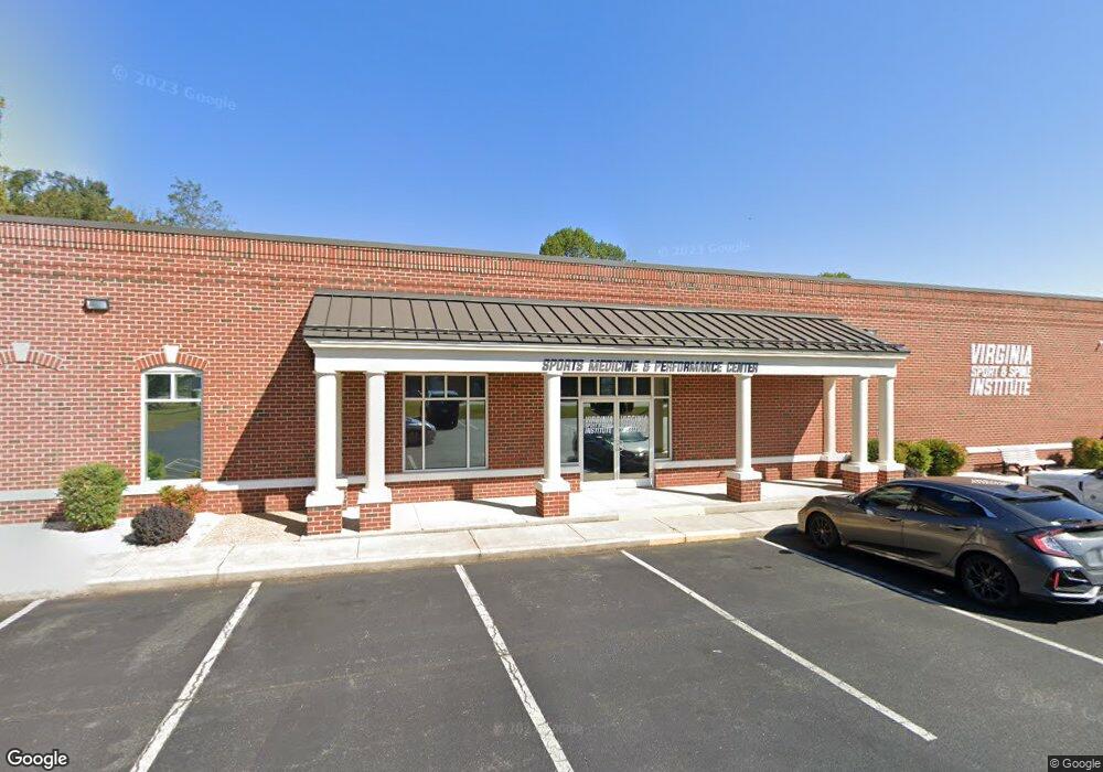
2011 Enterprise Dr Forest, VA 24551
Studio
--
Bath
7,150
Sq Ft
1.33
Acres
About This Home
This home is located at 2011 Enterprise Dr, Forest, VA 24551. 2011 Enterprise Dr is a home located in Lynchburg City with nearby schools including Sandusky Elementary School, Sandusky Middle School, and Heritage High School.
Ownership History
Date
Name
Owned For
Owner Type
Purchase Details
Closed on
Feb 25, 2021
Sold by
Pfd Realty Llc
Bought by
Lowes Group Llc
Home Financials for this Owner
Home Financials are based on the most recent Mortgage that was taken out on this home.
Original Mortgage
$1,045,500
Outstanding Balance
$935,085
Interest Rate
2.7%
Mortgage Type
Construction
Create a Home Valuation Report for This Property
The Home Valuation Report is an in-depth analysis detailing your home's value as well as a comparison with similar homes in the area
Purchase History
| Date | Buyer | Sale Price | Title Company |
|---|---|---|---|
| Lowes Group Llc | $1,030,000 | Virginia Title |
Source: Public Records
Mortgage History
| Date | Status | Borrower | Loan Amount |
|---|---|---|---|
| Open | Lowes Group Llc | $1,045,500 |
Source: Public Records
Tax History
| Year | Tax Paid | Tax Assessment Tax Assessment Total Assessment is a certain percentage of the fair market value that is determined by local assessors to be the total taxable value of land and additions on the property. | Land | Improvement |
|---|---|---|---|---|
| 2025 | $9,450 | $1,125,000 | $399,900 | $725,100 |
| 2024 | $9,590 | $1,077,500 | $399,900 | $677,600 |
| 2023 | $9,590 | $1,077,500 | $399,900 | $677,600 |
| 2022 | $9,337 | $906,500 | $399,900 | $506,600 |
| 2021 | $8,969 | $808,000 | $399,900 | $408,100 |
| 2020 | $8,230 | $741,400 | $333,300 | $408,100 |
| 2019 | $8,230 | $741,400 | $333,300 | $408,100 |
| 2018 | $8,230 | $741,400 | $333,300 | $408,100 |
| 2017 | $8,230 | $741,400 | $333,300 | $408,100 |
| 2016 | $8,230 | $741,400 | $333,300 | $408,100 |
| 2015 | $8,230 | $741,400 | $333,300 | $408,100 |
| 2014 | $8,230 | $741,400 | $333,300 | $408,100 |
Source: Public Records
Map
Nearby Homes
- 17513 Forest Rd
- 1170 Jefferson Oaks Ct Unit 24
- 103 Bexley Dr
- 1155 Jefferson Oaks Ct Unit 37
- 1055 Jefferson Oaks Ct Unit 3
- 112 Forest Dale Dr
- 206 Simsbury Ln
- 104 Creston Oaks Ct
- 404 Robin Dr
- 736 Wyndhurst Dr
- 207 Northwynd Cir
- 725 Wyndhurst Dr
- 1074 Jefferson Dr W
- 1136 Jefferson Dr W
- 213 Margate Dr
- 623 Wyndhurst Dr Unit 305
- 211 Robin Dr
- 1324 Cuddington Ln
- 1639 Rainbow Forest Dr
- 112 Wyndview Dr
- 306 Enterprise Dr
- 2010 Enterprise Dr
- 302 Enterprise Dr
- 1001 Dillard Dr
- 2009 Enterprise Dr
- 2012 Enterprise Dr
- 311 Brook Park Place
- 307 Brook Park Place
- 300 Enterprise Dr Unit B
- 309 Enterprise Dr
- 0 Brook Park Place
- 317 Brook Park Place
- 301 Enterprise Dr
- 206 Enterprise Dr
- 305 Enterprise Dr
- 304 Brook Park Place
- 1009 Dillard Dr
- 104 Homestead Dr
- 316 Brook Park Place
- 2001 Enterprise Dr