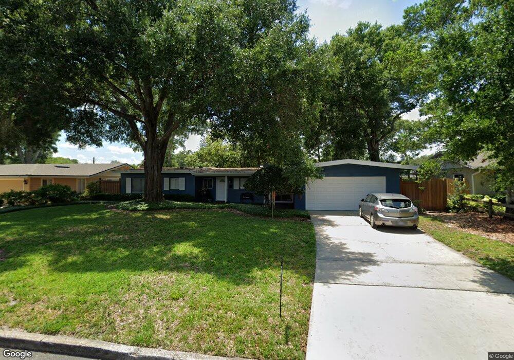
2011 Fosgate Dr Winter Park, FL 32789
Estimated Value: $690,011 - $1,065,000
3
Beds
2
Baths
1,588
Sq Ft
$560/Sq Ft
Est. Value
About This Home
This home is located at 2011 Fosgate Dr, Winter Park, FL 32789 and is currently estimated at $889,503, approximately $560 per square foot. 2011 Fosgate Dr is a home located in Orange County with nearby schools including Audubon Park School, Winter Park High, and Central Florida Leadership Academy Charter.
Ownership History
Date
Name
Owned For
Owner Type
Purchase Details
Closed on
Apr 30, 2009
Sold by
Fisher Joseph A and Fisher Jamison R
Bought by
Maxson Joel E and Maxson Marnie R
Current Estimated Value
Home Financials for this Owner
Home Financials are based on the most recent Mortgage that was taken out on this home.
Original Mortgage
$340,000
Outstanding Balance
$214,241
Interest Rate
4.8%
Mortgage Type
VA
Estimated Equity
$675,262
Purchase Details
Closed on
Apr 30, 2003
Sold by
Cho Sonmi and Ellis Sunae
Bought by
Fisher Joseph A
Home Financials for this Owner
Home Financials are based on the most recent Mortgage that was taken out on this home.
Original Mortgage
$135,000
Interest Rate
5.43%
Mortgage Type
Balloon
Purchase Details
Closed on
Sep 29, 1995
Sold by
Emmons Jane Glass
Bought by
Cho Sonni and Ellis Sunae
Create a Home Valuation Report for This Property
The Home Valuation Report is an in-depth analysis detailing your home's value as well as a comparison with similar homes in the area
Home Values in the Area
Average Home Value in this Area
Purchase History
| Date | Buyer | Sale Price | Title Company |
|---|---|---|---|
| Maxson Joel E | $345,800 | Attorney | |
| Fisher Joseph A | $223,000 | Fidelity National Title Insu | |
| Cho Sonni | $130,000 | -- |
Source: Public Records
Mortgage History
| Date | Status | Borrower | Loan Amount |
|---|---|---|---|
| Open | Maxson Joel E | $340,000 | |
| Previous Owner | Fisher Joseph A | $135,000 |
Source: Public Records
Tax History
| Year | Tax Paid | Tax Assessment Tax Assessment Total Assessment is a certain percentage of the fair market value that is determined by local assessors to be the total taxable value of land and additions on the property. | Land | Improvement |
|---|---|---|---|---|
| 2025 | $4,369 | $320,986 | -- | -- |
| 2024 | $4,057 | $311,940 | -- | -- |
| 2023 | $4,057 | $294,319 | $0 | $0 |
| 2022 | $3,804 | $285,747 | $0 | $0 |
| 2021 | $3,755 | $277,424 | $0 | $0 |
| 2020 | $3,608 | $273,594 | $0 | $0 |
| 2019 | $3,725 | $267,443 | $0 | $0 |
| 2018 | $3,700 | $262,456 | $0 | $0 |
| 2017 | $3,662 | $323,443 | $185,000 | $138,443 |
| 2016 | $3,585 | $319,310 | $185,000 | $134,310 |
| 2015 | $3,670 | $306,615 | $169,000 | $137,615 |
| 2014 | $3,700 | $321,090 | $188,000 | $133,090 |
Source: Public Records
Map
Nearby Homes
- 640 Arjay Way
- 1841 Harland Park Dr
- 2823 Wright Ave
- 2040 Randall Cir
- 151 Oakwood Way
- 1408 Chapman Cir
- 207 E Kings Way
- 1705 Elizabeths Walk
- 1581 Forest Ave
- 1702 Glenridge Way
- 2614 Parkland Dr
- 2501 Winter Park Rd
- 2722 Eastern Pkwy
- 3018 Northwood Blvd
- 1120 Preserve Point Dr
- 1751 Glencoe Rd
- 141 W Lake Sue Ave
- 1112 Preserve Point Dr
- 2812 Mulford Ave
- 2035 Lake Sue Dr
- 2019 Fosgate Dr
- 2003 Fosgate Dr
- 2012 Howard Dr
- 2016 Howard Dr
- 2004 Howard Dr
- 2027 Fosgate Dr
- 2010 Fosgate Dr
- 2000 Fosgate Dr
- 2018 Fosgate Dr
- 2024 Howard Dr
- 2026 Fosgate Dr
- 761 Glenridge Way
- 741 Glenridge Way
- 1981 Blue Ridge Rd
- 2102 Howard Dr
- 2011 Howard Dr
- 2005 Howard Dr
- 2104 Fosgate Dr
- 2017 Howard Dr
- 2113 Fosgate Dr
Your Personal Tour Guide
Ask me questions while you tour the home.