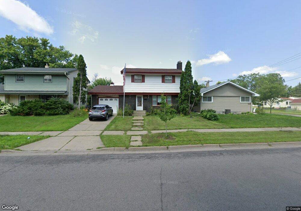
2011 Maryland Ave E Saint Paul, MN 55119
Southern Hayden Heights NeighborhoodEstimated Value: $261,000 - $272,000
3
Beds
2
Baths
1,274
Sq Ft
$211/Sq Ft
Est. Value
About This Home
This home is located at 2011 Maryland Ave E, Saint Paul, MN 55119 and is currently estimated at $268,604, approximately $210 per square foot. 2011 Maryland Ave E is a home located in Ramsey County with nearby schools including The Heights Community School, Battle Creek Middle School, and Johnson Senior High School.
Ownership History
Date
Name
Owned For
Owner Type
Purchase Details
Closed on
Nov 27, 2021
Sold by
Bu Dah and Nwee Paw
Bought by
Dei Eh Moo and Da Dah
Current Estimated Value
Home Financials for this Owner
Home Financials are based on the most recent Mortgage that was taken out on this home.
Original Mortgage
$194,000
Outstanding Balance
$151,705
Interest Rate
2.35%
Mortgage Type
New Conventional
Estimated Equity
$116,899
Purchase Details
Closed on
Jan 18, 2019
Sold by
Piepgras Theresa C
Bought by
Dei Eh Moo and Maung Maung
Home Financials for this Owner
Home Financials are based on the most recent Mortgage that was taken out on this home.
Original Mortgage
$194,750
Interest Rate
4.6%
Mortgage Type
New Conventional
Create a Home Valuation Report for This Property
The Home Valuation Report is an in-depth analysis detailing your home's value as well as a comparison with similar homes in the area
Home Values in the Area
Average Home Value in this Area
Purchase History
| Date | Buyer | Sale Price | Title Company |
|---|---|---|---|
| Dei Eh Moo | -- | Ancona Title & Escrow | |
| Dei Eh Moo | $205,000 | Gibraltar Title Agency |
Source: Public Records
Mortgage History
| Date | Status | Borrower | Loan Amount |
|---|---|---|---|
| Open | Dei Eh Moo | $194,000 | |
| Previous Owner | Dei Eh Moo | $194,750 |
Source: Public Records
Tax History
| Year | Tax Paid | Tax Assessment Tax Assessment Total Assessment is a certain percentage of the fair market value that is determined by local assessors to be the total taxable value of land and additions on the property. | Land | Improvement |
|---|---|---|---|---|
| 2025 | $3,668 | $268,700 | $31,500 | $237,200 |
| 2023 | $3,668 | $246,000 | $25,000 | $221,000 |
| 2022 | $3,564 | $258,500 | $25,000 | $233,500 |
| 2021 | $2,992 | $231,900 | $25,000 | $206,900 |
| 2020 | $2,888 | $204,900 | $20,500 | $184,400 |
| 2019 | $2,824 | $187,000 | $20,500 | $166,500 |
| 2018 | $2,692 | $162,300 | $20,500 | $141,800 |
| 2017 | $1,722 | $158,800 | $20,500 | $138,300 |
| 2016 | $1,762 | $0 | $0 | $0 |
| 2015 | $1,778 | $126,200 | $20,500 | $105,700 |
| 2014 | $1,368 | $0 | $0 | $0 |
Source: Public Records
Map
Nearby Homes
- 1885 Hawthorne Ave E
- 2325 Nokomis Ave
- 2112 Hawthorne Ave E
- 2311 Nokomis Ave
- 2003 Cottage Ave E
- 2155 Ivy Ave E Unit 1
- 2016 Sherwood Ave
- 2166 Cottage Ave E Unit 3
- 1879 Ames Ave
- 1964 Arlington Ave E
- 1779 Orange Ave E
- 1776 Maryland Ave E Unit 105
- 1862 Ames Ave
- 1963 Arlington Ave E
- 2061 Arlington Ave E
- 1809 Mechanic Ave
- 1954 Case Ave E
- 1842 Arlington Ave E
- 1728 Orange Ave E
- 1978 Utica Ave
- 2015 Maryland Ave E
- 2005 Maryland Ave E
- 1999 Maryland Ave E
- 2014 Hawthorne Ave E
- 2014 2014 Hawthorne-Avenue-e
- 2010 Hawthorne Ave E
- 1995 Maryland-Avenue-
- 1995 Maryland Ave E
- 2018 Hawthorne Ave E
- 2006 Hawthorne Ave E
- 2002 Hawthorne Ave E
- 2006 2006 Hawthorne-Avenue-e
- 1991 Maryland Ave E
- 2020 Hawthorne Ave E
- 2000 Maryland Ave E
- 1998 Hawthorne Ave E
- 1987 Maryland Ave E
- 1994 Hawthorne Ave E
- 2014 2014 E Hawthorne-Avenue-e
- 1990 Hawthorne Ave E
Your Personal Tour Guide
Ask me questions while you tour the home.