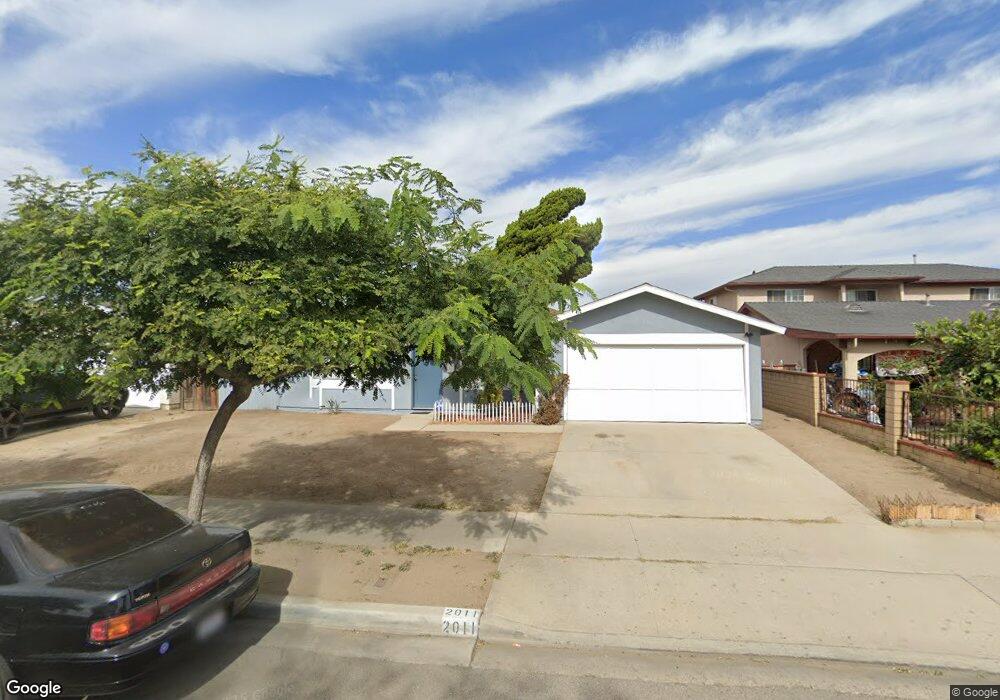
2011 Napoleon Ave Oxnard, CA 93033
Lemonwood Eastmont NeighborhoodEstimated Value: $669,499 - $791,000
3
Beds
2
Baths
1,407
Sq Ft
$514/Sq Ft
Est. Value
About This Home
This home is located at 2011 Napoleon Ave, Oxnard, CA 93033 and is currently estimated at $723,375, approximately $514 per square foot. 2011 Napoleon Ave is a home located in Ventura County with nearby schools including Lemonwood Elementary School, R.J. Frank Academy of Marine Science & Engineering, and Santa Clara High School.
Ownership History
Date
Name
Owned For
Owner Type
Purchase Details
Closed on
Feb 9, 2001
Sold by
United States Of America
Bought by
Davis Dwight E
Current Estimated Value
Home Financials for this Owner
Home Financials are based on the most recent Mortgage that was taken out on this home.
Original Mortgage
$185,440
Outstanding Balance
$66,031
Interest Rate
6.89%
Estimated Equity
$657,344
Create a Home Valuation Report for This Property
The Home Valuation Report is an in-depth analysis detailing your home's value as well as a comparison with similar homes in the area
Home Values in the Area
Average Home Value in this Area
Purchase History
| Date | Buyer | Sale Price | Title Company |
|---|---|---|---|
| Davis Dwight E | $203,000 | Chicago Title Co |
Source: Public Records
Mortgage History
| Date | Status | Borrower | Loan Amount |
|---|---|---|---|
| Open | Davis Dwight E | $185,440 |
Source: Public Records
Tax History
| Year | Tax Paid | Tax Assessment Tax Assessment Total Assessment is a certain percentage of the fair market value that is determined by local assessors to be the total taxable value of land and additions on the property. | Land | Improvement |
|---|---|---|---|---|
| 2025 | $3,781 | $310,374 | $124,149 | $186,225 |
| 2024 | $3,781 | $304,289 | $121,715 | $182,574 |
| 2023 | $3,643 | $298,323 | $119,328 | $178,995 |
| 2022 | $3,534 | $292,474 | $116,988 | $175,486 |
| 2021 | $3,506 | $286,740 | $114,694 | $172,046 |
| 2020 | $3,571 | $283,802 | $113,519 | $170,283 |
| 2019 | $3,471 | $278,239 | $111,294 | $166,945 |
| 2018 | $3,422 | $272,784 | $109,112 | $163,672 |
| 2017 | $3,248 | $267,436 | $106,973 | $160,463 |
| 2016 | $3,135 | $262,193 | $104,876 | $157,317 |
| 2015 | $3,168 | $258,256 | $103,301 | $154,955 |
| 2014 | $3,134 | $253,200 | $101,279 | $151,921 |
Source: Public Records
Map
Nearby Homes
- 1928 San Benito St
- 3700 Olds Rd Unit 86
- 1407 Peach Ave Unit 14
- 2117 Cardinal Ave Unit 2117h
- 2178 Thrush Ave Unit J
- 4032 Mockingbird Ln
- 2177 Robin Ave Unit 2177A
- 1645 Lime Ave Unit 91
- 3130 Paula St
- 2151 E Wooley Rd
- 4200 Browning Dr
- 3151 Fournier St
- 860 Morro Way
- 2400 E Pleasant Valley Rd Unit 108
- 4108 Ranchita Ln
- 4340 Highland Ave
- 3631 La Costa Place
- 360 Ibsen Place Unit 129
- 4160 Petit Dr Unit 39
- 225 W Iris St
- 2011 Napoleon Ave
- 2015 Napoleon Ave
- 2005 Napoleon Ave
- 2435 Earhart Ct
- 2021 Napoleon Ave
- 2001 Napoleon Ave
- 2421 Earhart Ct
- 2434 Dupont St
- 2430 Earhart Ct
- 2004 Napoleon Ave
- 2014 Napoleon Ave
- 2025 Napoleon Ave
- 2424 Dupont St
- 2020 Napoleon Ave
- 2000 Napoleon Ave
- 2420 Earhart Ct
- 2411 Earhart Ct
- 2031 Napoleon Ave
- 2024 Napoleon Ave
- 2414 Dupont St
Your Personal Tour Guide
Ask me questions while you tour the home.