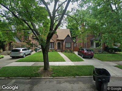
20114 Briarcliff Rd Detroit, MI 48221
Green Acres NeighborhoodEstimated Value: $229,397 - $310,000
--
Bed
2
Baths
1,610
Sq Ft
$169/Sq Ft
Est. Value
About This Home
This home is located at 20114 Briarcliff Rd, Detroit, MI 48221 and is currently estimated at $271,599, approximately $168 per square foot. 20114 Briarcliff Rd is a home located in Wayne County with nearby schools including Pasteur Elementary School, Charles L. Spain Elementary-Middle School, and Edward 'Duke' Ellington Conservatory of Music and Art.
Ownership History
Date
Name
Owned For
Owner Type
Purchase Details
Closed on
Jan 14, 2020
Sold by
Matous Stephen J and Matous Emmie B
Bought by
Matous Stephen J and Matous Emerenciana B
Current Estimated Value
Home Financials for this Owner
Home Financials are based on the most recent Mortgage that was taken out on this home.
Original Mortgage
$20,000
Interest Rate
3.7%
Mortgage Type
Credit Line Revolving
Create a Home Valuation Report for This Property
The Home Valuation Report is an in-depth analysis detailing your home's value as well as a comparison with similar homes in the area
Home Values in the Area
Average Home Value in this Area
Purchase History
| Date | Buyer | Sale Price | Title Company |
|---|---|---|---|
| Matous Stephen J | -- | Sterling Title Agency |
Source: Public Records
Mortgage History
| Date | Status | Borrower | Loan Amount |
|---|---|---|---|
| Closed | Matous Stephen J | $90,000 | |
| Closed | Matous Stephen J | $50,000 | |
| Closed | Matous Stephen J | $20,000 | |
| Closed | Matous Stephen J | $86,884 | |
| Closed | Matous Stephen J | $40,000 | |
| Closed | Matous Stephen J | $107,000 |
Source: Public Records
Tax History Compared to Growth
Tax History
| Year | Tax Paid | Tax Assessment Tax Assessment Total Assessment is a certain percentage of the fair market value that is determined by local assessors to be the total taxable value of land and additions on the property. | Land | Improvement |
|---|---|---|---|---|
| 2024 | $2,671 | $113,800 | $0 | $0 |
| 2023 | $2,593 | $91,300 | $0 | $0 |
| 2022 | $2,872 | $78,600 | $0 | $0 |
| 2021 | $2,791 | $64,100 | $0 | $0 |
| 2020 | $2,757 | $53,100 | $0 | $0 |
| 2019 | $2,710 | $41,300 | $0 | $0 |
| 2018 | $2,258 | $36,600 | $0 | $0 |
| 2017 | $637 | $33,600 | $0 | $0 |
| 2016 | $2,725 | $37,100 | $0 | $0 |
| 2015 | $3,690 | $36,900 | $0 | $0 |
| 2013 | $3,889 | $38,891 | $0 | $0 |
| 2010 | -- | $53,980 | $1,649 | $52,331 |
Source: Public Records
Map
Nearby Homes
- 20121 Briarcliff Rd
- 20201 Renfrew Rd
- 19938 Renfrew Rd
- 20073 Shrewsbury Rd
- 19650 Stratford Rd
- 20179 Canterbury Rd
- 2564 Woodstock Dr
- 19510 Stratford Rd
- 457 W Bennett
- 20403 Warrington Dr
- 20470 Warrington Dr
- 19566 Canterbury Rd
- 19445 Shrewsbury Rd
- 325 W Chesterfield St
- 19411 Woodston Rd
- 415 Laprairie St
- 19994 Santa Rosa Dr
- 20117 Santa Rosa Dr
- 381 Heatherdale Ln
- 287 Fielding St
- 20114 Briarcliff Rd
- 20120 Briarcliff Rd
- 20104 Briarcliff Rd
- 20121 Lichfield Rd
- 20121 Lichfield Rd
- 20103 Lichfield Rd
- 20130 Briarcliff Rd
- 20136 Briarcliff Rd
- 20115 Lichfield Rd
- 20066 Briarcliff Rd
- 20142 Briarcliff Rd
- 20145 Lichfield Rd
- 20137 Lichfield Rd
- 20115 Briarcliff Rd
- 20150 Briarcliff Rd
- 20050 Briarcliff Rd
- 20137 Briarcliff Rd
- 20059 Lichfield Rd
- 20155 Lichfield Rd
- 20155 Lichfield Rd