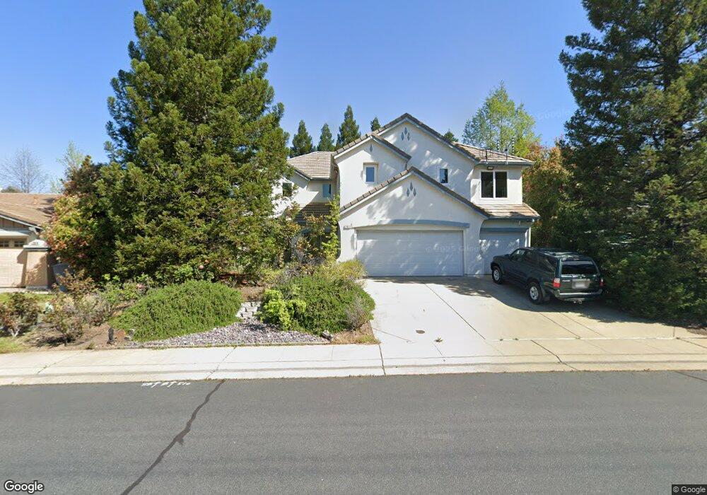
2012 Cassia Way Rocklin, CA 95765
Sunset West NeighborhoodEstimated Value: $609,000 - $822,000
5
Beds
3
Baths
3,412
Sq Ft
$218/Sq Ft
Est. Value
About This Home
This home is located at 2012 Cassia Way, Rocklin, CA 95765 and is currently estimated at $742,773, approximately $217 per square foot. 2012 Cassia Way is a home located in Placer County with nearby schools including Ruhkala Elementary School, Spring View Middle School, and Whitney High.
Ownership History
Date
Name
Owned For
Owner Type
Purchase Details
Closed on
Aug 28, 2001
Sold by
Kb Home Sacramento Inc
Bought by
Lee Tennyson
Current Estimated Value
Home Financials for this Owner
Home Financials are based on the most recent Mortgage that was taken out on this home.
Original Mortgage
$261,250
Outstanding Balance
$102,615
Interest Rate
7.09%
Mortgage Type
Purchase Money Mortgage
Estimated Equity
$640,158
Create a Home Valuation Report for This Property
The Home Valuation Report is an in-depth analysis detailing your home's value as well as a comparison with similar homes in the area
Home Values in the Area
Average Home Value in this Area
Purchase History
| Date | Buyer | Sale Price | Title Company |
|---|---|---|---|
| Lee Tennyson | $327,000 | First American Title Ins Co |
Source: Public Records
Mortgage History
| Date | Status | Borrower | Loan Amount |
|---|---|---|---|
| Open | Lee Tennyson | $261,250 |
Source: Public Records
Tax History Compared to Growth
Tax History
| Year | Tax Paid | Tax Assessment Tax Assessment Total Assessment is a certain percentage of the fair market value that is determined by local assessors to be the total taxable value of land and additions on the property. | Land | Improvement |
|---|---|---|---|---|
| 2025 | $6,228 | $482,439 | $110,785 | $371,654 |
| 2023 | $6,228 | $463,707 | $106,484 | $357,223 |
| 2022 | $7,102 | $454,616 | $104,397 | $350,219 |
| 2021 | $6,924 | $445,702 | $102,350 | $343,352 |
| 2020 | $6,894 | $441,133 | $101,301 | $339,832 |
| 2019 | $6,761 | $432,484 | $99,315 | $333,169 |
| 2018 | $6,603 | $424,005 | $97,368 | $326,637 |
| 2017 | $6,533 | $415,692 | $95,459 | $320,233 |
| 2016 | $6,571 | $407,542 | $93,588 | $313,954 |
| 2015 | $6,475 | $401,422 | $92,183 | $309,239 |
| 2014 | $6,410 | $393,560 | $90,378 | $303,182 |
Source: Public Records
Map
Nearby Homes
- 6149 Preston Cir
- 6261 Arctic Loon Way
- 2150 Hannah Way
- Residence Two Plan at The Residences at West Oaks - The Residences
- Residence One Plan at The Residences at West Oaks
- Residence One Plan at The Residences at West Oaks - The Residences
- Residence Two Plan at The Residences at West Oaks
- 1806 Whimbrel Ct
- 2210 Arnold Dr
- 1407 Sandhill Dr
- 6457 Sonora Pass Way
- 6137 Lonetree Blvd
- 2203 Solitude Way
- 6288 Lonetree Blvd
- 6170 Lonetree Blvd
- 5919 Blackstone Dr
- 6526 Mystery Mountain Way
- 6565 Powder Ridge Dr
- 6212 Night Ridge Way
- 1402 Skibbereen Way
- 2014 Cassia Way
- 2010 Cassia Way
- 1906 Azalea Way
- 1908 Azalea Way
- 1904 Azalea Way
- 2016 Cassia Way
- 1910 Azalea Way
- 1902 Azalea Way
- 6200 Princess Ct
- 1912 Azalea Way
- 2006 Cassia Way
- 6200 Camellia Cir
- 6202 Camellia Cir
- 6161 Preston Cir
- 6204 Camellia Cir
- 1914 Azalea Way
- 6210 Princess Ct
- 6160 Preston Cir
- 2019 Cassia Way
- 2004 Cassia Way