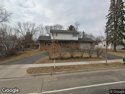
2012 Texas Ave S Saint Louis Park, MN 55426
Westwood Hills NeighborhoodEstimated Value: $490,000 - $575,000
3
Beds
4
Baths
2,544
Sq Ft
$206/Sq Ft
Est. Value
About This Home
This home is located at 2012 Texas Ave S, Saint Louis Park, MN 55426 and is currently estimated at $524,271, approximately $206 per square foot. 2012 Texas Ave S is a home located in Hennepin County with nearby schools including Aquila Elementary School, St. Louis Park Middle School, and St. Louis Park High School.
Ownership History
Date
Name
Owned For
Owner Type
Purchase Details
Closed on
May 24, 2013
Sold by
Cell Harriet
Bought by
Crouse Elizabeth T and Sherburne Paul S
Current Estimated Value
Home Financials for this Owner
Home Financials are based on the most recent Mortgage that was taken out on this home.
Original Mortgage
$230,637
Outstanding Balance
$166,034
Interest Rate
3.38%
Mortgage Type
New Conventional
Estimated Equity
$358,237
Create a Home Valuation Report for This Property
The Home Valuation Report is an in-depth analysis detailing your home's value as well as a comparison with similar homes in the area
Home Values in the Area
Average Home Value in this Area
Purchase History
| Date | Buyer | Sale Price | Title Company |
|---|---|---|---|
| Crouse Elizabeth T | $279,817 | Burnet Title |
Source: Public Records
Mortgage History
| Date | Status | Borrower | Loan Amount |
|---|---|---|---|
| Open | Crouse Elizabeth T | $230,637 | |
| Previous Owner | Cell Harriet | $92,857 |
Source: Public Records
Tax History Compared to Growth
Tax History
| Year | Tax Paid | Tax Assessment Tax Assessment Total Assessment is a certain percentage of the fair market value that is determined by local assessors to be the total taxable value of land and additions on the property. | Land | Improvement |
|---|---|---|---|---|
| 2023 | $5,786 | $434,200 | $199,900 | $234,300 |
| 2022 | $5,134 | $446,900 | $190,400 | $256,500 |
| 2021 | $4,944 | $385,600 | $165,600 | $220,000 |
| 2020 | $5,041 | $375,700 | $157,800 | $217,900 |
| 2019 | $5,224 | $368,200 | $150,300 | $217,900 |
| 2018 | $5,079 | $368,200 | $150,300 | $217,900 |
| 2017 | $4,599 | $326,500 | $118,900 | $207,600 |
| 2016 | $4,714 | $322,800 | $107,300 | $215,500 |
| 2015 | $4,446 | $297,800 | $100,300 | $197,500 |
| 2014 | -- | $296,500 | $95,200 | $201,300 |
Source: Public Records
Map
Nearby Homes
- 2019 Utah Ave S
- 1641 Utah Ave S
- 2040 Utah Ave S
- 1650 Utah Dr S
- 2201 Texas Ave S
- 2200 Quebec Dr
- 1630 Oregon Ave S
- 2208 Oregon Ct
- 1604 Oregon Ave S
- 7414 W 22nd St Unit 204
- 7414 W 22nd St Unit 212
- 7412 W 22nd St Unit 204
- 7412 W 22nd St Unit 301
- 2225 Oregon Ct
- 2200 Nevada Ave S Unit 313
- 8206 Virginia Cir N
- 2417 Rhode Island Ave S
- 8501 Virginia Cir N
- 2401 Cavell Ave S
- 1647 Jersey Ave S
- 2012 Texas Ave S
- 2018 Texas Ave S
- 2012 2012 Texas-Avenue-s
- 2012 2012 Texas Ave S
- 2018 Texas Ave S
- 2006 Texas Ave S
- 2007 Utah Ave S
- 2013 Utah Ave S
- 2006 2006 Texas Ave S
- 2024 Texas Ave S
- 8009 W Franklin Ave
- 2001 Utah Ave S
- 8001 W Franklin Ave
- 2025 Utah Ave S
- 2030 Texas Ave S
- 2008 Utah Ave S
- 2030 2030 Texas-Avenue-s
- 2000 Utah Ave S
- 2016 Utah Ave S
- 2016 Utah Ave S