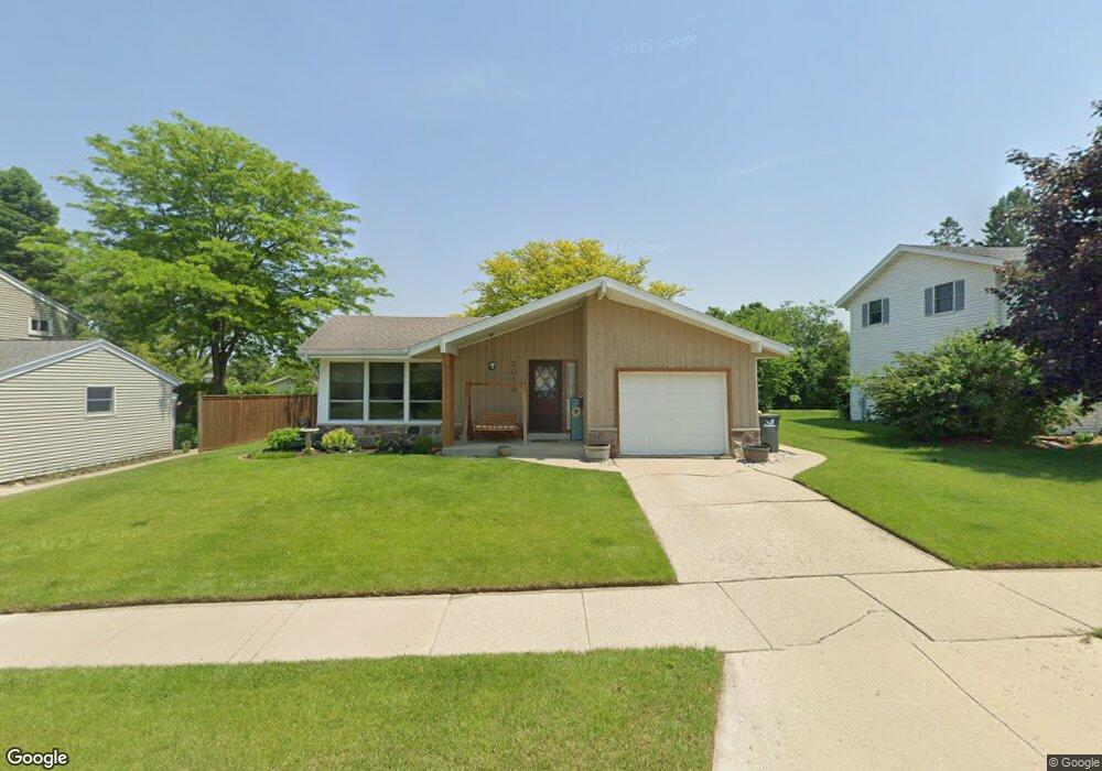
2013 Manhattan Dr Waukesha, WI 53186
Estimated Value: $349,000 - $387,000
3
Beds
2
Baths
1,307
Sq Ft
$284/Sq Ft
Est. Value
About This Home
This home is located at 2013 Manhattan Dr, Waukesha, WI 53186 and is currently estimated at $370,592, approximately $283 per square foot. 2013 Manhattan Dr is a home located in Waukesha County with nearby schools including John F. Miller School, Banting Elementary School, and Horning Middle School.
Ownership History
Date
Name
Owned For
Owner Type
Purchase Details
Closed on
Jun 22, 2017
Sold by
At Home Proeprties Llc
Bought by
Seiden Joel F and Seiden Niki
Current Estimated Value
Home Financials for this Owner
Home Financials are based on the most recent Mortgage that was taken out on this home.
Original Mortgage
$207,163
Outstanding Balance
$172,458
Interest Rate
4.05%
Mortgage Type
FHA
Estimated Equity
$198,134
Purchase Details
Closed on
Jul 15, 2008
Sold by
Anick Katherine M
Bought by
At Home Properties Llc
Create a Home Valuation Report for This Property
The Home Valuation Report is an in-depth analysis detailing your home's value as well as a comparison with similar homes in the area
Home Values in the Area
Average Home Value in this Area
Purchase History
| Date | Buyer | Sale Price | Title Company |
|---|---|---|---|
| Seiden Joel F | -- | None Available | |
| At Home Properties Llc | $144,000 | None Available |
Source: Public Records
Mortgage History
| Date | Status | Borrower | Loan Amount |
|---|---|---|---|
| Open | Seiden Joel F | $207,163 |
Source: Public Records
Tax History Compared to Growth
Tax History
| Year | Tax Paid | Tax Assessment Tax Assessment Total Assessment is a certain percentage of the fair market value that is determined by local assessors to be the total taxable value of land and additions on the property. | Land | Improvement |
|---|---|---|---|---|
| 2024 | $4,467 | $302,400 | $57,900 | $244,500 |
| 2023 | $4,340 | $302,400 | $57,900 | $244,500 |
| 2022 | $4,158 | $218,000 | $52,700 | $165,300 |
| 2021 | $4,253 | $218,000 | $52,700 | $165,300 |
| 2020 | $4,113 | $218,000 | $52,700 | $165,300 |
| 2019 | $3,983 | $218,000 | $52,700 | $165,300 |
| 2018 | $3,727 | $200,000 | $46,900 | $153,100 |
| 2017 | $3,438 | $180,400 | $46,900 | $133,500 |
| 2016 | $3,307 | $162,500 | $46,900 | $115,600 |
| 2015 | $3,277 | $162,500 | $46,900 | $115,600 |
| 2014 | $3,350 | $159,300 | $46,900 | $112,400 |
| 2013 | $3,350 | $159,300 | $46,900 | $112,400 |
Source: Public Records
Map
Nearby Homes
- 1112 Gertrude St
- 1116 Josephine St
- 1729 Stardust Dr Unit B
- 1308 Danny St
- 1333 Niagara St
- 1415 Niagara St Unit 109
- 1471 Cleveland Ave
- 2109 Melody Ln
- 918 Niagara St
- 1542 Whiterock Ave
- 937 E Moreland Blvd
- 1522 Pewaukee Rd
- 925 Harding Ave
- 440 Gascoigne Dr
- 1021 Aurora St
- 1103 Arcadian Ave
- 1021 Arcadian Ave
- 526 Peters Dr
- 1139 White Rock Ave
- N10W23564 Robinhood Ct
- 2017 Manhattan Dr
- 2009 Manhattan Dr
- 2008 Manhattan Dr
- 2021 Manhattan Dr
- 2020 Manhattan Dr
- 2003 Manhattan Dr
- 2014 Manhattan Dr
- 2002 Manhattan Dr
- 2014 Butler Dr
- 2027 Manhattan Dr
- 2008 Butler Dr
- 2020 Butler Dr
- 1939 Manhattan Dr
- 2026 Butler Dr
- 2002 Butler Dr
- 2026 Manhattan Dr
- 2031 Manhattan Dr
- 1936 Manhattan Dr
- 2032 Butler Dr
- 1932 Butler Dr