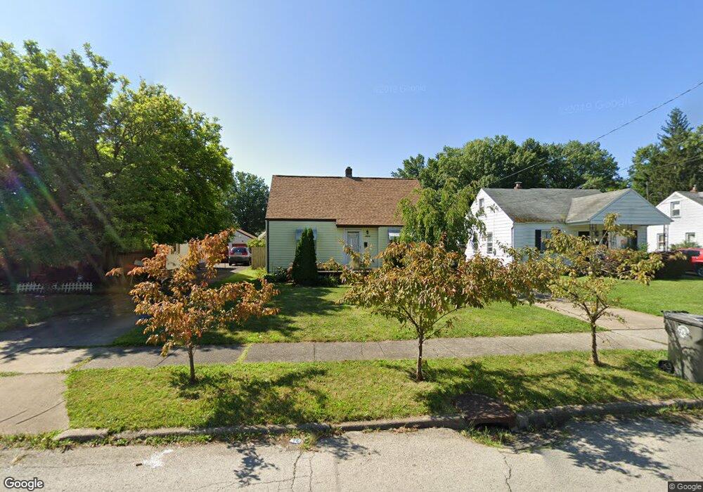
2013 Medford Ave Youngstown, OH 44514
Estimated Value: $96,553 - $129,000
2
Beds
1
Bath
804
Sq Ft
$137/Sq Ft
Est. Value
About This Home
This home is located at 2013 Medford Ave, Youngstown, OH 44514 and is currently estimated at $110,388, approximately $137 per square foot. 2013 Medford Ave is a home located in Mahoning County with nearby schools including Paul C. Bunn Elementary School, Chaney High School, and Summit Academy Secondary School - Youngstown.
Ownership History
Date
Name
Owned For
Owner Type
Purchase Details
Closed on
May 29, 1996
Sold by
Lalama Guy
Bought by
Mamone John R
Current Estimated Value
Home Financials for this Owner
Home Financials are based on the most recent Mortgage that was taken out on this home.
Original Mortgage
$29,600
Interest Rate
7.51%
Mortgage Type
New Conventional
Purchase Details
Closed on
Nov 9, 1990
Bought by
Lalama Guy
Create a Home Valuation Report for This Property
The Home Valuation Report is an in-depth analysis detailing your home's value as well as a comparison with similar homes in the area
Home Values in the Area
Average Home Value in this Area
Purchase History
| Date | Buyer | Sale Price | Title Company |
|---|---|---|---|
| Mamone John R | $37,000 | -- | |
| Lalama Guy | $26,500 | -- |
Source: Public Records
Mortgage History
| Date | Status | Borrower | Loan Amount |
|---|---|---|---|
| Closed | Mamone John R | $29,600 |
Source: Public Records
Tax History Compared to Growth
Tax History
| Year | Tax Paid | Tax Assessment Tax Assessment Total Assessment is a certain percentage of the fair market value that is determined by local assessors to be the total taxable value of land and additions on the property. | Land | Improvement |
|---|---|---|---|---|
| 2024 | $952 | $19,940 | $2,430 | $17,510 |
| 2023 | $945 | $19,940 | $2,430 | $17,510 |
| 2022 | $942 | $15,290 | $2,500 | $12,790 |
| 2021 | $942 | $15,290 | $2,500 | $12,790 |
| 2020 | $947 | $15,290 | $2,500 | $12,790 |
| 2019 | $944 | $13,650 | $2,230 | $11,420 |
| 2018 | $953 | $13,650 | $2,230 | $11,420 |
| 2017 | $950 | $13,650 | $2,230 | $11,420 |
| 2016 | $1,086 | $16,790 | $2,230 | $14,560 |
| 2015 | $1,063 | $16,790 | $2,230 | $14,560 |
| 2014 | $1,055 | $16,790 | $2,230 | $14,560 |
| 2013 | $1,041 | $16,790 | $2,230 | $14,560 |
Source: Public Records
Map
Nearby Homes
- 2001 Brownlee Ave
- 1928 Medford Ave
- 2002 Bancroft Ave
- 1954 Everett Ave
- 2007 E Midlothian Blvd
- 0 Weston Ave
- 0 Crescent Dr Unit 5124984
- 608 Maplewood Ave
- 1653 Brownlee Ave
- 1654 Wakefield Ave
- 4528 Sheridan Rd
- 1633 Wakefield Ave
- 2016 Pointview Ave
- 1709 S Heights Ave
- 574 Spring St
- 1912 Thalia Ave
- 2510 E Midlothian Blvd
- 1560 Wakefield Ave
- 491 Spring St
- 1513 Wakefield Ave
- 2019 Medford Ave
- 2007 Medford Ave
- 2001 Medford Ave
- 2023 Medford Ave
- 2029 Medford Ave
- 2020 Brownlee Ave
- 2008 Brownlee Ave
- 2024 Brownlee Ave
- 2002 Brownlee Ave
- 2035 Medford Ave
- 2014 Medford Ave
- 2008 Medford Ave
- 2030 Brownlee Ave
- 2002 Medford Ave
- 2024 Medford Ave
- 1977 Medford Ave
- 2030 Medford Ave
- 2041 Medford Ave
- 1982 Brownlee Ave
- 2036 Medford Ave