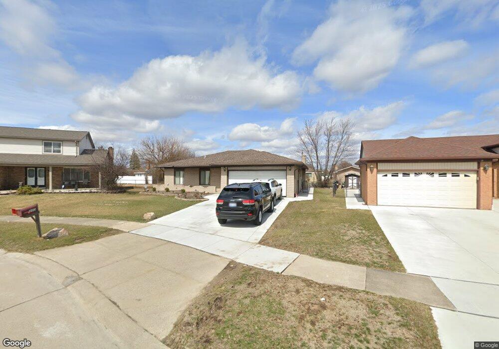
2013 Michael Dr Sterling Heights, MI 48310
Estimated Value: $331,235 - $361,000
--
Bed
1
Bath
1,577
Sq Ft
$220/Sq Ft
Est. Value
About This Home
This home is located at 2013 Michael Dr, Sterling Heights, MI 48310 and is currently estimated at $347,309, approximately $220 per square foot. 2013 Michael Dr is a home located in Macomb County with nearby schools including Holden Elementary School, Grissom Middle School, and Sterling Heights Senior H.S..
Ownership History
Date
Name
Owned For
Owner Type
Purchase Details
Closed on
Aug 30, 2004
Sold by
Marino Thomas F and Marino Rosemary A
Bought by
Khamou Rafat and Zoura Juleit
Current Estimated Value
Home Financials for this Owner
Home Financials are based on the most recent Mortgage that was taken out on this home.
Original Mortgage
$156,000
Outstanding Balance
$78,418
Interest Rate
6.1%
Mortgage Type
Stand Alone First
Estimated Equity
$268,891
Create a Home Valuation Report for This Property
The Home Valuation Report is an in-depth analysis detailing your home's value as well as a comparison with similar homes in the area
Home Values in the Area
Average Home Value in this Area
Purchase History
| Date | Buyer | Sale Price | Title Company |
|---|---|---|---|
| Khamou Rafat | $195,000 | Great Lakes Title Of Mi |
Source: Public Records
Mortgage History
| Date | Status | Borrower | Loan Amount |
|---|---|---|---|
| Open | Khamou Rafat | $156,000 |
Source: Public Records
Tax History Compared to Growth
Tax History
| Year | Tax Paid | Tax Assessment Tax Assessment Total Assessment is a certain percentage of the fair market value that is determined by local assessors to be the total taxable value of land and additions on the property. | Land | Improvement |
|---|---|---|---|---|
| 2025 | $3,585 | $158,500 | $0 | $0 |
| 2024 | $3,458 | $147,600 | $0 | $0 |
| 2023 | $3,282 | $135,800 | $0 | $0 |
| 2022 | $3,183 | $122,900 | $0 | $0 |
| 2021 | $3,290 | $118,600 | $0 | $0 |
| 2020 | $3,128 | $112,800 | $0 | $0 |
| 2019 | $3,084 | $105,900 | $0 | $0 |
| 2018 | $3,111 | $93,100 | $0 | $0 |
| 2017 | $3,000 | $88,100 | $13,700 | $74,400 |
| 2016 | $2,936 | $88,100 | $0 | $0 |
| 2015 | -- | $81,000 | $0 | $0 |
| 2014 | -- | $66,200 | $0 | $0 |
Source: Public Records
Map
Nearby Homes
- 37631 Douglas Ct
- 37718 Douglas Ct
- 3373 Auburn Dr
- 38223 Forsdale Dr
- 2711 Winter Dr
- 37147 Dundee St
- 2127 Hopkins Dr
- 37183 Curwood Dr
- 2938 Fox Hill Dr
- 3069 Wolverine Dr
- 2956 Charity Dr
- 2750 Dover Dr
- 3408 Rowland Ct
- 3038 Donna Dr
- 2656 E Big Beaver Rd
- 2734 E Wattles Rd
- 2703 Downey Dr
- 2573 Cottonwood Dr
- 3217 Barton Dr
- 36862 Park Place Dr Unit 2
- 2025 Michael Dr
- 1946 Fox Hill Dr
- 2037 Michael Dr
- 1934 Fox Hill Dr
- 37755 Samantha Dr
- 2014 Fox Hill Dr
- 1922 Fox Hill Dr
- 2049 Michael Dr
- 2024 Michael Dr
- 37743 Samantha Dr
- 2026 Fox Hill Dr
- 2036 Michael Dr
- 2061 Michael Dr
- 37731 Samantha Dr
- 2048 Michael Dr
- 2038 Fox Hill Dr
- 37720 Samantha Dr
- 2073 Michael Dr
- 37719 Samantha Dr
- 2060 Michael Dr