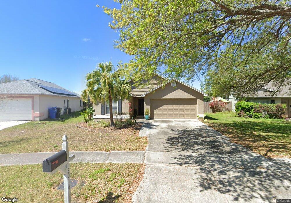
2014 Lori Ann St Brandon, FL 33510
Estimated Value: $317,100 - $353,000
3
Beds
2
Baths
1,382
Sq Ft
$239/Sq Ft
Est. Value
About This Home
This home is located at 2014 Lori Ann St, Brandon, FL 33510 and is currently estimated at $330,275, approximately $238 per square foot. 2014 Lori Ann St is a home located in Hillsborough County with nearby schools including Schmidt Elementary School, Mann Middle School, and Armwood High School.
Ownership History
Date
Name
Owned For
Owner Type
Purchase Details
Closed on
Jul 11, 2018
Sold by
Huckins Cindy L
Bought by
Smith Laura Leigh
Current Estimated Value
Purchase Details
Closed on
Feb 15, 2006
Sold by
Reneau Family Trust
Bought by
Huckins Cindy L
Home Financials for this Owner
Home Financials are based on the most recent Mortgage that was taken out on this home.
Original Mortgage
$137,700
Interest Rate
7.25%
Mortgage Type
New Conventional
Purchase Details
Closed on
Jul 13, 2005
Sold by
Menne Bruce A and Menne Carol B
Bought by
Reneau Family Trust
Purchase Details
Closed on
Oct 8, 1996
Sold by
Menne Bruce A
Bought by
Menne Bruce A
Create a Home Valuation Report for This Property
The Home Valuation Report is an in-depth analysis detailing your home's value as well as a comparison with similar homes in the area
Home Values in the Area
Average Home Value in this Area
Purchase History
| Date | Buyer | Sale Price | Title Company |
|---|---|---|---|
| Smith Laura Leigh | -- | None Available | |
| Huckins Cindy L | $159,100 | Genesis Title Company | |
| Reneau Family Trust | -- | -- | |
| Menne Bruce A | $100 | -- |
Source: Public Records
Mortgage History
| Date | Status | Borrower | Loan Amount |
|---|---|---|---|
| Previous Owner | Huckins Cindy L | $137,700 |
Source: Public Records
Tax History
| Year | Tax Paid | Tax Assessment Tax Assessment Total Assessment is a certain percentage of the fair market value that is determined by local assessors to be the total taxable value of land and additions on the property. | Land | Improvement |
|---|---|---|---|---|
| 2025 | $3,983 | $171,068 | -- | -- |
| 2024 | $3,983 | $166,247 | -- | -- |
| 2023 | $3,864 | $161,405 | $0 | $0 |
| 2022 | $3,687 | $156,704 | $0 | $0 |
| 2021 | $3,639 | $152,140 | $0 | $0 |
| 2020 | $3,557 | $150,039 | $33,340 | $116,699 |
| 2019 | $3,040 | $146,594 | $33,340 | $113,254 |
| 2018 | $2,693 | $129,433 | $0 | $0 |
| 2017 | $2,489 | $116,312 | $0 | $0 |
| 2016 | $2,322 | $104,639 | $0 | $0 |
| 2015 | $2,176 | $95,126 | $0 | $0 |
| 2014 | $2,009 | $86,478 | $0 | $0 |
| 2013 | -- | $78,616 | $0 | $0 |
Source: Public Records
Map
Nearby Homes
- 2070 Sarah Louise Dr
- 2320 Palm Ave
- 2318 Hibiscus Ave
- 1803 Lake Crest Ave
- 3471 High Hampton Cir
- 3456 High Hampton Cir
- 1735 Lakeview Village Dr
- 2769 Scarlet Bay Place
- 2109 Broadway View Ave
- 2764 Emory Sound Place
- 2760 Emory Sound Place
- 2710 Scarlet Bay Place
- 2110 Laceflower Dr
- 1952 Fruitridge St
- 2130 Laceflower Dr
- 2140 Laceflower Dr
- 1657 Palm Leaf Dr
- 2212 Broadway View Ave
- 2208 Laceflower Dr
- 2102 Columbus Dr
- 2012 Lori Ann St
- 2016 Lori Ann St
- 2010 Lori Ann St
- 2047 Sarah Louise Dr
- 2018 Lori Ann St
- 2043 Sarah Louise Dr
- 2051 Sarah Louise Dr
- 2039 Sarah Louise Dr
- 2008 Lori Ann St
- 2020 Lori Ann St
- 2011 Lori Ann St
- 2055 Sarah Louise Dr
- 2013 Lori Ann St
- 2009 Lori Ann St
- 2006 Lori Ann St
- 2059 Sarah Louise Dr
- 2022 Lori Ann St
- 2007 Lori Ann St
- 2035 Sarah Louise Dr
- 2015 Lori Ann St
Your Personal Tour Guide
Ask me questions while you tour the home.