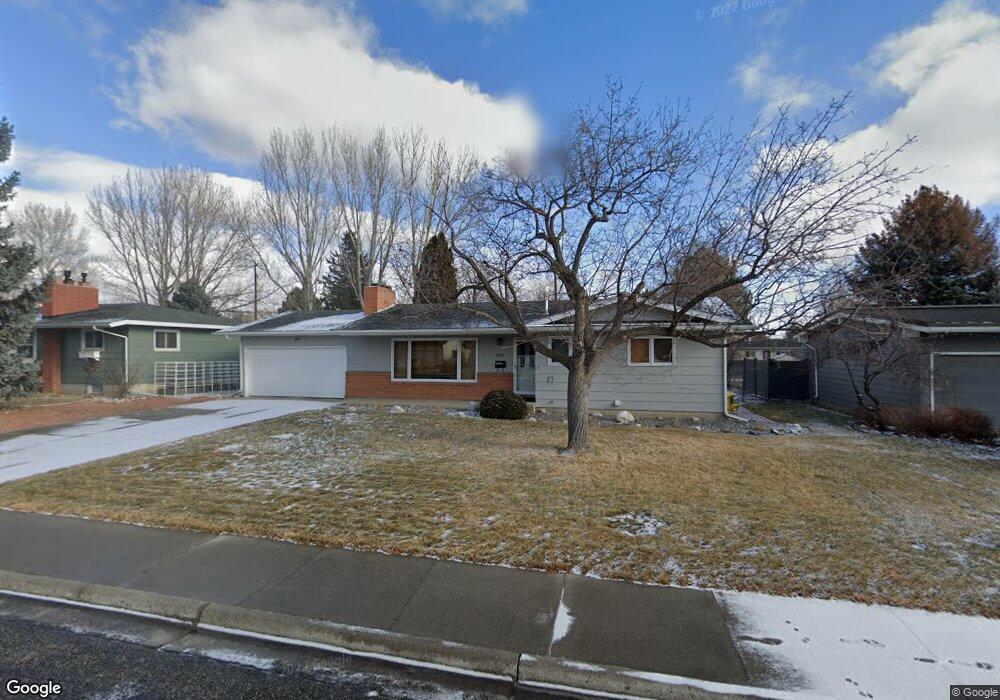
2015 16th St W Billings, MT 59102
North Central Billings NeighborhoodEstimated Value: $352,000 - $397,000
2
Beds
2
Baths
1,616
Sq Ft
$227/Sq Ft
Est. Value
About This Home
This home is located at 2015 16th St W, Billings, MT 59102 and is currently estimated at $367,310, approximately $227 per square foot. 2015 16th St W is a home located in Yellowstone County with nearby schools including Rose Park School, Lewis & Clark Junior High School, and Billings Senior High School.
Ownership History
Date
Name
Owned For
Owner Type
Purchase Details
Closed on
Dec 19, 2019
Sold by
Reed Charles and Reed Audrey
Bought by
Casterline Paul C
Current Estimated Value
Home Financials for this Owner
Home Financials are based on the most recent Mortgage that was taken out on this home.
Original Mortgage
$245,250
Outstanding Balance
$215,757
Interest Rate
3.6%
Mortgage Type
New Conventional
Estimated Equity
$151,553
Purchase Details
Closed on
Mar 4, 2014
Sold by
Estate Of Timothy C Reed
Bought by
Reed Charles and Reed Audrey
Create a Home Valuation Report for This Property
The Home Valuation Report is an in-depth analysis detailing your home's value as well as a comparison with similar homes in the area
Home Values in the Area
Average Home Value in this Area
Purchase History
We collect this data history from publicly available records. To have your information removed, we recommend requesting removal directly through your county’s website.
| Date | Buyer | Sale Price | Title Company |
|---|---|---|---|
| Casterline Paul C | -- | First American Title | |
| Reed Charles | -- | None Available |
Source: Public Records
Mortgage History
We collect this data history from publicly available records. To have your information removed, we recommend requesting removal directly through your county’s website.
| Date | Status | Borrower | Loan Amount |
|---|---|---|---|
| Open | Casterline Paul C | $245,250 |
Source: Public Records
Tax History
| Year | Tax Paid | Tax Assessment Tax Assessment Total Assessment is a certain percentage of the fair market value that is determined by local assessors to be the total taxable value of land and additions on the property. | Land | Improvement |
|---|---|---|---|---|
| 2025 | $3,710 | $355,700 | $52,375 | $303,325 |
| 2024 | $3,710 | $365,000 | $47,645 | $317,355 |
| 2023 | $3,715 | $365,000 | $47,645 | $317,355 |
| 2022 | $3,041 | $258,200 | $0 | $0 |
| 2021 | $2,887 | $258,200 | $0 | $0 |
| 2020 | $2,919 | $250,400 | $0 | $0 |
| 2019 | $2,739 | $244,800 | $0 | $0 |
| 2018 | $2,642 | $230,500 | $0 | $0 |
| 2017 | $2,574 | $230,500 | $0 | $0 |
| 2016 | $2,528 | $229,500 | $0 | $0 |
| 2015 | $2,475 | $229,500 | $0 | $0 |
| 2014 | $2,190 | $106,636 | $0 | $0 |
Source: Public Records
Map
Nearby Homes
- 2095 17th St W
- 1600 Avenue E
- 1409 Colton Blvd
- 1405 Avenue F
- 1729 Avenue E
- 1329 Parkhill Dr
- 41 Heatherwood Ln
- 1322 Avenue F
- 2202 13th St W
- 1400 Poly Dr Unit 4D
- 1237 Avenue E
- 1833 Iris Ln
- 13 Stanford Ct
- 1220 Ponderosa Dr
- 2225 12th St W
- 1905 Poly Dr
- 1837 Avenue B
- 1124 Parkhill Dr
- 1119 O Malley Dr
- 2807 Terrace Dr
- 2017 16th St W
- 2009 16th St W
- 2018 Lamar Dr
- 2020 Lamar Dr
- 2010 Lamar Dr
- 1540 Colton Blvd
- 1541 Parkhill Dr
- 2020 16th St W
- 2010 16th St W
- 2024 16th St W
- 2026 Lamar Dr
- 1531 Parkhill Dr
- 2030 16th St W
- 1603 Parkhill Dr
- 1537 Colton Blvd
- 2021 Plaza Dr
- 2015 Lamar Dr
- 2021 Lamar Dr
- 2009 Lamar Dr
- 2017 Lamar Dr
Your Personal Tour Guide
Ask me questions while you tour the home.