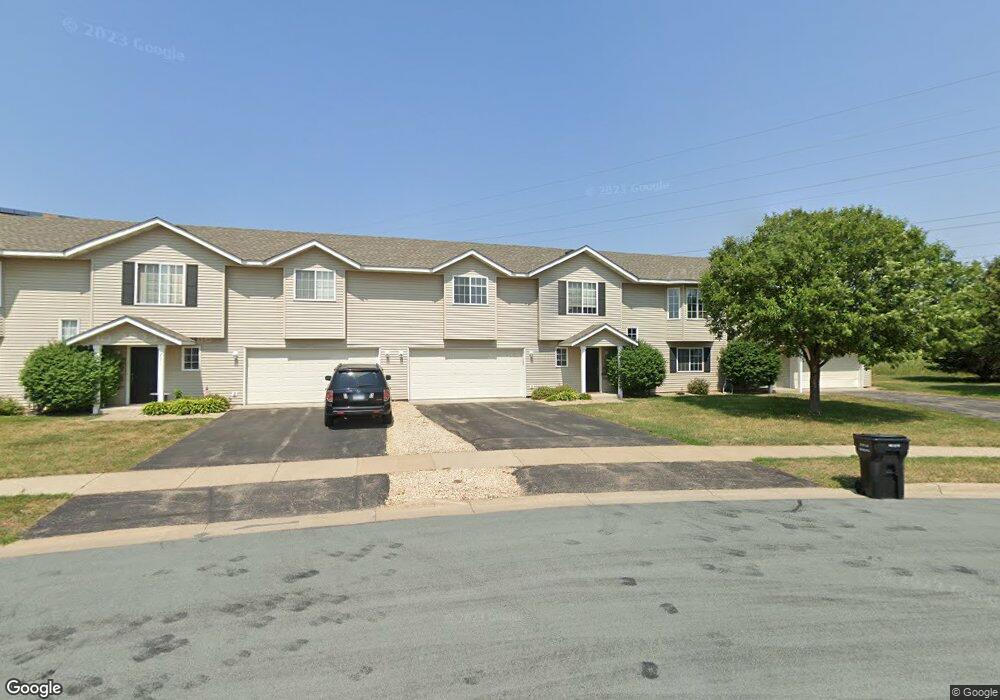
2015 Brittany Ct Shakopee, MN 55379
Estimated Value: $228,000 - $251,000
2
Beds
2
Baths
1,258
Sq Ft
$191/Sq Ft
Est. Value
About This Home
This home is located at 2015 Brittany Ct, Shakopee, MN 55379 and is currently estimated at $240,376, approximately $191 per square foot. 2015 Brittany Ct is a home located in Scott County with nearby schools including Sun Path Elementary School, Shakopee West Middle School, and Shakopee Senior High School.
Ownership History
Date
Name
Owned For
Owner Type
Purchase Details
Closed on
Nov 18, 2016
Sold by
Tcf National Bank
Bought by
Kalpresh Properties Llc
Current Estimated Value
Home Financials for this Owner
Home Financials are based on the most recent Mortgage that was taken out on this home.
Original Mortgage
$106,500
Outstanding Balance
$14,438
Interest Rate
3.52%
Mortgage Type
Commercial
Estimated Equity
$225,938
Purchase Details
Closed on
Apr 1, 2004
Sold by
Isabell Angela Lynn
Bought by
Shackle Gregg T
Purchase Details
Closed on
Apr 26, 2001
Sold by
Mw Johnson Construction
Bought by
Isabell Angela L
Create a Home Valuation Report for This Property
The Home Valuation Report is an in-depth analysis detailing your home's value as well as a comparison with similar homes in the area
Home Values in the Area
Average Home Value in this Area
Purchase History
| Date | Buyer | Sale Price | Title Company |
|---|---|---|---|
| Kalpresh Properties Llc | $142,000 | Burnet Title | |
| Shackle Gregg T | $159,900 | -- | |
| Isabell Angela L | $129,453 | -- |
Source: Public Records
Mortgage History
| Date | Status | Borrower | Loan Amount |
|---|---|---|---|
| Open | Kalpresh Properties Llc | $106,500 |
Source: Public Records
Tax History Compared to Growth
Tax History
| Year | Tax Paid | Tax Assessment Tax Assessment Total Assessment is a certain percentage of the fair market value that is determined by local assessors to be the total taxable value of land and additions on the property. | Land | Improvement |
|---|---|---|---|---|
| 2025 | $2,354 | $233,200 | $72,300 | $160,900 |
| 2024 | $2,392 | $222,400 | $68,800 | $153,600 |
| 2023 | $2,456 | $222,600 | $71,000 | $151,600 |
| 2022 | $2,330 | $225,200 | $72,700 | $152,500 |
| 2021 | $2,086 | $182,800 | $57,000 | $125,800 |
| 2020 | $2,192 | $179,000 | $52,500 | $126,500 |
| 2019 | $2,064 | $165,100 | $44,400 | $120,700 |
| 2018 | $2,026 | $0 | $0 | $0 |
| 2016 | $1,574 | $0 | $0 | $0 |
| 2014 | -- | $0 | $0 | $0 |
Source: Public Records
Map
Nearby Homes
- 1820 Mockingbird Ave
- 1552 Dublin Ct
- 1844 Mockingbird Ave Unit 1102
- 2399 Tyrone Dr
- 2447 Tyrone Dr
- 2471 Tyrone Dr
- 2263 Tyrone Dr
- 2388 Vierling Dr E
- 1511 England Way
- 2006 Tyrone Dr
- Lewis Plan at Summerland Place - Landmark Collection
- 2795 Downing Ave
- Vanderbilt Plan at Summerland Place - Landmark Collection
- Sinclair Plan at Summerland Place - Landmark Collection
- 1164 Merrifield Ct
- 1933 Davis Ct
- Nokomis Plan at Summerland Place - The Tradition Collection
- Gregorian Plan at Summerland Place - The Tradition Collection
- 1542 Philipp Way
- Pryor Plan at Summerland Place - The Tradition Collection
- 2011 Brittany Ct
- 2019 Brittany Ct
- 2007 Brittany Ct
- 2023 Brittany Ct
- 2003 Brittany Ct
- 2027 Brittany Ct
- 2006 Brittany Ct
- 2024 Brittany Ct
- 1999 Brittany Ct
- 2002 Brittany Ct
- 2028 Brittany Ct
- 2035 Brittany Ct
- 1998 Brittany Ct
- 1995 Brittany Ct
- 2032 Brittany Ct
- 1994 Brittany Ct
- 2036 Brittany Ct
- 2039 Brittany Ct
- 1993 Downing Ave
- 1977 Downing Ave