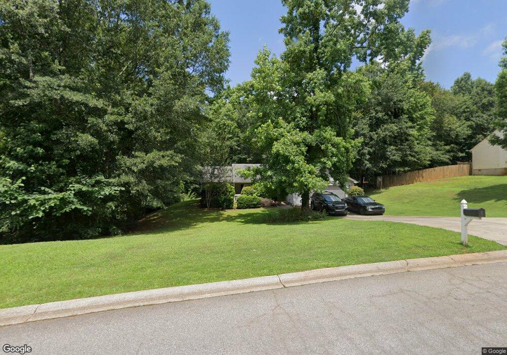
2015 Emerald Pointe Dr Winder, GA 30680
Estimated Value: $286,145 - $319,000
3
Beds
2
Baths
1,270
Sq Ft
$241/Sq Ft
Est. Value
About This Home
This home is located at 2015 Emerald Pointe Dr, Winder, GA 30680 and is currently estimated at $306,536, approximately $241 per square foot. 2015 Emerald Pointe Dr is a home located in Barrow County with nearby schools including Statham Elementary School, Bear Creek Middle School, and Winder-Barrow High School.
Ownership History
Date
Name
Owned For
Owner Type
Purchase Details
Closed on
Apr 1, 2004
Sold by
Southfork Hms Inc
Bought by
Dutton Joseph R
Current Estimated Value
Home Financials for this Owner
Home Financials are based on the most recent Mortgage that was taken out on this home.
Original Mortgage
$105,633
Outstanding Balance
$49,258
Interest Rate
5.53%
Mortgage Type
New Conventional
Estimated Equity
$257,278
Purchase Details
Closed on
Nov 12, 2003
Sold by
Sierra Development Inc
Bought by
Southfork Homes Inc
Purchase Details
Closed on
Jun 18, 2002
Sold by
Davis George H
Bought by
Sierra Development Inc
Create a Home Valuation Report for This Property
The Home Valuation Report is an in-depth analysis detailing your home's value as well as a comparison with similar homes in the area
Home Values in the Area
Average Home Value in this Area
Purchase History
| Date | Buyer | Sale Price | Title Company |
|---|---|---|---|
| Dutton Joseph R | $108,900 | -- | |
| Southfork Homes Inc | $450,000 | -- | |
| Sierra Development Inc | $419,200 | -- |
Source: Public Records
Mortgage History
| Date | Status | Borrower | Loan Amount |
|---|---|---|---|
| Open | Dutton Joseph R | $105,633 |
Source: Public Records
Tax History Compared to Growth
Tax History
| Year | Tax Paid | Tax Assessment Tax Assessment Total Assessment is a certain percentage of the fair market value that is determined by local assessors to be the total taxable value of land and additions on the property. | Land | Improvement |
|---|---|---|---|---|
| 2024 | $2,109 | $94,042 | $18,400 | $75,642 |
| 2023 | $1,706 | $94,642 | $18,400 | $76,242 |
| 2022 | $1,899 | $71,813 | $18,400 | $53,413 |
| 2021 | $1,760 | $62,371 | $16,000 | $46,371 |
| 2020 | $1,754 | $62,371 | $16,000 | $46,371 |
| 2019 | $1,573 | $53,569 | $16,000 | $37,569 |
| 2018 | $1,415 | $47,769 | $10,200 | $37,569 |
| 2017 | $1,072 | $36,824 | $10,200 | $26,624 |
| 2016 | $1,083 | $37,116 | $10,200 | $26,916 |
| 2015 | $1,097 | $37,408 | $10,200 | $27,208 |
| 2014 | $977 | $33,381 | $5,880 | $27,501 |
| 2013 | -- | $32,041 | $5,880 | $26,161 |
Source: Public Records
Map
Nearby Homes
- 1415 Red Oak Way
- 1642 White Oak Dr
- 1453 Solomon Dr
- 1023 Solomon Ct
- 315 Paige Way
- 1593 Highway 82
- 1431 Solomon Dr
- 330 Anchors Way
- 1914 Hearthstone Ct
- 385 Finch Landing Rd
- 212 Rainbow Ln
- 29 Nunnally Rd SE
- 1295 Double Bridges Rd
- 1212 Highway 211 NE
- 1226 Highway 211 NE
- 113 Platte St
- 130 (Tract 1) Bowman Mill Rd NE
- 130 Bowman Mill Rd NE Unit 1
- 207 Cedar Grove Church Rd
- 1206 Corkybrooke Ln
- 2013 Emerald Pointe Dr
- 2017 Emerald Pointe Dr
- 2011 Emerald Pointe Lot6
- 2011 Emerald Pointe Dr
- 1571 Brush Creek Dr
- 2022 Emerald Pointe Dr
- 2018 Emerald Pointe Dr
- 2019 Emerald Pointe Dr
- 2009 Emerald Point
- 2009 Emerald Pte
- 2009 Emerald Pointe Dr Unit 2009
- 2009 Emerald Pointe Dr
- 2009 Emerald Pointe Dr Unit A
- 1573 Brush Creek Dr
- 2007 Emerald Pointe Dr
- 2021 Emerald Pointe Dr
- 1570 Brush Creek Dr
- 1575 Brush Creek Dr
- 2023 Emerald Pointe Dr
- 2005 Emerald Pointe Dr