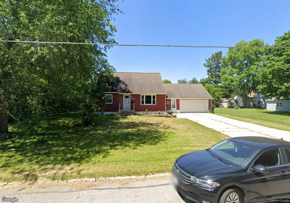
2015 Franklin St Cedar Falls, IA 50613
Estimated Value: $197,000 - $213,000
3
Beds
1
Bath
1,123
Sq Ft
$183/Sq Ft
Est. Value
About This Home
This home is located at 2015 Franklin St, Cedar Falls, IA 50613 and is currently estimated at $205,106, approximately $182 per square foot. 2015 Franklin St is a home located in Black Hawk County with nearby schools including Cedar Heights Elementary School, Peet Junior High School, and Cedar Falls High School.
Ownership History
Date
Name
Owned For
Owner Type
Purchase Details
Closed on
Sep 8, 2009
Sold by
Tunwall Carl S and Tunwall Sandra K
Bought by
Adelmund Jett B
Current Estimated Value
Home Financials for this Owner
Home Financials are based on the most recent Mortgage that was taken out on this home.
Original Mortgage
$103,950
Interest Rate
5.27%
Mortgage Type
New Conventional
Create a Home Valuation Report for This Property
The Home Valuation Report is an in-depth analysis detailing your home's value as well as a comparison with similar homes in the area
Home Values in the Area
Average Home Value in this Area
Purchase History
| Date | Buyer | Sale Price | Title Company |
|---|---|---|---|
| Adelmund Jett B | $115,500 | None Available |
Source: Public Records
Mortgage History
| Date | Status | Borrower | Loan Amount |
|---|---|---|---|
| Previous Owner | Adelmund Jett B | $103,950 |
Source: Public Records
Tax History
| Year | Tax Paid | Tax Assessment Tax Assessment Total Assessment is a certain percentage of the fair market value that is determined by local assessors to be the total taxable value of land and additions on the property. | Land | Improvement |
|---|---|---|---|---|
| 2025 | $2,826 | $200,020 | $77,620 | $122,400 |
| 2024 | $2,826 | $175,630 | $51,740 | $123,890 |
| 2023 | $2,894 | $175,630 | $51,740 | $123,890 |
| 2022 | $2,928 | $156,730 | $51,740 | $104,990 |
| 2021 | $2,836 | $156,730 | $51,740 | $104,990 |
| 2020 | $2,837 | $0 | $0 | $0 |
Source: Public Records
Map
Nearby Homes
- 408 W 20th St
- 2018 Tremont St
- 404 W 20th St
- 2020 Tremont St
- 2103 Franklin St
- 422 W 20th St
- 2004 Franklin St
- 2109 Franklin St Unit 2111
- 2010 Franklin St
- 1937 Franklin St
- 409 W 20th St
- 2104 Tremont St
- 1938 Tremont St
- 2115 Franklin St Unit 2117
- 1929 Franklin St
- 2003 Tremont St
- 1938 Franklin St
- 2110 Franklin St
- 2015 Tremont St
- 2021 Tremont St
Your Personal Tour Guide
Ask me questions while you tour the home.