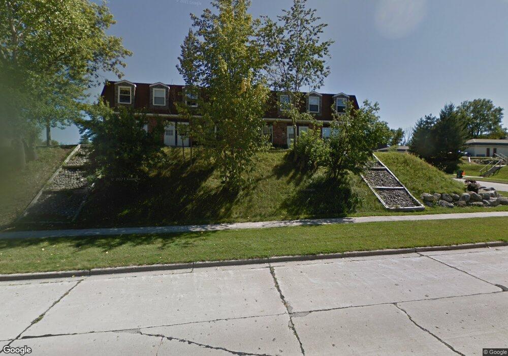
2015 Green Tree Rd West Bend, WI 53090
Estimated Value: $196,000 - $240,000
3
Beds
1
Bath
1,178
Sq Ft
$187/Sq Ft
Est. Value
About This Home
This home is located at 2015 Green Tree Rd, West Bend, WI 53090 and is currently estimated at $220,472, approximately $187 per square foot. 2015 Green Tree Rd is a home located in Washington County with nearby schools including Green Tree Elementary School, Silverbrook Intermediate School, and East High School.
Ownership History
Date
Name
Owned For
Owner Type
Purchase Details
Closed on
Feb 5, 2010
Sold by
Fritzke Nicholas R and Fritzke Amanda K
Bought by
Schwinn Dianne C
Current Estimated Value
Purchase Details
Closed on
Sep 30, 2005
Sold by
Kokott Robert G and Kokott Kathy Joe
Bought by
Fritzke Nicholas R and Fritzke Amanda K
Home Financials for this Owner
Home Financials are based on the most recent Mortgage that was taken out on this home.
Original Mortgage
$104,200
Interest Rate
5.83%
Mortgage Type
New Conventional
Create a Home Valuation Report for This Property
The Home Valuation Report is an in-depth analysis detailing your home's value as well as a comparison with similar homes in the area
Home Values in the Area
Average Home Value in this Area
Purchase History
| Date | Buyer | Sale Price | Title Company |
|---|---|---|---|
| Schwinn Dianne C | $109,000 | Abstract & Title Company | |
| Fritzke Nicholas R | $109,000 | Priority Title Corporation |
Source: Public Records
Mortgage History
| Date | Status | Borrower | Loan Amount |
|---|---|---|---|
| Previous Owner | Fritzke Nicholas R | $104,200 | |
| Closed | Schwinn Dianne C | $0 |
Source: Public Records
Tax History Compared to Growth
Tax History
| Year | Tax Paid | Tax Assessment Tax Assessment Total Assessment is a certain percentage of the fair market value that is determined by local assessors to be the total taxable value of land and additions on the property. | Land | Improvement |
|---|---|---|---|---|
| 2024 | $1,914 | $157,700 | $15,000 | $142,700 |
| 2023 | $1,698 | $93,300 | $10,000 | $83,300 |
| 2022 | $1,492 | $93,300 | $10,000 | $83,300 |
| 2021 | $1,510 | $93,300 | $10,000 | $83,300 |
| 2020 | $1,529 | $93,300 | $10,000 | $83,300 |
| 2019 | $1,464 | $93,300 | $10,000 | $83,300 |
| 2018 | $1,431 | $93,300 | $10,000 | $83,300 |
| 2017 | $1,474 | $84,600 | $10,000 | $74,600 |
| 2016 | $1,476 | $84,600 | $10,000 | $74,600 |
| 2015 | $1,574 | $84,600 | $10,000 | $74,600 |
| 2014 | $1,574 | $84,600 | $10,000 | $74,600 |
| 2013 | $1,703 | $84,600 | $10,000 | $74,600 |
Source: Public Records
Map
Nearby Homes
- 1900 Camden Ln
- 1600 Patricia Dr
- 1420 W Sunset Ridge Dr
- 1817 N Main St
- 7107 River Dr N
- 1669 N Main St
- 615 Roosevelt Dr
- Lt3 Woodford Dr
- Lt2 Woodford Dr
- Lt1 Dandelion Ln
- 2050 Stratford Rd
- Lt1 Sleepy Hollow Rd
- 1509 Monroe St
- 2149 Briar Dr
- 1348 Fond du Lac St
- 1153 N 11th Ave
- 1521 Quietwood Ln
- 7297 Salisbury Rd
- 2951 Glen Ivy Dr
- 7434 Werner Rd
- 2017 Green Tree Rd
- 2013 Green Tree Rd
- 2011 Green Tree Rd
- 2025 Green Tree Rd
- 2027 Green Tree Rd
- 2018 Green Tree Rd
- 2029 Green Tree Rd
- 2031 Green Tree Rd
- 2033 Green Tree Rd
- 2035 Green Tree Rd
- 2012 Green Tree Rd
- 2007 Green Tree Rd
- Lt0 Camden Ln
- 1965 Camden Ln
- 1963 Camden Ln
- 2005 Green Tree Rd
- 1960 Camden Ln
- 2003 Green Tree Rd
- 1958 Camden Ln
- 1961 Camden Ln