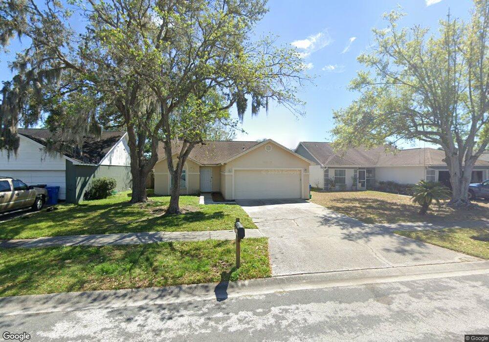
2015 Lori Ann St Brandon, FL 33510
Estimated Value: $313,452 - $358,000
3
Beds
2
Baths
1,270
Sq Ft
$261/Sq Ft
Est. Value
About This Home
This home is located at 2015 Lori Ann St, Brandon, FL 33510 and is currently estimated at $330,863, approximately $260 per square foot. 2015 Lori Ann St is a home located in Hillsborough County with nearby schools including Schmidt Elementary School, Mclane Middle School, and Mann Middle School.
Ownership History
Date
Name
Owned For
Owner Type
Purchase Details
Closed on
Mar 2, 2023
Sold by
Trust No 2015
Bought by
Johnson Jarred
Current Estimated Value
Home Financials for this Owner
Home Financials are based on the most recent Mortgage that was taken out on this home.
Original Mortgage
$69,450
Outstanding Balance
$54,595
Interest Rate
4%
Mortgage Type
New Conventional
Estimated Equity
$276,268
Purchase Details
Closed on
Oct 30, 2019
Sold by
Kirkland W Barbara
Bought by
Johnson Constance E
Purchase Details
Closed on
Dec 27, 2017
Sold by
Kirkland W Barbara
Bought by
Kirkland W Barbara
Purchase Details
Closed on
Dec 18, 2017
Sold by
Kirkland W Barbara
Bought by
Kirkland W Barbara
Purchase Details
Closed on
Nov 22, 1996
Sold by
Johnson Jeffrey R and Johnson E
Bought by
Kirkland W Barbara
Create a Home Valuation Report for This Property
The Home Valuation Report is an in-depth analysis detailing your home's value as well as a comparison with similar homes in the area
Home Values in the Area
Average Home Value in this Area
Purchase History
| Date | Buyer | Sale Price | Title Company |
|---|---|---|---|
| Johnson Jarred | $69,500 | -- | |
| Johnson Jordan | -- | -- | |
| Johnson Constance E | -- | None Available | |
| Kirkland W Barbara | -- | None Available | |
| Kirkland W Barbara | -- | None Available | |
| Kirkland W Barbara | $100 | -- |
Source: Public Records
Mortgage History
| Date | Status | Borrower | Loan Amount |
|---|---|---|---|
| Open | Johnson Jarred | $69,450 |
Source: Public Records
Tax History Compared to Growth
Tax History
| Year | Tax Paid | Tax Assessment Tax Assessment Total Assessment is a certain percentage of the fair market value that is determined by local assessors to be the total taxable value of land and additions on the property. | Land | Improvement |
|---|---|---|---|---|
| 2024 | $3,575 | $211,094 | $67,678 | $143,416 |
| 2023 | $3,972 | $213,880 | $67,678 | $146,202 |
| 2022 | $3,707 | $216,606 | $67,678 | $148,928 |
| 2021 | $3,245 | $157,391 | $43,990 | $113,401 |
| 2020 | $2,923 | $138,522 | $35,531 | $102,991 |
| 2019 | $2,789 | $135,551 | $35,531 | $100,020 |
| 2018 | $2,547 | $120,057 | $0 | $0 |
| 2017 | $2,360 | $108,661 | $0 | $0 |
| 2016 | $2,214 | $99,735 | $0 | $0 |
| 2015 | $2,073 | $90,668 | $0 | $0 |
| 2014 | $1,918 | $82,425 | $0 | $0 |
| 2013 | -- | $74,932 | $0 | $0 |
Source: Public Records
Map
Nearby Homes
- 2070 Sarah Louise Dr
- 1740 Lakeview Village Dr
- 1930 Fruitridge St
- 1933 Fruitridge St
- 1729 Lake Crest Ave
- 2110 Shady Point Ln
- 1709 Open Field Loop
- 0 Williams Rd Unit MFRTB8446110
- 1701 Open Field Loop
- 3102 Williams Rd
- 2761 Emory Sound Place
- 2764 Emory Sound Place
- 2760 Emory Sound Place
- 1909 Dove Field Place
- 2106 Lennox Dale Ln
- 3506 High Hampton Cir
- 2130 Broadway View Ave
- 2110 Laceflower Dr
- 2138 Broadway View Ave
- 2714 Chestnut Creek Place
- 2017 Lori Ann St
- 2013 Lori Ann St
- 2019 Lori Ann St
- 2011 Lori Ann St
- 2021 Lori Ann St
- 2020 Lori Ann St
- 2009 Lori Ann St
- 2018 Lori Ann St
- 2022 Lori Ann St
- 2024 Lori Ann St
- 2016 Lori Ann St
- 2007 Lori Ann St
- 2014 Lori Ann St
- 2023 Lori Ann St
- 2026 Lori Ann St
- 2012 Lori Ann St
- 2005 Lori Ann St
- 2010 Lori Ann St
- 1725 Brandon Trace Ave
- 1736 Brandon Trace Ave