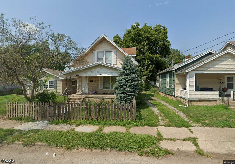
2015 Sherman Ave Middletown, OH 45044
Sherman NeighborhoodEstimated Value: $60,000 - $132,000
2
Beds
1
Bath
1,143
Sq Ft
$91/Sq Ft
Est. Value
About This Home
This home is located at 2015 Sherman Ave, Middletown, OH 45044 and is currently estimated at $103,568, approximately $90 per square foot. 2015 Sherman Ave is a home located in Butler County with nearby schools including Amanda Elementary School, Highview 6th Grade Center, and Middletown Middle School.
Ownership History
Date
Name
Owned For
Owner Type
Purchase Details
Closed on
Jan 14, 2022
Sold by
Hopkins Gary L and Hopkins Linda L
Bought by
Sfr3-040 Llc
Current Estimated Value
Purchase Details
Closed on
Feb 13, 2003
Sold by
Hopkins Linda L and Ratliff Linda L
Bought by
Hopkins Gary and Hopkins Linda L
Home Financials for this Owner
Home Financials are based on the most recent Mortgage that was taken out on this home.
Original Mortgage
$65,000
Interest Rate
6.06%
Mortgage Type
Purchase Money Mortgage
Create a Home Valuation Report for This Property
The Home Valuation Report is an in-depth analysis detailing your home's value as well as a comparison with similar homes in the area
Home Values in the Area
Average Home Value in this Area
Purchase History
| Date | Buyer | Sale Price | Title Company |
|---|---|---|---|
| Sfr3-040 Llc | $48,500 | Rivertowne Title | |
| Hopkins Gary | -- | Premier Title Services Inc |
Source: Public Records
Mortgage History
| Date | Status | Borrower | Loan Amount |
|---|---|---|---|
| Previous Owner | Hopkins Gary | $65,000 |
Source: Public Records
Tax History Compared to Growth
Tax History
| Year | Tax Paid | Tax Assessment Tax Assessment Total Assessment is a certain percentage of the fair market value that is determined by local assessors to be the total taxable value of land and additions on the property. | Land | Improvement |
|---|---|---|---|---|
| 2024 | $1,627 | $23,860 | $4,580 | $19,280 |
| 2023 | $1,257 | $24,170 | $4,580 | $19,590 |
| 2022 | $436 | $16,250 | $4,580 | $11,670 |
| 2021 | $419 | $16,250 | $4,580 | $11,670 |
| 2020 | $437 | $16,250 | $4,580 | $11,670 |
| 2019 | $947 | $13,060 | $4,430 | $8,630 |
| 2018 | $272 | $13,060 | $4,430 | $8,630 |
| 2017 | $272 | $13,060 | $4,430 | $8,630 |
| 2016 | $179 | $11,470 | $4,430 | $7,040 |
| 2015 | $177 | $11,470 | $4,430 | $7,040 |
| 2014 | $435 | $11,470 | $4,430 | $7,040 |
| 2013 | $435 | $16,040 | $4,430 | $11,610 |
Source: Public Records
Map
Nearby Homes
- 2008 Logan Ave
- 1814.5 Logan Ave
- 410 Moore St
- 408 Moore St
- 319 Moore St
- 2124 Sherman Ave
- 401 S Sutphin St
- 407 S Sutphin St
- 2208 Superior Ave
- 2016 Linden Ave
- 1814 Logan Ave
- 2109 Queen Ave
- 2100 Queen Ave
- 2112 Central Ave
- 2128 Queen Ave
- 2007 Central Ave
- 2113 Central Ave
- 2406 S Sutphin St
- 2115 Central Ave
- 2119 Central Ave
- 2017 Sherman Ave
- 2013 Sherman Ave
- 2019 Sherman Ave
- 2009 Sherman Ave
- 2021 Sherman Ave
- 2007 Sherman Ave
- 2023 Sherman Ave
- 2005 Sherman Ave
- 2012 Logan Ave
- 2010 Logan Ave
- 2016 Logan Ave
- 2025 Sherman Ave
- 2006 Logan Ave
- 2018 Logan Ave
- 2014 Sherman Ave
- 2004 Logan Ave
- 2020 Logan Ave
- 2006 Sherman Ave
- 415 Moore St
- 413 Moore St