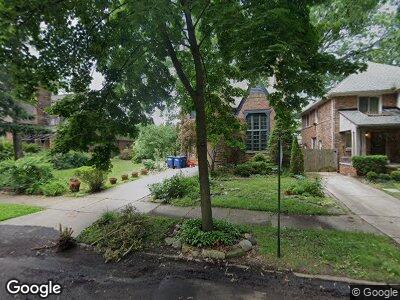
20153 Briarcliff Rd Detroit, MI 48221
Green Acres NeighborhoodEstimated Value: $126,000 - $334,000
--
Bed
--
Bath
2,739
Sq Ft
$91/Sq Ft
Est. Value
About This Home
This home is located at 20153 Briarcliff Rd, Detroit, MI 48221 and is currently estimated at $249,270, approximately $91 per square foot. 20153 Briarcliff Rd is a home located in Wayne County with nearby schools including Pasteur Elementary School, Charles L. Spain Elementary-Middle School, and Edward 'Duke' Ellington Conservatory of Music and Art.
Ownership History
Date
Name
Owned For
Owner Type
Purchase Details
Closed on
Dec 21, 2015
Sold by
Kinkead Daniel H and Kinkead Colleen H
Bought by
Kinkead Daniel H and Kinkead Colleen H
Current Estimated Value
Purchase Details
Closed on
Aug 11, 2004
Sold by
Druckman Adam and Becker Audrey
Bought by
Kinkead Daniel H
Home Financials for this Owner
Home Financials are based on the most recent Mortgage that was taken out on this home.
Original Mortgage
$177,600
Interest Rate
6.08%
Mortgage Type
Unknown
Create a Home Valuation Report for This Property
The Home Valuation Report is an in-depth analysis detailing your home's value as well as a comparison with similar homes in the area
Home Values in the Area
Average Home Value in this Area
Purchase History
| Date | Buyer | Sale Price | Title Company |
|---|---|---|---|
| Kinkead Daniel H | -- | Attorney | |
| Kinkead Daniel H | $222,000 | Htc |
Source: Public Records
Mortgage History
| Date | Status | Borrower | Loan Amount |
|---|---|---|---|
| Open | Kinkead Daniel H | $160,100 | |
| Previous Owner | Kinkead Daniel H | $177,600 | |
| Previous Owner | Kinkead Daniel H | $22,200 |
Source: Public Records
Tax History Compared to Growth
Tax History
| Year | Tax Paid | Tax Assessment Tax Assessment Total Assessment is a certain percentage of the fair market value that is determined by local assessors to be the total taxable value of land and additions on the property. | Land | Improvement |
|---|---|---|---|---|
| 2024 | $116 | $4,800 | $0 | $0 |
| 2023 | $113 | $4,800 | $0 | $0 |
| 2022 | $126 | $4,800 | $0 | $0 |
| 2021 | $122 | $4,800 | $0 | $0 |
| 2020 | $121 | $4,800 | $0 | $0 |
| 2019 | $118 | $4,800 | $0 | $0 |
| 2018 | $97 | $2,000 | $0 | $0 |
| 2017 | $31 | $2,000 | $0 | $0 |
| 2016 | $113 | $36,500 | $0 | $0 |
| 2015 | $160 | $1,600 | $0 | $0 |
| 2013 | $165 | $1,650 | $0 | $0 |
| 2010 | -- | $1,650 | $1,649 | $1 |
Source: Public Records
Map
Nearby Homes
- 20121 Briarcliff Rd
- 20201 Renfrew Rd
- 19938 Renfrew Rd
- 20073 Shrewsbury Rd
- 19650 Stratford Rd
- 20179 Canterbury Rd
- 2564 Woodstock Dr
- 19510 Stratford Rd
- 457 W Bennett
- 20403 Warrington Dr
- 20470 Warrington Dr
- 19566 Canterbury Rd
- 19445 Shrewsbury Rd
- 325 W Chesterfield St
- 19411 Woodston Rd
- 415 Laprairie St
- 19994 Santa Rosa Dr
- 20117 Santa Rosa Dr
- 381 Heatherdale Ln
- 287 Fielding St
- 20153 Briarcliff Rd
- 20153 Briarcliff Rd
- 20161 Briarcliff Rd
- 20161 Briarcliff Rd
- 20137 Briarcliff Rd
- 20145 Briarcliff Rd
- 20169 Briarcliff Rd
- 20169 Briarcliff Rd
- 20177 Briarcliff Rd
- 20177 Briarcliff Rd
- 20154 Renfrew Rd
- 20160 Renfrew Rd
- 20144 Renfrew Rd
- 20170 Renfrew Rd
- 20136 Renfrew Rd
- 20129 Briarcliff Rd
- 20185 Briarcliff Rd
- 20185 Briarcliff Rd
- 20176 Renfrew Rd
- 20130 Renfrew Rd