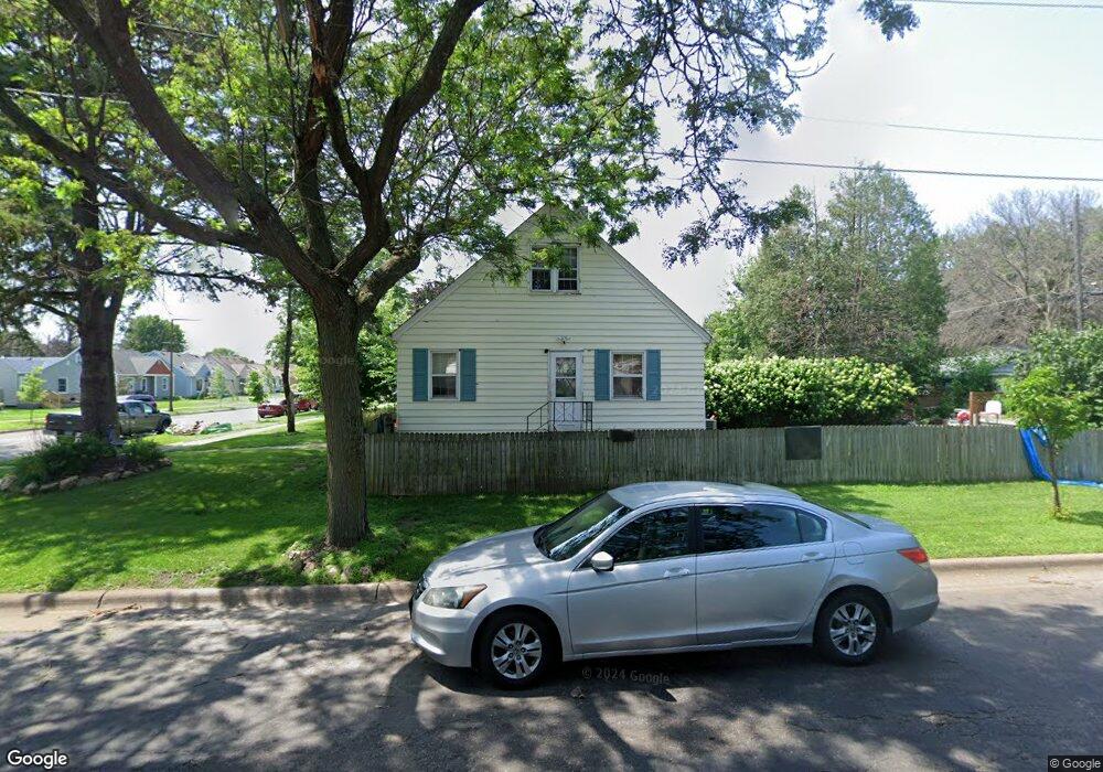
2017 2017 Hawthorne-Avenue-e St. Paul, MN 55119
Southern Hayden Heights NeighborhoodEstimated Value: $217,000 - $250,000
2
Beds
1
Bath
946
Sq Ft
$243/Sq Ft
Est. Value
About This Home
This home is located at 2017 2017 Hawthorne-Avenue-e, St. Paul, MN 55119 and is currently estimated at $230,087, approximately $243 per square foot. 2017 2017 Hawthorne-Avenue-e is a home located in Ramsey County with nearby schools including The Heights Community School, Txuj Ci HMong Language and Culture Upper Campus, and Johnson Senior High School.
Ownership History
Date
Name
Owned For
Owner Type
Purchase Details
Closed on
Jun 3, 2015
Sold by
Singleton Zachary and Singleton Jennifer
Bought by
Williams Stacy
Current Estimated Value
Home Financials for this Owner
Home Financials are based on the most recent Mortgage that was taken out on this home.
Original Mortgage
$120,280
Outstanding Balance
$82,306
Interest Rate
0.78%
Mortgage Type
New Conventional
Estimated Equity
$147,781
Purchase Details
Closed on
Aug 29, 1997
Sold by
Galba Mike and Payson Margo R
Bought by
Zufall Lisa K
Create a Home Valuation Report for This Property
The Home Valuation Report is an in-depth analysis detailing your home's value as well as a comparison with similar homes in the area
Home Values in the Area
Average Home Value in this Area
Purchase History
| Date | Buyer | Sale Price | Title Company |
|---|---|---|---|
| Williams Stacy | $127,757 | Stewart Title | |
| Zufall Lisa K | $72,900 | -- |
Source: Public Records
Mortgage History
| Date | Status | Borrower | Loan Amount |
|---|---|---|---|
| Open | Williams Stacy | $120,280 |
Source: Public Records
Tax History Compared to Growth
Tax History
| Year | Tax Paid | Tax Assessment Tax Assessment Total Assessment is a certain percentage of the fair market value that is determined by local assessors to be the total taxable value of land and additions on the property. | Land | Improvement |
|---|---|---|---|---|
| 2025 | $3,250 | $225,300 | $30,000 | $195,300 |
| 2023 | $3,250 | $213,100 | $25,000 | $188,100 |
| 2022 | $2,968 | $236,000 | $25,000 | $211,000 |
| 2021 | $2,616 | $182,600 | $25,000 | $157,600 |
| 2020 | $2,572 | $167,100 | $18,400 | $148,700 |
| 2019 | $2,578 | $154,900 | $18,400 | $136,500 |
| 2018 | $2,146 | $153,100 | $18,400 | $134,700 |
| 2017 | $1,672 | $139,600 | $18,400 | $121,200 |
| 2016 | $1,698 | $0 | $0 | $0 |
| 2015 | -- | $108,000 | $18,400 | $89,600 |
| 2014 | $1,318 | $0 | $0 | $0 |
Source: Public Records
Map
Nearby Homes
- 1976 Orange Ave E
- 2032 Hyacinth Ave E
- 1931 Hawthorne Ave E
- 1891 Maryland Ave E
- 1868 Ivy Ave E
- 2112 Cottage Ave E
- 1406 Furness Pkwy
- 2311 Nokomis Ave
- 2102 Sherwood Ave
- 1250 Mcknight Rd N
- 1806 Sherwood Ave
- 1828 Arlington Ave E
- 1126 Breen St
- 1732 Maryland Ave E
- 1950 Case Ave E
- 1111 Breen St
- 1711 Maryland Ave E
- 1905 Montana Ave E
- 2106 Stillwater Ave E
- 1729 Sherwood Ave
- 2017 Hawthorne Ave E
- 2013 Hawthorne Ave E
- 2009 Hawthorne Ave E
- 2014 2014 E Hawthorne-Avenue-e
- 2005 Hawthorne Ave E
- 2021 Hawthorne Ave E
- 2021 2021 Hawthorne-Avenue-e
- 2014 Orange Ave E
- 2001 Hawthorne Ave E
- 2025 Hawthorne Ave E
- 2018 Hawthorne Ave E
- 2014 Hawthorne Ave E
- 2014 2014 Hawthorne-Avenue-e
- 2008 Orange Ave E
- 2006 2006 Hawthorne-Avenue-e
- 2024 Orange Ave E
- 2010 Hawthorne Ave E
- 1997 Hawthorne Ave E
- 2006 Hawthorne Ave E
- 2000 Orange Ave E