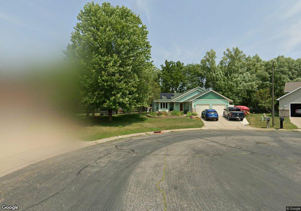
2017 Johnson Ct Northfield, MN 55057
Estimated Value: $361,000 - $391,000
4
Beds
2
Baths
1,234
Sq Ft
$305/Sq Ft
Est. Value
About This Home
This home is located at 2017 Johnson Ct, Northfield, MN 55057 and is currently estimated at $376,045, approximately $304 per square foot. 2017 Johnson Ct is a home located in Rice County with nearby schools including Bridgewater Elementary School, Northfield Middle School, and Northfield Senior High School.
Ownership History
Date
Name
Owned For
Owner Type
Purchase Details
Closed on
May 10, 2019
Sold by
Pepel Jennifer and Pepel Joseph J
Bought by
Zemanek William and Zemanek Alexandra
Current Estimated Value
Home Financials for this Owner
Home Financials are based on the most recent Mortgage that was taken out on this home.
Original Mortgage
$251,010
Interest Rate
3.9%
Mortgage Type
New Conventional
Purchase Details
Closed on
Jan 5, 2018
Sold by
Jewison Ted J and Jewison Julie A
Bought by
Pepel Jennifer and Pepel Joseph J
Home Financials for this Owner
Home Financials are based on the most recent Mortgage that was taken out on this home.
Original Mortgage
$219,300
Interest Rate
3.94%
Mortgage Type
Future Advance Clause Open End Mortgage
Create a Home Valuation Report for This Property
The Home Valuation Report is an in-depth analysis detailing your home's value as well as a comparison with similar homes in the area
Home Values in the Area
Average Home Value in this Area
Purchase History
| Date | Buyer | Sale Price | Title Company |
|---|---|---|---|
| Zemanek William | $278,900 | Edina Realty Title Inc | |
| Pepel Jennifer | $258,000 | Edina Realty Title Inc |
Source: Public Records
Mortgage History
| Date | Status | Borrower | Loan Amount |
|---|---|---|---|
| Previous Owner | Zemanek William | $251,010 | |
| Previous Owner | Pepel Jennifer | $219,300 |
Source: Public Records
Tax History
| Year | Tax Paid | Tax Assessment Tax Assessment Total Assessment is a certain percentage of the fair market value that is determined by local assessors to be the total taxable value of land and additions on the property. | Land | Improvement |
|---|---|---|---|---|
| 2025 | $5,844 | $339,300 | $72,800 | $266,500 |
| 2024 | $5,844 | $316,000 | $66,600 | $249,400 |
| 2023 | $4,692 | $316,000 | $66,600 | $249,400 |
| 2022 | $4,286 | $289,600 | $62,400 | $227,200 |
| 2021 | $4,116 | $256,000 | $56,200 | $199,800 |
| 2020 | $3,824 | $242,100 | $54,100 | $188,000 |
| 2019 | $3,436 | $232,300 | $52,000 | $180,300 |
| 2018 | $3,290 | $208,500 | $47,900 | $160,600 |
| 2017 | $2,964 | $197,200 | $45,800 | $151,400 |
| 2016 | $2,852 | $193,800 | $45,800 | $148,000 |
| 2015 | $2,740 | $179,200 | $45,800 | $133,400 |
| 2014 | -- | $174,000 | $45,800 | $128,200 |
Source: Public Records
Map
Nearby Homes
- 1741 Roosevelt Dr
- 1802 Van Buren Ct
- 2100 Taylor Ct
- 2004 Lincoln St S
- 1513 Senate Ln
- 1301 Presidential Dr
- 2300 Pepper Ridge Ln
- XXXX Division St S
- 2106 Sunnyview Ln
- 205 Linden Place S
- 1908 Sibley View Ln
- Outlot Honeylocust Dr
- 2620 Oak Lawn Dr
- 301 Aster Dr
- 2432 Aspen St
- 2505 Aspen St
- 609 Afton Dr
- 421 Ford St E
- 425 Ford St E
- 917 Division St S
- 2013 Johnson Ct
- 2012 Johnson Ct
- 2009 Johnson Ct
- 2008 Johnson Ct
- 1852 Kennedy Ct
- 1821 Truman Ct
- 1854 Kennedy Ct
- 2005 Johnson Ct
- 2004 Johnson Ct
- 1917 Adams Ct
- 1932 Tyler Ct
- 1850 Kennedy Ct
- 1911 Adams Ct
- 1823 Truman Ct
- 1856 Kennedy Ct
- 1936 Tyler Ct
- 1817 Truman Ct
- 2001 Johnson Ct
- 2000 Johnson Ct
- 1925 Roosevelt Dr
Your Personal Tour Guide
Ask me questions while you tour the home.