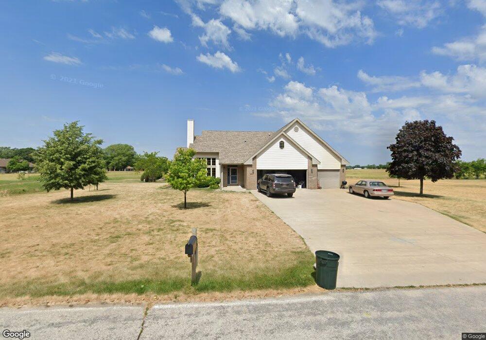
2017 W River Dr Humboldt, IA 50548
Estimated Value: $371,000 - $399,000
3
Beds
3
Baths
2,202
Sq Ft
$173/Sq Ft
Est. Value
About This Home
This home is located at 2017 W River Dr, Humboldt, IA 50548 and is currently estimated at $381,781, approximately $173 per square foot. 2017 W River Dr is a home located in Humboldt County with nearby schools including Clyde D. Mease Elementary School, Taft Elementary School, and Humboldt Middle School.
Ownership History
Date
Name
Owned For
Owner Type
Purchase Details
Closed on
Dec 17, 2010
Sold by
Johnson Nicholas F and Johnson Annette R
Bought by
Kirchhoff Brian L
Current Estimated Value
Home Financials for this Owner
Home Financials are based on the most recent Mortgage that was taken out on this home.
Original Mortgage
$168,000
Outstanding Balance
$112,230
Interest Rate
4.44%
Mortgage Type
New Conventional
Estimated Equity
$269,551
Create a Home Valuation Report for This Property
The Home Valuation Report is an in-depth analysis detailing your home's value as well as a comparison with similar homes in the area
Home Values in the Area
Average Home Value in this Area
Purchase History
| Date | Buyer | Sale Price | Title Company |
|---|---|---|---|
| Kirchhoff Brian L | $210,000 | None Available |
Source: Public Records
Mortgage History
| Date | Status | Borrower | Loan Amount |
|---|---|---|---|
| Open | Kirchhoff Brian L | $168,000 |
Source: Public Records
Tax History Compared to Growth
Tax History
| Year | Tax Paid | Tax Assessment Tax Assessment Total Assessment is a certain percentage of the fair market value that is determined by local assessors to be the total taxable value of land and additions on the property. | Land | Improvement |
|---|---|---|---|---|
| 2025 | $6,050 | $358,850 | $40,320 | $318,530 |
| 2024 | $6,050 | $349,880 | $40,320 | $309,560 |
| 2023 | $5,582 | $349,880 | $40,320 | $309,560 |
| 2022 | $5,244 | $280,400 | $28,800 | $251,600 |
| 2021 | $5,244 | $269,380 | $28,800 | $240,580 |
| 2020 | $5,088 | $259,280 | $28,800 | $230,480 |
| 2019 | $4,360 | $218,640 | $0 | $0 |
| 2018 | $4,512 | $218,640 | $0 | $0 |
| 2017 | $4,512 | $205,120 | $0 | $0 |
| 2016 | $4,358 | $205,120 | $0 | $0 |
| 2015 | $4,358 | $205,120 | $0 | $0 |
| 2014 | $4,266 | $205,120 | $0 | $0 |
Source: Public Records
Map
Nearby Homes
- 2102 W River Dr
- 2013 W River Dr
- 2014 W River Dr
- 2100 W River Dr
- 2012 W River Dr
- 2107 W River Dr
- 2111 W River Dr
- 2010 W River Dr
- 2104 W River Dr
- 2106 W River Dr
- 2113 W River Dr
- 2108 W River Dr
- 2009 W River Dr
- 2009 W River Dr
- 2008 W River Dr
- 2115 W River Dr
- 0 W River Dr
- 0 W River Dr
- 2110 W River Dr
- 2112 W River Dr