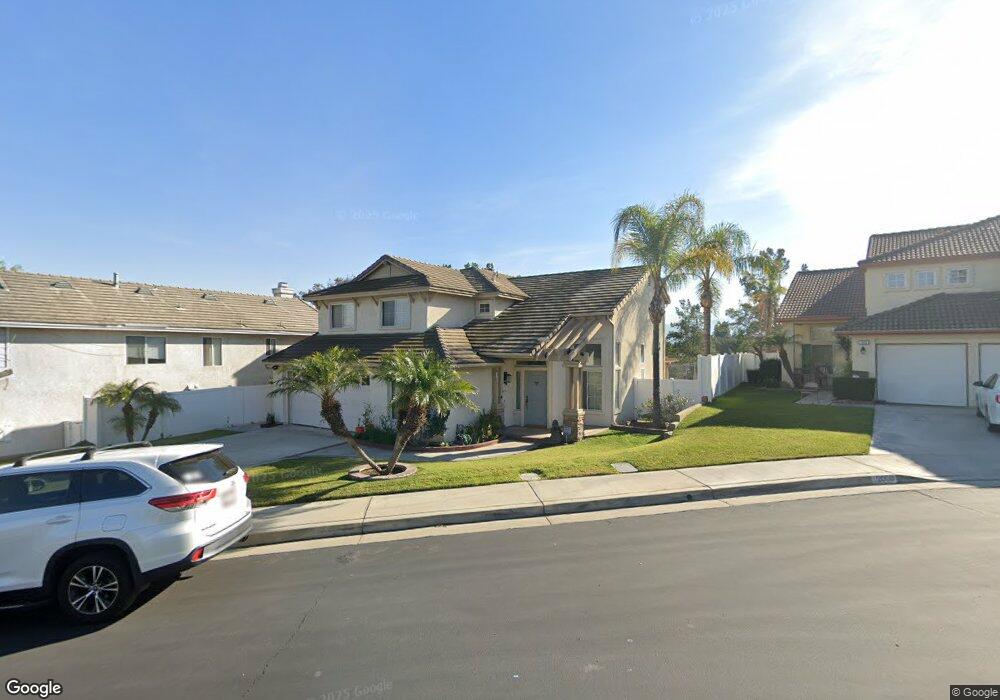
2018 Atherton Cir Corona, CA 92879
Corona Ranch NeighborhoodEstimated Value: $735,000 - $768,000
3
Beds
3
Baths
1,781
Sq Ft
$424/Sq Ft
Est. Value
About This Home
This home is located at 2018 Atherton Cir, Corona, CA 92879 and is currently estimated at $755,397, approximately $424 per square foot. 2018 Atherton Cir is a home located in Riverside County with nearby schools including William McKinley Elementary School, Auburndale Intermediate, and Centennial High School.
Ownership History
Date
Name
Owned For
Owner Type
Purchase Details
Closed on
Apr 12, 2005
Sold by
Lam Anthony Khai and Lam Nory
Bought by
Lam Anthony Khai and Lam Nory
Current Estimated Value
Home Financials for this Owner
Home Financials are based on the most recent Mortgage that was taken out on this home.
Original Mortgage
$320,000
Outstanding Balance
$161,178
Interest Rate
5.92%
Mortgage Type
Stand Alone Refi Refinance Of Original Loan
Estimated Equity
$594,219
Purchase Details
Closed on
Jan 9, 1996
Sold by
Summit Corona Lp
Bought by
Lam Anthony Khai and Lam Nory
Home Financials for this Owner
Home Financials are based on the most recent Mortgage that was taken out on this home.
Original Mortgage
$165,200
Interest Rate
6.98%
Mortgage Type
Purchase Money Mortgage
Create a Home Valuation Report for This Property
The Home Valuation Report is an in-depth analysis detailing your home's value as well as a comparison with similar homes in the area
Home Values in the Area
Average Home Value in this Area
Purchase History
| Date | Buyer | Sale Price | Title Company |
|---|---|---|---|
| Lam Anthony Khai | -- | Southland Title Corporation | |
| Lam Anthony Khai | $174,000 | First American Title Ins Co |
Source: Public Records
Mortgage History
| Date | Status | Borrower | Loan Amount |
|---|---|---|---|
| Open | Lam Anthony Khai | $320,000 | |
| Previous Owner | Lam Anthony Khai | $165,200 |
Source: Public Records
Tax History
| Year | Tax Paid | Tax Assessment Tax Assessment Total Assessment is a certain percentage of the fair market value that is determined by local assessors to be the total taxable value of land and additions on the property. | Land | Improvement |
|---|---|---|---|---|
| 2025 | $4,127 | $305,137 | $49,817 | $255,320 |
| 2023 | $4,127 | $293,290 | $47,884 | $245,406 |
| 2022 | $3,991 | $287,541 | $46,946 | $240,595 |
| 2021 | $3,912 | $281,904 | $46,026 | $235,878 |
| 2020 | $3,863 | $279,015 | $45,555 | $233,460 |
| 2019 | $3,777 | $273,545 | $44,662 | $228,883 |
| 2018 | $3,695 | $268,183 | $43,788 | $224,395 |
| 2017 | $3,609 | $262,926 | $42,930 | $219,996 |
| 2016 | $3,567 | $257,772 | $42,089 | $215,683 |
| 2015 | $3,491 | $253,902 | $41,457 | $212,445 |
| 2014 | $3,396 | $248,931 | $40,646 | $208,285 |
Source: Public Records
Map
Nearby Homes
- 1860 Coolidge St
- 693 John Dr
- 2156 Blazing St
- 2125 Tehachapi Dr
- 686 Azure Ln Unit 2
- 2225 Indigo Hills Dr Unit 3
- 2230 Indigo Hills Dr Unit 4
- 2265 Indigo Hills Dr Unit 6
- 2290 Indigo Hills Dr Unit 6
- 928 Allegre Dr
- 748 Navarro Dr
- 747 Ochee Cir
- 1010 La Terraza Cir Unit 207
- 2275 Dorado St
- 2131 Almeria St Unit 102
- 1020 La Terraza Cir Unit 102
- 1937 Madera Cir
- 1455 Cresta Rd
- 1445 Del Norte Dr
- 1454 Cresta Rd
- 2008 Atherton Cir
- 2028 Atherton Cir
- 2038 Atherton Cir
- 1998 Atherton Cir
- 2033 Stonehaven Dr
- 1988 Atherton Cir
- 2047 Stonehaven Dr
- 2048 Atherton Cir
- 1978 Atherton Cir
- 2061 Stonehaven Dr
- 2058 Atherton Cir
- 2024 Stonehaven Dr
- 2038 Stonehaven Dr
- 1935 Stonehaven Dr
- 2043 Atherton Cir
- 2010 Stonehaven Dr
- 2052 Stonehaven Dr
- 2075 Stonehaven Dr
- 2066 Stonehaven Dr
- 1996 Stonehaven Dr
Your Personal Tour Guide
Ask me questions while you tour the home.