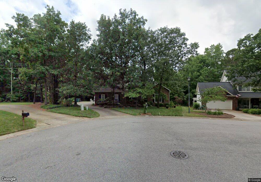
2018 Millbrook Ln Matthews, NC 28104
Estimated Value: $413,000 - $572,219
3
Beds
2
Baths
1,797
Sq Ft
$269/Sq Ft
Est. Value
About This Home
This home is located at 2018 Millbrook Ln, Matthews, NC 28104 and is currently estimated at $484,055, approximately $269 per square foot. 2018 Millbrook Ln is a home located in Union County with nearby schools including Stallings Elementary School, Porter Ridge Middle School, and Porter Ridge High School.
Ownership History
Date
Name
Owned For
Owner Type
Purchase Details
Closed on
Oct 16, 1998
Sold by
Sumrall Glenn R and Sumrall Johnnie B
Bought by
Clark Hal and Clark Brenda A
Current Estimated Value
Home Financials for this Owner
Home Financials are based on the most recent Mortgage that was taken out on this home.
Original Mortgage
$103,000
Outstanding Balance
$22,356
Interest Rate
6.8%
Estimated Equity
$461,699
Create a Home Valuation Report for This Property
The Home Valuation Report is an in-depth analysis detailing your home's value as well as a comparison with similar homes in the area
Home Values in the Area
Average Home Value in this Area
Purchase History
| Date | Buyer | Sale Price | Title Company |
|---|---|---|---|
| Clark Hal | $176,000 | -- |
Source: Public Records
Mortgage History
| Date | Status | Borrower | Loan Amount |
|---|---|---|---|
| Open | Clark Hal | $103,000 |
Source: Public Records
Tax History Compared to Growth
Tax History
| Year | Tax Paid | Tax Assessment Tax Assessment Total Assessment is a certain percentage of the fair market value that is determined by local assessors to be the total taxable value of land and additions on the property. | Land | Improvement |
|---|---|---|---|---|
| 2024 | $2,660 | $0 | $0 | $0 |
| 2023 | $2,547 | $0 | $0 | $0 |
| 2022 | $2,526 | $0 | $0 | $0 |
| 2021 | $2,526 | $0 | $0 | $0 |
| 2020 | $2,538 | $250,600 | $42,500 | $208,100 |
| 2019 | $2,539 | $250,600 | $42,500 | $208,100 |
| 2018 | $0 | $250,600 | $42,500 | $208,100 |
| 2017 | $2,579 | $242,100 | $42,500 | $199,600 |
| 2016 | $2,540 | $242,100 | $42,500 | $199,600 |
| 2015 | $2,570 | $242,100 | $42,500 | $199,600 |
| 2014 | $1,538 | $215,370 | $43,000 | $172,370 |
Source: Public Records
Map
Nearby Homes
- 1431 Porch Swing Ln
- 8120 Stevens Mill Rd
- Lawyers Rd Lawyers Rd
- 1026 Galloway Dr
- 14404 Lawyers Rd
- 1330 Millview Ln
- 1346 Millview Ln
- 1377 Millview Ln
- 1004 Moose Trail
- 909 Kayla Ct
- 3100 Shady Grove Ln
- 8056 Hunley Ridge Rd
- 8048 Hunley Ridge Rd
- 2241 Flagstick Dr
- 2314 Flagstick Dr
- 7213 Three Wood Dr
- 3000 Beech Ct
- 0 Allen Black Rd
- 3108 Leicester Dr
- 1715 Union Rd
- 2010 Millbrook Ln
- 2026 Millbrook Ln
- 2002 Millbrook Ln
- 2011 Millbrook Ln
- 1016 Millwright Ln
- 2003 Millbrook Ln
- 2019 Millbrook Ln
- 1114 Millwright Ln
- 1964 Millbrook Ln
- 1000 Millwright Ln
- 1126 Millwright Ln
- 1132 Millwright Ln
- 1015 Millwright Ln
- 1956 Millbrook Ln
- 1951 Millbrook Ln
- 1111 Millwright Ln
- 1009 Millwright Ln
- 1117 Millwright Ln
- 1144 Millwright Ln
- 1948 Millbrook Ln