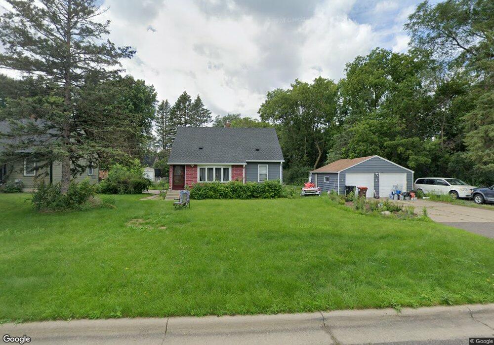
2019 Dieter St Saint Paul, MN 55109
Gladstone NeighborhoodEstimated Value: $321,000 - $342,924
3
Beds
2
Baths
1,046
Sq Ft
$316/Sq Ft
Est. Value
About This Home
This home is located at 2019 Dieter St, Saint Paul, MN 55109 and is currently estimated at $330,481, approximately $315 per square foot. 2019 Dieter St is a home located in Ramsey County with nearby schools including Weaver Elementary School, John Glenn Middle School, and Mounds Park Academy.
Ownership History
Date
Name
Owned For
Owner Type
Purchase Details
Closed on
Sep 29, 2016
Sold by
Anderson Natalie
Bought by
Guerra Patricio T
Current Estimated Value
Home Financials for this Owner
Home Financials are based on the most recent Mortgage that was taken out on this home.
Original Mortgage
$201,286
Outstanding Balance
$161,573
Interest Rate
3.5%
Mortgage Type
FHA
Estimated Equity
$168,908
Purchase Details
Closed on
Jul 18, 2014
Sold by
Ristow Wallace W and Ristow Jean M
Bought by
Ristow Wallace W and Wallace W Ristow Revocable Trust
Create a Home Valuation Report for This Property
The Home Valuation Report is an in-depth analysis detailing your home's value as well as a comparison with similar homes in the area
Home Values in the Area
Average Home Value in this Area
Purchase History
| Date | Buyer | Sale Price | Title Company |
|---|---|---|---|
| Guerra Patricio T | $211,212 | Titlesmart Inc | |
| Ristow Wallace W | $515 | None Available |
Source: Public Records
Mortgage History
| Date | Status | Borrower | Loan Amount |
|---|---|---|---|
| Open | Guerra Patricio T | $201,286 |
Source: Public Records
Tax History Compared to Growth
Tax History
| Year | Tax Paid | Tax Assessment Tax Assessment Total Assessment is a certain percentage of the fair market value that is determined by local assessors to be the total taxable value of land and additions on the property. | Land | Improvement |
|---|---|---|---|---|
| 2025 | $4,232 | $335,100 | $70,700 | $264,400 |
| 2023 | $4,232 | $300,900 | $70,700 | $230,200 |
| 2022 | $3,482 | $278,600 | $70,700 | $207,900 |
| 2021 | $3,260 | $244,900 | $70,700 | $174,200 |
| 2020 | $3,538 | $235,600 | $70,700 | $164,900 |
| 2019 | $2,780 | $237,600 | $70,700 | $166,900 |
| 2018 | $2,824 | $195,700 | $70,700 | $125,000 |
| 2017 | $2,726 | $193,400 | $70,700 | $122,700 |
| 2016 | $2,498 | $0 | $0 | $0 |
| 2015 | $2,550 | $168,300 | $64,900 | $103,400 |
| 2014 | $2,002 | $0 | $0 | $0 |
Source: Public Records
Map
Nearby Homes
- 1940 Barclay St
- 1984 Prosperity Rd
- 1854 Barclay St
- 1869 Birmingham St
- 1467 County Road B E
- 1870 Clarence St
- 1509 Sandhurst Ave E
- 1849 Kennard St
- 1496 Laurie Rd E
- 1937 Flandrau St
- 1666 Laurie Rd E
- 1856 Flandrau St
- 1694 Laurie Rd E
- 1435 Price Ave
- 1751 Clarence St
- 1201 Frost Ave
- 1247 Lealand Rd E
- 1740 English St
- 1672 Manton St
- 1627 Christie Place
- 2013 Dieter St
- 2007 Dieter St
- 2012 Barclay St
- 2018 Dieter St
- 2012 Dieter St
- 2012 Dieter St N
- 2026 Dieter St
- 1999 Dieter St
- 2006 Dieter St
- 2000 Dieter St
- 1993 Dieter St
- 1993 Dieter St N
- 1998 Barclay St
- 1994 Dieter St
- 2021 Hazelwood St
- 2013 Hazelwood St
- 2046 Barclay St
- 2005 Barclay St
- 2007 Hazelwood St
- 1505 Ryan Ave E