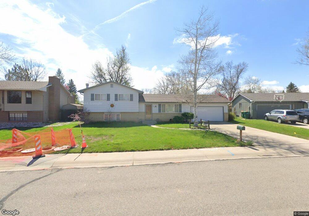
2019 Sheffield Ct Fort Collins, CO 80526
Estimated Value: $488,169 - $554,000
3
Beds
2
Baths
1,628
Sq Ft
$325/Sq Ft
Est. Value
About This Home
This home is located at 2019 Sheffield Ct, Fort Collins, CO 80526 and is currently estimated at $529,542, approximately $325 per square foot. 2019 Sheffield Ct is a home located in Larimer County with nearby schools including Bennett Elementary School, Blevins Middle School, and Rocky Mountain High School.
Ownership History
Date
Name
Owned For
Owner Type
Purchase Details
Closed on
Feb 27, 2002
Sold by
Strand Averil G
Bought by
Averil G Strand Trust
Current Estimated Value
Purchase Details
Closed on
Dec 26, 2001
Sold by
Averil G Strand Trust
Bought by
Strand Averil G
Home Financials for this Owner
Home Financials are based on the most recent Mortgage that was taken out on this home.
Original Mortgage
$121,000
Interest Rate
6.41%
Purchase Details
Closed on
Mar 16, 2001
Sold by
Strand Averil G
Bought by
Averil G Strand Trust and Strand Averil G
Purchase Details
Closed on
Jan 11, 2001
Sold by
Strand Lisa G
Bought by
Strand Averil G
Purchase Details
Closed on
May 29, 1998
Sold by
Campbell Randall B Sharon G
Bought by
Strand Thomas Gwyn and Strand Averil G
Home Financials for this Owner
Home Financials are based on the most recent Mortgage that was taken out on this home.
Original Mortgage
$121,380
Interest Rate
7.22%
Mortgage Type
FHA
Create a Home Valuation Report for This Property
The Home Valuation Report is an in-depth analysis detailing your home's value as well as a comparison with similar homes in the area
Home Values in the Area
Average Home Value in this Area
Purchase History
| Date | Buyer | Sale Price | Title Company |
|---|---|---|---|
| Averil G Strand Trust | -- | -- | |
| Strand Averil G | -- | -- | |
| Averil G Strand Trust | -- | -- | |
| Strand Averil G | -- | -- | |
| Strand Thomas Gwyn | $131,900 | -- |
Source: Public Records
Mortgage History
| Date | Status | Borrower | Loan Amount |
|---|---|---|---|
| Closed | Strand Averil G | $121,000 | |
| Closed | Strand Thomas Gwyn | $121,380 |
Source: Public Records
Tax History Compared to Growth
Tax History
| Year | Tax Paid | Tax Assessment Tax Assessment Total Assessment is a certain percentage of the fair market value that is determined by local assessors to be the total taxable value of land and additions on the property. | Land | Improvement |
|---|---|---|---|---|
| 2025 | $3,002 | $34,967 | $3,015 | $31,952 |
| 2024 | $2,856 | $34,967 | $3,015 | $31,952 |
| 2022 | $2,335 | $24,729 | $3,128 | $21,601 |
| 2021 | $2,360 | $25,440 | $3,218 | $22,222 |
| 2020 | $2,348 | $25,097 | $3,218 | $21,879 |
| 2019 | $2,358 | $25,097 | $3,218 | $21,879 |
| 2018 | $1,917 | $21,031 | $3,240 | $17,791 |
| 2017 | $1,910 | $21,031 | $3,240 | $17,791 |
| 2016 | $1,708 | $18,706 | $3,582 | $15,124 |
| 2015 | $1,695 | $18,700 | $3,580 | $15,120 |
| 2014 | $1,423 | $15,600 | $3,580 | $12,020 |
Source: Public Records
Map
Nearby Homes
- 2206 Rambouillet Dr
- 2404 Sheffield Cir E
- 2420 Sheffield Cir E
- 1955 Kingsborough Dr
- 1701 Glenwood Dr
- 1757 Concord Dr
- 1905 Yorktown Ave
- 2213 Shropshire Ave
- 2607 S Taft Hill Rd
- 2114 Water Blossom Ln
- 2613 Hanover Dr
- 2800 S Taft Hill Rd
- 2455 Wyandotte Dr
- 1513 Independence Rd
- 1854 Marlborough Ct
- 2109 W Drake Rd
- 2001 W Prospect Rd
- 2001 Evergreen Dr
- 2706 Dunbar Ave
- 1680 Foxbrook Way
- 2025 Sheffield Ct
- 2013 Sheffield Ct
- 2008 Manchester Dr
- 2000 Manchester Dr
- 2016 Manchester Dr
- 2125 Sheffield Dr
- 2007 Sheffield Ct
- 2024 Manchester Dr
- 2012 Sheffield Ct
- 2142 Sheffield Dr
- 2032 Manchester Dr
- 2119 Sheffield Dr
- 2136 Sheffield Dr
- 2148 Sheffield Dr
- 2300 Manchester Ct
- 2001 Sheffield Ct
- 2130 Sheffield Dr
- 2201 Sheffield Dr
- 2006 Sheffield Ct
- 2000 Sheffield Ct