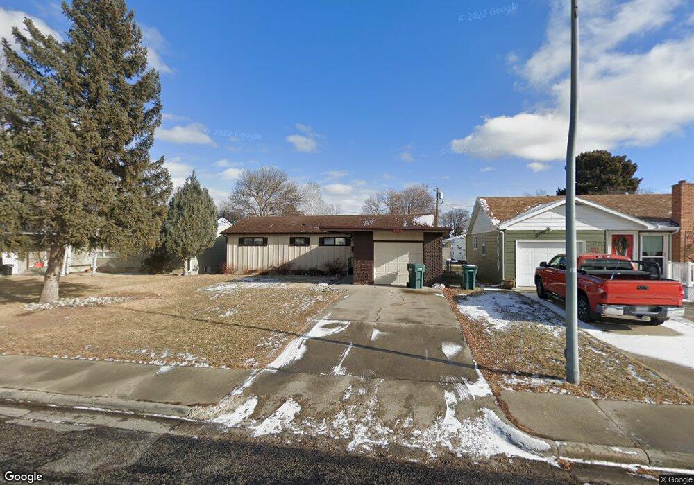
2019 Wilshire St Billings, MT 59102
North Central Billings NeighborhoodEstimated Value: $353,000 - $396,000
4
Beds
2
Baths
2,660
Sq Ft
$140/Sq Ft
Est. Value
About This Home
This home is located at 2019 Wilshire St, Billings, MT 59102 and is currently estimated at $372,720, approximately $140 per square foot. 2019 Wilshire St is a home located in Yellowstone County with nearby schools including Rose Park School, Lewis & Clark Junior High School, and Billings Senior High School.
Ownership History
Date
Name
Owned For
Owner Type
Purchase Details
Closed on
Dec 8, 2014
Sold by
Vralsted Leann C
Bought by
Barraza Arthur R and Guapo Emma
Current Estimated Value
Home Financials for this Owner
Home Financials are based on the most recent Mortgage that was taken out on this home.
Original Mortgage
$195,886
Outstanding Balance
$149,881
Interest Rate
3.89%
Mortgage Type
FHA
Estimated Equity
$222,839
Create a Home Valuation Report for This Property
The Home Valuation Report is an in-depth analysis detailing your home's value as well as a comparison with similar homes in the area
Home Values in the Area
Average Home Value in this Area
Purchase History
| Date | Buyer | Sale Price | Title Company |
|---|---|---|---|
| Barraza Arthur R | -- | First Montana Title |
Source: Public Records
Mortgage History
| Date | Status | Borrower | Loan Amount |
|---|---|---|---|
| Open | Barraza Arthur R | $195,886 |
Source: Public Records
Tax History Compared to Growth
Tax History
| Year | Tax Paid | Tax Assessment Tax Assessment Total Assessment is a certain percentage of the fair market value that is determined by local assessors to be the total taxable value of land and additions on the property. | Land | Improvement |
|---|---|---|---|---|
| 2025 | $3,202 | $334,000 | $47,988 | $286,012 |
| 2024 | $3,202 | $317,200 | $44,394 | $272,806 |
| 2023 | $3,190 | $317,200 | $44,394 | $272,806 |
| 2022 | $2,757 | $238,500 | $42,088 | $196,412 |
| 2021 | $2,619 | $238,500 | $0 | $0 |
| 2020 | $2,666 | $232,600 | $0 | $0 |
| 2019 | $2,550 | $232,600 | $0 | $0 |
| 2018 | $2,387 | $211,900 | $0 | $0 |
| 2017 | $2,325 | $211,900 | $0 | $0 |
| 2016 | $2,147 | $196,200 | $0 | $0 |
| 2015 | $2,102 | $196,200 | $0 | $0 |
| 2014 | $1,890 | $92,803 | $0 | $0 |
Source: Public Records
Map
Nearby Homes
- 1444 Colton Blvd
- 1436 Parkhill Dr
- 24 Heatherwood Ln Unit 12D
- 56 Shadow Place
- 46 Shadow Place Unit 6B
- 2202 13th St W
- 41 Heatherwood Ln
- 1400 Poly Dr Unit 4D
- 1229 Avenue E
- 1121 Parkhill Dr
- 1240 Avenue D Unit 8
- 1240 Avenue D Unit 7
- 1124 Parkhill Dr
- 1214 Harvard Ave
- 1734 Mariposa Ln
- 1745 Parkhill Dr
- 1034 Avenue F
- 1833 Iris Ln
- 1503 11th St W
- 1028 Princeton Ave
- 2023 Wilshire St
- 2015 Wilshire St
- 1416 Colton Blvd
- 2011 Wilshire St
- 2020 14th St W
- 1406 Colton Blvd
- 2024 14th St W
- 2018 14th St W
- 2016 Wilshire St
- 2014 Wilshire St
- 2007 Wilshire St
- 2030 Wilshire St
- 2012 Wilshire St
- 1420 Colton Blvd
- 1423 Parkhill Dr
- 2008 Wilshire St
- 2006 Wilshire St
- 1415 Colton Blvd
- 1409 Colton Blvd
- 1423 Colton Blvd