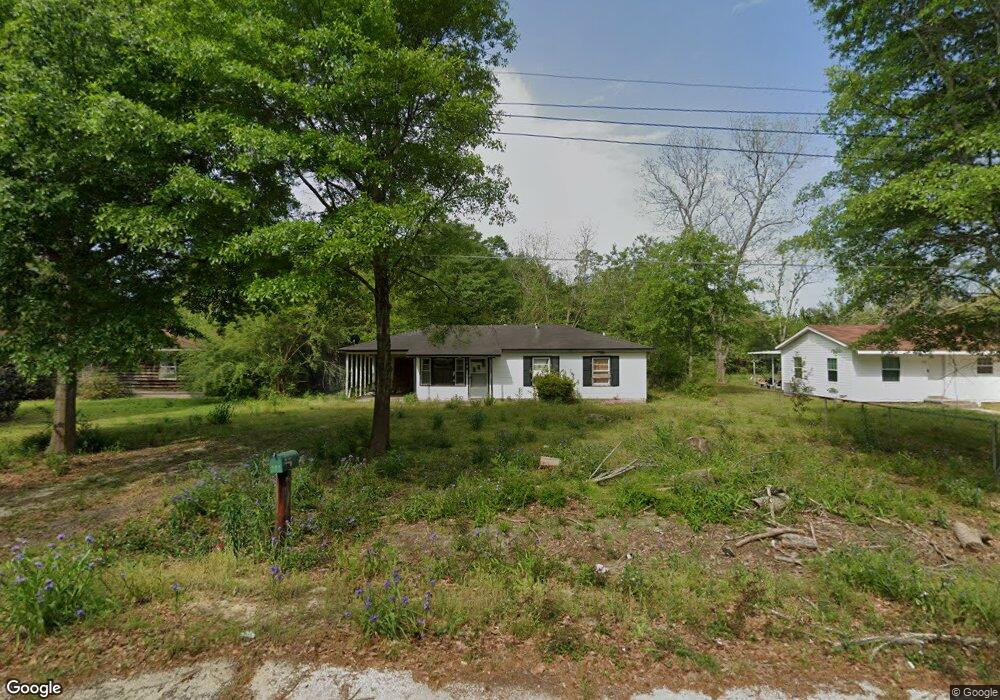
202 10th Ave Atmore, AL 36502
Estimated Value: $85,773 - $153,000
--
Bed
1
Bath
950
Sq Ft
$122/Sq Ft
Est. Value
About This Home
This home is located at 202 10th Ave, Atmore, AL 36502 and is currently estimated at $115,693, approximately $121 per square foot. 202 10th Ave is a home located in Escambia County with nearby schools including Rachel Patterson Elementary School, A.C. Moore Elementary School, and Escambia County Middle School.
Ownership History
Date
Name
Owned For
Owner Type
Purchase Details
Closed on
Sep 14, 2012
Sold by
First National Bank And Trust
Bought by
Rollin M Shane and Wedgeworth Ronald
Current Estimated Value
Purchase Details
Closed on
Jul 13, 2012
Sold by
Bonner Frederick Gilmore and Bonner Kyna R
Bought by
First National Bank Of Atmore
Purchase Details
Closed on
Aug 30, 2005
Sold by
White Kenneth Shane
Bought by
Peavy Sheila M
Home Financials for this Owner
Home Financials are based on the most recent Mortgage that was taken out on this home.
Original Mortgage
$44,550
Interest Rate
5.77%
Create a Home Valuation Report for This Property
The Home Valuation Report is an in-depth analysis detailing your home's value as well as a comparison with similar homes in the area
Home Values in the Area
Average Home Value in this Area
Purchase History
| Date | Buyer | Sale Price | Title Company |
|---|---|---|---|
| Rollin M Shane | -- | -- | |
| First National Bank Of Atmore | -- | -- | |
| Peavy Sheila M | -- | -- |
Source: Public Records
Mortgage History
| Date | Status | Borrower | Loan Amount |
|---|---|---|---|
| Previous Owner | Peavy Sheila M | $44,550 |
Source: Public Records
Tax History Compared to Growth
Tax History
| Year | Tax Paid | Tax Assessment Tax Assessment Total Assessment is a certain percentage of the fair market value that is determined by local assessors to be the total taxable value of land and additions on the property. | Land | Improvement |
|---|---|---|---|---|
| 2024 | $199 | $4,960 | $0 | $0 |
| 2023 | $199 | $7,740 | $0 | $0 |
| 2022 | $262 | $5,940 | $0 | $0 |
| 2021 | $248 | $5,940 | $0 | $0 |
| 2020 | $217 | $5,320 | $0 | $0 |
| 2019 | $211 | $5,200 | $0 | $0 |
| 2018 | $201 | $5,000 | $0 | $0 |
| 2017 | $186 | $4,700 | $0 | $0 |
| 2015 | -- | $4,700 | $1,000 | $3,700 |
| 2014 | -- | $4,700 | $1,000 | $3,700 |
Source: Public Records
Map
Nearby Homes
- 212 11th Ave
- 311 Cloverdale Rd
- 56 Old Bratt Rd
- 208 14th Ave
- 308 4th Ave
- 326 E Horner St
- 325 E Horner St
- 511 4th Ave
- 208 Beck St
- 511 E Pine St
- 301 E Craig St
- 501 S Presley St
- 401 E Oak St
- 301 Roberts St
- 701 Mcrae St
- 64 King St Unit 3, 4, 5 Blk C
- 00 Mcrae St
- 00 Mcrae St Unit 3
- 0 E Owens St Unit 666137
- 0 E Owens St Unit 9,10 364614