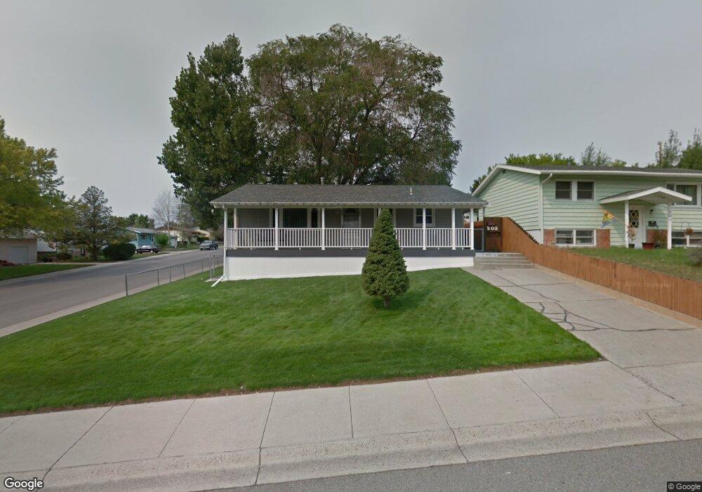
202 13th St W Billings, MT 59102
East Central Billings NeighborhoodEstimated Value: $257,000 - $331,000
3
Beds
2
Baths
925
Sq Ft
$330/Sq Ft
Est. Value
About This Home
This home is located at 202 13th St W, Billings, MT 59102 and is currently estimated at $305,200, approximately $329 per square foot. 202 13th St W is a home located in Yellowstone County with nearby schools including Miles Avenue School, Lewis & Clark Junior High School, and Billings West High School.
Ownership History
Date
Name
Owned For
Owner Type
Purchase Details
Closed on
Nov 24, 2010
Sold by
Trimbo Dennis B and Trimbo Dennis L
Bought by
Trimbo Dennis L and Trimbo Ruth L
Current Estimated Value
Home Financials for this Owner
Home Financials are based on the most recent Mortgage that was taken out on this home.
Original Mortgage
$69,000
Interest Rate
4.16%
Mortgage Type
New Conventional
Create a Home Valuation Report for This Property
The Home Valuation Report is an in-depth analysis detailing your home's value as well as a comparison with similar homes in the area
Home Values in the Area
Average Home Value in this Area
Purchase History
| Date | Buyer | Sale Price | Title Company |
|---|---|---|---|
| Trimbo Dennis L | -- | None Available |
Source: Public Records
Mortgage History
| Date | Status | Borrower | Loan Amount |
|---|---|---|---|
| Closed | Trimbo Dennis L | $69,000 |
Source: Public Records
Tax History Compared to Growth
Tax History
| Year | Tax Paid | Tax Assessment Tax Assessment Total Assessment is a certain percentage of the fair market value that is determined by local assessors to be the total taxable value of land and additions on the property. | Land | Improvement |
|---|---|---|---|---|
| 2025 | $2,514 | $307,800 | $47,968 | $259,832 |
| 2024 | $2,514 | $258,900 | $44,379 | $214,521 |
| 2023 | $2,519 | $258,900 | $44,379 | $214,521 |
| 2022 | $1,967 | $208,300 | $0 | $0 |
| 2021 | $2,198 | $208,300 | $0 | $0 |
| 2020 | $2,162 | $195,100 | $0 | $0 |
| 2019 | $2,065 | $195,100 | $0 | $0 |
| 2018 | $2,085 | $194,000 | $0 | $0 |
| 2017 | $1,796 | $194,000 | $0 | $0 |
| 2016 | $1,910 | $185,000 | $0 | $0 |
| 2015 | $1,867 | $185,000 | $0 | $0 |
| 2014 | $1,654 | $86,548 | $0 | $0 |
Source: Public Records
Map
Nearby Homes
- 1231 Saint Johns Ave
- 1122 Howard Ave
- 1113 Lynn Ave
- 1212 Concord Dr
- 1019 Miles Ave
- 1310 Yellowstone Ave Unit 6
- 1310 Yellowstone Ave Unit 11
- 1310 Yellowstone Ave Unit 16
- 141 S 12th St W
- 1256 & 1260 Yellowstone Ave
- 305 17th St W
- 1265 Yellowstone Ave
- 927 Miles Ave
- 1263 Yellowstone Ave
- 925 Miles Ave
- 1230 Clark Ave
- 1537 Wyoming Ave Unit D
- 1214 Clark Ave
- 1604 Wyoming Ave
- 1225 Clark Ave
- 206 13th St W
- 210 13th St W
- 1315 Cook Ave
- 1302 Cook Ave
- 1306 Cook Ave
- 209 Normandy Dr
- 216 13th St W
- 1310 Cook Ave
- 215 Normandy Dr
- 1245 Cook Ave
- 1314 Cook Ave
- 219 Normandy Dr
- 220 13th St W
- 1246 Howard Ave
- 1237 Cook Ave
- 1318 Cook Ave
- 1303 Saint Johns Ave
- 1305 Saint Johns Ave
- 1244 Howard Ave
- 1311 Saint Johns Ave