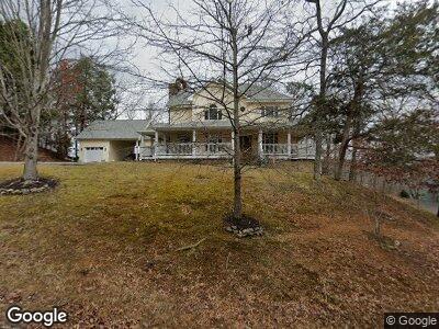
202 Clear Point Ln Pigeon Forge, TN 37863
Estimated Value: $608,000 - $690,759
--
Bed
5
Baths
3,314
Sq Ft
$196/Sq Ft
Est. Value
About This Home
This home is located at 202 Clear Point Ln, Pigeon Forge, TN 37863 and is currently estimated at $649,380, approximately $195 per square foot. 202 Clear Point Ln is a home located in Sevier County with nearby schools including Northview Elementary School, Catons Chapel Elementary School, and Jones Cove Elementary School.
Ownership History
Date
Name
Owned For
Owner Type
Purchase Details
Closed on
Jul 5, 1994
Sold by
Etal Miller Geald L
Bought by
Anthony Acosta
Current Estimated Value
Purchase Details
Closed on
Jun 29, 1994
Bought by
Acosta Anthony and Acosta Evelyn T
Purchase Details
Closed on
Nov 19, 1991
Bought by
Miller Gerald L William Massalon
Create a Home Valuation Report for This Property
The Home Valuation Report is an in-depth analysis detailing your home's value as well as a comparison with similar homes in the area
Home Values in the Area
Average Home Value in this Area
Purchase History
| Date | Buyer | Sale Price | Title Company |
|---|---|---|---|
| Anthony Acosta | -- | -- | |
| Acosta Anthony | $26,500 | -- | |
| Miller Gerald L William Massalon | $512,400 | -- |
Source: Public Records
Mortgage History
| Date | Status | Borrower | Loan Amount |
|---|---|---|---|
| Open | Costa Anthony | $25,000 | |
| Open | Acosta Anthony | $141,500 |
Source: Public Records
Tax History Compared to Growth
Tax History
| Year | Tax Paid | Tax Assessment Tax Assessment Total Assessment is a certain percentage of the fair market value that is determined by local assessors to be the total taxable value of land and additions on the property. | Land | Improvement |
|---|---|---|---|---|
| 2024 | $348 | $105,275 | $10,000 | $95,275 |
| 2023 | $348 | $105,275 | $0 | $0 |
| 2022 | $1,732 | $105,275 | $10,000 | $95,275 |
| 2021 | $1,732 | $105,275 | $10,000 | $95,275 |
| 2020 | $1,742 | $105,275 | $10,000 | $95,275 |
| 2019 | $1,742 | $84,575 | $10,000 | $74,575 |
| 2018 | $1,742 | $84,575 | $10,000 | $74,575 |
| 2017 | $1,742 | $84,575 | $10,000 | $74,575 |
| 2016 | $1,742 | $84,575 | $10,000 | $74,575 |
| 2015 | -- | $86,125 | $0 | $0 |
| 2014 | $1,576 | $86,115 | $0 | $0 |
Source: Public Records
Map
Nearby Homes
- 2229 Battle Ground Dr
- 2210 Battle Ground Dr
- 2432 Henderson Springs Rd
- Lot 28 River Bank Rd
- 0 River Bank Rd Unit 1287584
- 1230 Bird Nest Way
- 1237 Bird Nest Way
- 1227 Bird Nest Way
- 1232 Bird Nest Way
- 1258 Bird Nest Way
- 1542 Bears Den Way
- 1518 Firefly Trail Way
- 1550 Bears Den Way
- 1215 Bird Nest Way
- 1707 High Rock Way
- 1106 Black Bear Cub Way
- 2140 Battle Hill Rd
- 644 Lloyd Huskey Rd
- 640 Lloyd Huskey Rd
- Lot 32 Blueberry Ridge Way
- 202 Clear Point Ln
- 199 Clear Point Ln
- 201 Clear Point Ln
- 2231 Battle Ground Dr
- 2223 Battle Ground Dr
- 2226 Battle Ground Dr
- 0000 Battle Ground Dr
- 2235 Battle Ground Dr
- Lot 41 Autumn Ln
- 2230 Battle Ground Dr
- 2218 Battle Ground Dr
- 2236 Battle Ground Dr
- 2213 Battle Ground Dr
- 641 S Asbury Dr
- Lot 40 Autumn Ln
- 2479 Riverbend Loop
- 2479 Riverbend Loop Unit 58
- 2214 Battle Ground Dr
- 302 White Cap Ln
- 635 S Asbury Dr