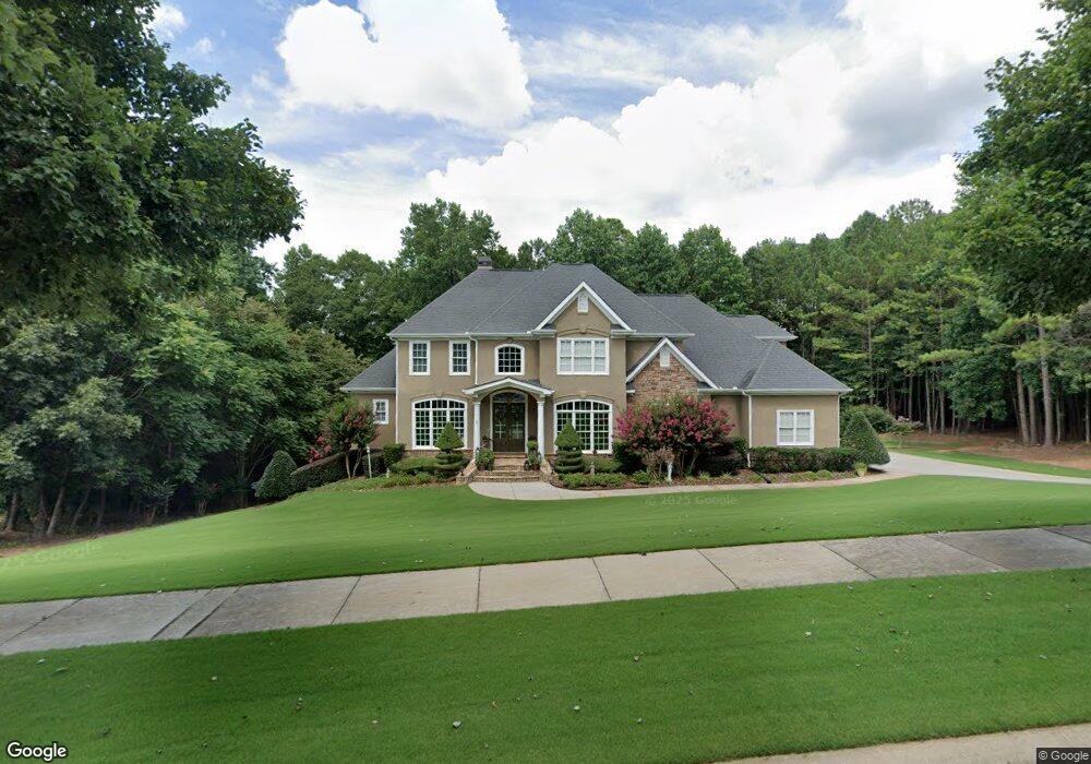
202 Dunquin Rock Tyrone, GA 30290
Estimated Value: $790,184 - $881,000
--
Bed
--
Bath
3,704
Sq Ft
$231/Sq Ft
Est. Value
About This Home
This home is located at 202 Dunquin Rock, Tyrone, GA 30290 and is currently estimated at $856,546, approximately $231 per square foot. 202 Dunquin Rock is a home located in Fayette County with nearby schools including Crabapple Lane Elementary School, Flat Rock Middle School, and Sandy Creek High School.
Ownership History
Date
Name
Owned For
Owner Type
Purchase Details
Closed on
Nov 12, 2003
Sold by
Kenny Johnson Homes Inc
Bought by
Wilkins Barry R and Wilkins Conniece
Current Estimated Value
Home Financials for this Owner
Home Financials are based on the most recent Mortgage that was taken out on this home.
Original Mortgage
$75,241
Outstanding Balance
$35,254
Interest Rate
6.04%
Mortgage Type
New Conventional
Estimated Equity
$821,292
Purchase Details
Closed on
Apr 16, 2003
Sold by
Lake Windsong Development Co Llc
Bought by
Kenny Johnson Homes Inc
Home Financials for this Owner
Home Financials are based on the most recent Mortgage that was taken out on this home.
Original Mortgage
$369,900
Interest Rate
5.6%
Create a Home Valuation Report for This Property
The Home Valuation Report is an in-depth analysis detailing your home's value as well as a comparison with similar homes in the area
Home Values in the Area
Average Home Value in this Area
Purchase History
| Date | Buyer | Sale Price | Title Company |
|---|---|---|---|
| Wilkins Barry R | $493,300 | -- | |
| Kenny Johnson Homes Inc | $73,000 | -- |
Source: Public Records
Mortgage History
| Date | Status | Borrower | Loan Amount |
|---|---|---|---|
| Open | Wilkins Barry R | $75,241 | |
| Open | Wilkins Barry R | $394,580 | |
| Previous Owner | Kenny Johnson Homes Inc | $369,900 |
Source: Public Records
Tax History Compared to Growth
Tax History
| Year | Tax Paid | Tax Assessment Tax Assessment Total Assessment is a certain percentage of the fair market value that is determined by local assessors to be the total taxable value of land and additions on the property. | Land | Improvement |
|---|---|---|---|---|
| 2024 | $4,728 | $321,580 | $42,000 | $279,580 |
| 2023 | $4,296 | $307,960 | $42,000 | $265,960 |
| 2022 | $4,578 | $267,600 | $42,000 | $225,600 |
| 2021 | $4,436 | $231,160 | $30,000 | $201,160 |
| 2020 | $4,530 | $216,920 | $30,000 | $186,920 |
| 2019 | $4,498 | $213,320 | $30,000 | $183,320 |
| 2018 | $6,356 | $201,960 | $30,000 | $171,960 |
| 2017 | $6,379 | $201,960 | $30,000 | $171,960 |
| 2016 | $5,730 | $178,080 | $22,800 | $155,280 |
| 2015 | $6,849 | $208,880 | $22,800 | $186,080 |
| 2014 | -- | $174,520 | $22,800 | $151,720 |
| 2013 | -- | $171,920 | $0 | $0 |
Source: Public Records
Map
Nearby Homes
- 135 Crimson Ridge
- 100 Ashland Trail
- 104 Ashland Trail
- 110 Kylemore Pass
- 2185 Castle Lake Dr
- 100 Clydesdale Ct
- 121 Northwoods Rd
- 28 Border Point
- 11 Line Creek Cir
- 200 Chaparral Trace
- 240 Lynnwood Ave
- 475 Castlewood Rd
- 575 Laurelwood Dr
- 130 E Crestwood Rd
- 95 Tyler Woods Dr
- 100 Leisure Trail
- 25 Sycamore Way
- 235 Ashmere Ct
- 152 Ardenlee Dr
- 105 Farmington Dr
- 200 Dunquin Rock
- 204 Dunquin Rock
- 311 Roundstone Rock Unit 83
- 311 Roundstone Rock
- 201 Dunquin Rock
- 201 Dunquin Rock Unit 15
- 106 Beresford Rd
- 313 Roundstone Rock Unit 82
- 309 Roundstone Rock Unit 84
- 203 Dunquin Rock
- 206 Dunquin Rock
- 307 Roundstone Rock
- 307 Roundstone Rock Unit 85
- 112 Beresford Rd
- 104 Beresford Rd
- 107 Beresford Rd
- 314 Roundstone Rock
- 110 Beresford Rd
- 109 Beresford Rd
- 105 Beresford Rd