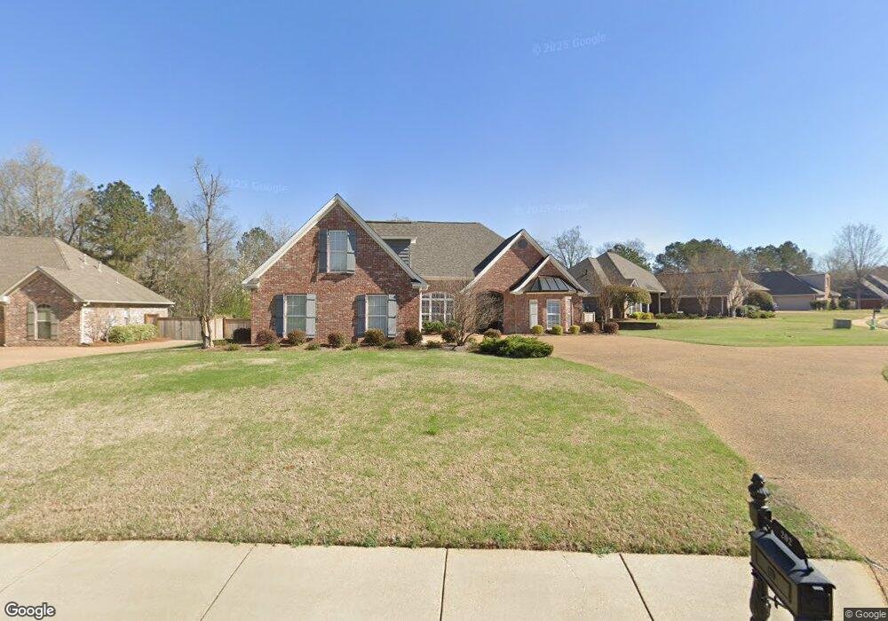
202 Legacy Dr Brandon, MS 39042
Estimated Value: $409,539 - $448,000
4
Beds
4
Baths
2,670
Sq Ft
$162/Sq Ft
Est. Value
About This Home
This home is located at 202 Legacy Dr, Brandon, MS 39042 and is currently estimated at $432,135, approximately $161 per square foot. 202 Legacy Dr is a home located in Rankin County with nearby schools including Rouse Elementary School, Brandon Elementary School, and Stonebridge Elementary School.
Ownership History
Date
Name
Owned For
Owner Type
Purchase Details
Closed on
Jun 5, 2007
Sold by
Orman John Thomas and Orman Margaret M
Bought by
Burrell Properties Inc
Current Estimated Value
Purchase Details
Closed on
Jan 16, 2007
Sold by
Eastside Development Inc
Bought by
Burrell Properties Inc
Purchase Details
Closed on
Dec 8, 2005
Sold by
Burrell Jeffery and Burrell Susan
Bought by
King David Jeffrey and King Donna S
Home Financials for this Owner
Home Financials are based on the most recent Mortgage that was taken out on this home.
Original Mortgage
$57,500
Interest Rate
6.29%
Create a Home Valuation Report for This Property
The Home Valuation Report is an in-depth analysis detailing your home's value as well as a comparison with similar homes in the area
Home Values in the Area
Average Home Value in this Area
Purchase History
| Date | Buyer | Sale Price | Title Company |
|---|---|---|---|
| Burrell Properties Inc | -- | -- | |
| Burrell Properties Inc | -- | -- | |
| King David Jeffrey | -- | Southern Title Services, Inc | |
| Burrell Jeffery D | -- | Southern Title Services, Inc |
Source: Public Records
Mortgage History
| Date | Status | Borrower | Loan Amount |
|---|---|---|---|
| Previous Owner | Burrell Jeffery D | $57,500 | |
| Previous Owner | Burrell Jeffery D | $145,795 |
Source: Public Records
Tax History
| Year | Tax Paid | Tax Assessment Tax Assessment Total Assessment is a certain percentage of the fair market value that is determined by local assessors to be the total taxable value of land and additions on the property. | Land | Improvement |
|---|---|---|---|---|
| 2025 | $3,516 | $28,830 | $0 | $0 |
| 2024 | $3,463 | $28,830 | $0 | $0 |
| 2023 | $2,946 | $30,072 | $0 | $0 |
| 2022 | $2,912 | $30,072 | $0 | $0 |
| 2021 | $3,580 | $30,072 | $0 | $0 |
| 2020 | $3,580 | $30,072 | $0 | $0 |
| 2019 | $3,224 | $26,736 | $0 | $0 |
| 2018 | $3,170 | $26,736 | $0 | $0 |
| 2017 | $3,170 | $26,736 | $0 | $0 |
| 2016 | $2,884 | $26,357 | $0 | $0 |
| 2015 | $2,884 | $26,357 | $0 | $0 |
| 2014 | $2,828 | $26,357 | $0 | $0 |
| 2013 | -- | $26,357 | $0 | $0 |
Source: Public Records
Map
Nearby Homes
- 2701 Highway 80 E
- 104 Meadowcreek Dr
- 0 Trickhambridge Rd
- 148 W Legacy Dr
- 1101 Susan Cove
- 109 W Legacy Dr
- 103 Pimlico Dr
- 2008 Brookstone Place
- 104 City Limits Rd
- 100 City Limits Rd
- 2743 U S 80
- 811 Osagian Cir
- 705 Brookwood Cir
- 1106 Pointe Cove
- 1104 Pointe Cove
- 105 Easthaven Dr
- 110 Trickhambridge Rd
- 0 Shiloh Rd Unit 4106044
- 1002 Eastview Cove
- 1 E Government St
Your Personal Tour Guide
Ask me questions while you tour the home.