Estimated Value: $279,000 - $319,000
3
Beds
1
Bath
1,109
Sq Ft
$266/Sq Ft
Est. Value
About This Home
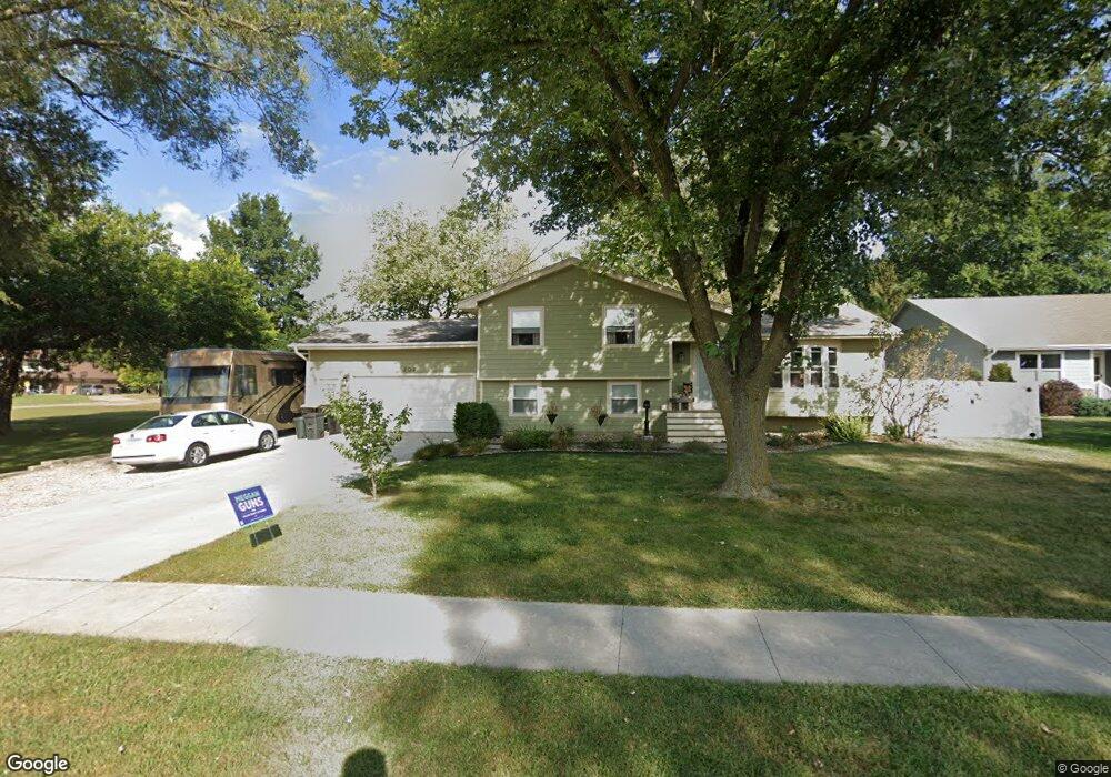
This home is located at 202 N 17th St, Adel, IA 50003 and is currently estimated at $294,987, approximately $265 per square foot. 202 N 17th St is a home located in Dallas County with nearby schools including Adel Elementary School, ADM Middle School, and DeSoto Intermediate School.
Ownership History
Date
Name
Owned For
Owner Type
Purchase Details
Closed on
Apr 23, 2014
Sold by
Hill Jacqueline and Hill David C
Bought by
Shepherd Robert and Fuller Sara
Current Estimated Value
Home Financials for this Owner
Home Financials are based on the most recent Mortgage that was taken out on this home.
Original Mortgage
$171,000
Outstanding Balance
$125,757
Interest Rate
3.5%
Mortgage Type
Adjustable Rate Mortgage/ARM
Estimated Equity
$169,230
Purchase Details
Closed on
Jun 13, 2006
Sold by
Sirva Relocation Llc
Bought by
Anderson Michael S and Anderson Melissa J
Home Financials for this Owner
Home Financials are based on the most recent Mortgage that was taken out on this home.
Original Mortgage
$137,000
Interest Rate
6.87%
Mortgage Type
Adjustable Rate Mortgage/ARM
Create a Home Valuation Report for This Property
The Home Valuation Report is an in-depth analysis detailing your home's value as well as a comparison with similar homes in the area
Home Values in the Area
Average Home Value in this Area
Purchase History
| Date | Buyer | Sale Price | Title Company |
|---|---|---|---|
| Shepherd Robert | $180,000 | None Available | |
| Anderson Michael S | $147,000 | Stewart Title Guaranty Compa |
Source: Public Records
Mortgage History
| Date | Status | Borrower | Loan Amount |
|---|---|---|---|
| Open | Shepherd Robert | $171,000 | |
| Previous Owner | Anderson Michael S | $137,000 |
Source: Public Records
Tax History Compared to Growth
Tax History
| Year | Tax Paid | Tax Assessment Tax Assessment Total Assessment is a certain percentage of the fair market value that is determined by local assessors to be the total taxable value of land and additions on the property. | Land | Improvement |
|---|---|---|---|---|
| 2024 | $4,992 | $295,120 | $40,000 | $255,120 |
| 2023 | $4,992 | $295,120 | $40,000 | $255,120 |
| 2022 | $4,076 | $259,090 | $40,000 | $219,090 |
| 2021 | $4,076 | $214,920 | $40,000 | $174,920 |
| 2020 | $3,784 | $200,110 | $40,000 | $160,110 |
| 2019 | $3,802 | $189,940 | $40,000 | $149,940 |
| 2018 | $3,802 | $182,620 | $40,000 | $142,620 |
| 2017 | $3,734 | $182,620 | $40,000 | $142,620 |
| 2016 | $3,530 | $178,800 | $39,280 | $139,520 |
| 2015 | $2,796 | $140,800 | $0 | $0 |
| 2014 | $2,796 | $140,800 | $0 | $0 |
Source: Public Records
Map
Nearby Homes
- 212 N 17th St
- 1522 Main St
- 1701 Main St
- 1910 Court St
- 418 N 15th St
- 1515 Chance Ct
- 1208 Rapids St
- 1519 Greene St
- 1307 Greene St
- 1316 Orchard St
- 402 S 11th St
- 2121 Greene St
- 1515 Aspen Dr
- 815 Grove St
- 212 Nile Kinnick Dr N
- 712 Rapids St
- 105 S 6th St
- 0 van Fossen Ln
- 820 Greenwood Hills Dr
- 1404 S 10th St