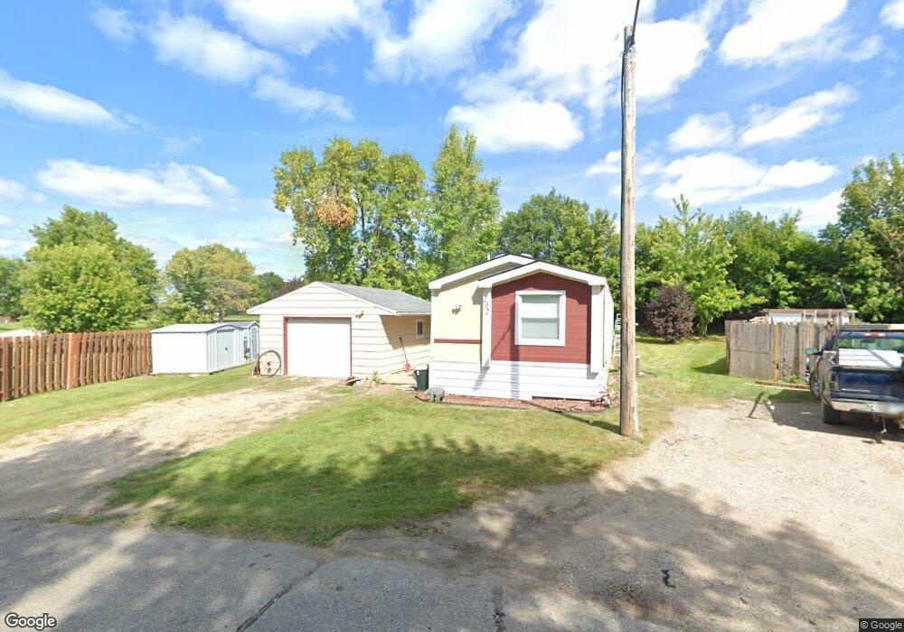
202 N Circle Dr Rothsay, MN 56579
Estimated Value: $59,036 - $182,000
Studio
--
Bath
1,184
Sq Ft
$112/Sq Ft
Est. Value
About This Home
This home is located at 202 N Circle Dr, Rothsay, MN 56579 and is currently estimated at $132,509, approximately $111 per square foot. 202 N Circle Dr is a home with nearby schools including Rothsay Elementary School and Rothsay Secondary School.
Create a Home Valuation Report for This Property
The Home Valuation Report is an in-depth analysis detailing your home's value as well as a comparison with similar homes in the area
Tax History
| Year | Tax Paid | Tax Assessment Tax Assessment Total Assessment is a certain percentage of the fair market value that is determined by local assessors to be the total taxable value of land and additions on the property. | Land | Improvement |
|---|---|---|---|---|
| 2025 | $502 | $32,600 | $4,300 | $28,300 |
| 2024 | $500 | $31,800 | $4,300 | $27,500 |
| 2023 | $376 | $23,000 | $4,300 | $18,700 |
| 2022 | $364 | $37,600 | $0 | $0 |
| 2021 | $264 | $23,000 | $4,300 | $18,700 |
| 2020 | $242 | $13,200 | $3,500 | $9,700 |
| 2019 | $226 | $11,600 | $3,500 | $8,100 |
| 2018 | $120 | $11,600 | $3,500 | $8,100 |
| 2017 | $134 | $11,100 | $3,500 | $7,600 |
| 2016 | $130 | $15,100 | $3,500 | $11,600 |
| 2015 | $178 | $0 | $0 | $0 |
| 2014 | -- | $19,100 | $3,500 | $15,600 |
Source: Public Records
Map
Nearby Homes
- 153 Center St N
- 3278 210th St
- TBD 250th St
- Lot 2 Jacobs Dr
- TBD Hwy 59
- Tbd
- 19319 380th St
- 110 S Niggeler St
- 101 W Broadway
- TBD 370th St
- Tbd 190th St
- (LOT B) TBD 100th Ave
- Tbd 190th St
- 18987 N Hidden Acres Loop
- TBD 190th St
- TBD1 190th St
- (LOT A) TBD 100th Ave
- 0 Tbd 100th Ave Unit LotWP004
- 0 Tbd 100th Ave Unit LotWP003 23378671
- 20619 Hillcrest Rd
Your Personal Tour Guide
Ask me questions while you tour the home.