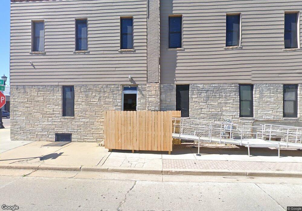
202 N Main St Davison, MI 48423
Estimated Value: $143,533
Studio
--
Bath
2,818
Sq Ft
$51/Sq Ft
Est. Value
About This Home
This home is located at 202 N Main St, Davison, MI 48423 and is currently priced at $143,533, approximately $50 per square foot. 202 N Main St is a home located in Genesee County with nearby schools including Thomson Elementary School, Hill Elementary School, and Gates Elementary School.
Ownership History
Date
Name
Owned For
Owner Type
Purchase Details
Closed on
Jun 27, 2013
Sold by
Perry Michael James and Perry Betty Jo
Bought by
Mjw Llc
Current Estimated Value
Purchase Details
Closed on
Oct 9, 2007
Sold by
Perry Michael
Bought by
Perry Michael James
Home Financials for this Owner
Home Financials are based on the most recent Mortgage that was taken out on this home.
Original Mortgage
$93,100
Interest Rate
6.49%
Mortgage Type
Commercial
Purchase Details
Closed on
Apr 11, 2007
Sold by
Ash Betty M
Bought by
Elga Cu
Create a Home Valuation Report for This Property
The Home Valuation Report is an in-depth analysis detailing your home's value as well as a comparison with similar homes in the area
Home Values in the Area
Average Home Value in this Area
Purchase History
| Date | Buyer | Sale Price | Title Company |
|---|---|---|---|
| Mjw Llc | $69,900 | Sargents Title Company | |
| Perry Michael James | -- | Cislo Title Co | |
| Elga Cu | $95,686 | None Available |
Source: Public Records
Mortgage History
| Date | Status | Borrower | Loan Amount |
|---|---|---|---|
| Previous Owner | Perry Michael James | $93,100 |
Source: Public Records
Tax History
| Year | Tax Paid | Tax Assessment Tax Assessment Total Assessment is a certain percentage of the fair market value that is determined by local assessors to be the total taxable value of land and additions on the property. | Land | Improvement |
|---|---|---|---|---|
| 2025 | $4,487 | $147,500 | $0 | $0 |
| 2024 | $1,946 | $129,600 | $0 | $0 |
| 2023 | $1,855 | $119,500 | $0 | $0 |
| 2022 | $4,021 | $107,000 | $0 | $0 |
| 2021 | $3,878 | $101,700 | $0 | $0 |
| 2020 | $1,608 | $92,900 | $0 | $0 |
| 2019 | $3,151 | $85,400 | $0 | $0 |
| 2018 | $3,468 | $61,800 | $0 | $0 |
| 2017 | $3,360 | $61,800 | $0 | $0 |
| 2016 | $3,330 | $60,400 | $0 | $0 |
| 2015 | $3,332 | $54,000 | $0 | $0 |
| 2012 | -- | $51,900 | $12,500 | $39,400 |
Source: Public Records
Map
Nearby Homes
- 216 N Genesee St
- 322 North Dr
- 505 N Main St
- 230 W Flint St
- 511 Garland St
- 334 E Clark St Unit 340 344
- 625 Charles St
- 603 E Chelsea Cir
- 10294 Carriage Way
- 612 Carriage Way
- 0000 S State Rd
- 0 Davison Rd Unit 218068693
- 611 W Flint St
- 726 W 2nd St
- 000 Davison Rd
- 436 Gary Ray Dr
- 730 Natalia Dr
- 801 Hemlock Dr
- 502 Gary Ray Dr
- 9216 Davison Rd
- 220 N Main St
- 3 N Main St
- 211 N Main St
- 222 N Main St Unit 1166
- 222 N Main St
- 3 S Main St
- 203 N Davison St
- 213 N Davison St
- 205 E 2nd St
- 219 N Davison St
- 219 N Davison St Unit 221 N. Davison st. A
- 219 N Davison St Unit 219 N. Davison St. A
- 000000 N State Rd
- 221 N Davison St
- 221 N Davison St Unit . 1
- 111 E 2nd St
- 227 N Davison St
- 316 N Main St
- 302 Mill St
- 303 N Davison St
Your Personal Tour Guide
Ask me questions while you tour the home.