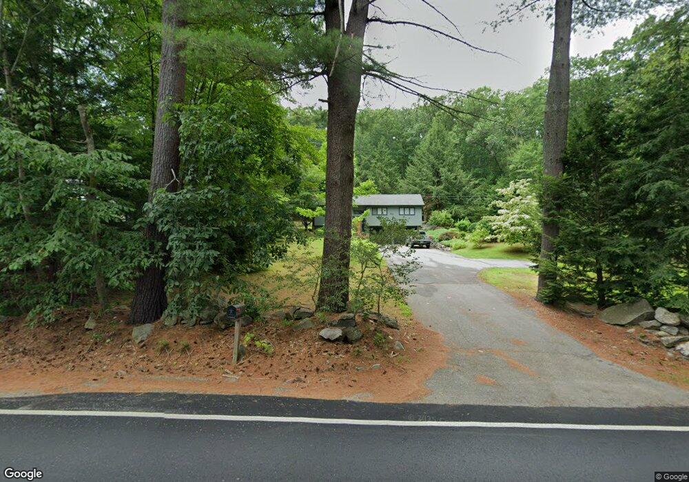
202 S Merrimack Rd Hollis, NH 03049
Hollis NeighborhoodEstimated Value: $533,000 - $605,000
3
Beds
2
Baths
1,384
Sq Ft
$406/Sq Ft
Est. Value
About This Home
This home is located at 202 S Merrimack Rd, Hollis, NH 03049 and is currently estimated at $562,067, approximately $406 per square foot. 202 S Merrimack Rd is a home with nearby schools including Hollis Primary School, Hollis Upper Elementary School, and Hollis-Brookline Middle School.
Ownership History
Date
Name
Owned For
Owner Type
Purchase Details
Closed on
May 23, 2023
Sold by
Carmichael Brian D
Bought by
Carmichael Ft
Current Estimated Value
Purchase Details
Closed on
Jul 9, 2003
Sold by
Deschamps Walter J and Deschamps Andrea L
Bought by
Carmichael Brian D
Home Financials for this Owner
Home Financials are based on the most recent Mortgage that was taken out on this home.
Original Mortgage
$205,600
Interest Rate
5.45%
Mortgage Type
Purchase Money Mortgage
Create a Home Valuation Report for This Property
The Home Valuation Report is an in-depth analysis detailing your home's value as well as a comparison with similar homes in the area
Home Values in the Area
Average Home Value in this Area
Purchase History
| Date | Buyer | Sale Price | Title Company |
|---|---|---|---|
| Carmichael Ft | -- | None Available | |
| Carmichael Brian D | $257,000 | -- |
Source: Public Records
Mortgage History
| Date | Status | Borrower | Loan Amount |
|---|---|---|---|
| Previous Owner | Carmichael Brian D | $205,600 |
Source: Public Records
Tax History Compared to Growth
Tax History
| Year | Tax Paid | Tax Assessment Tax Assessment Total Assessment is a certain percentage of the fair market value that is determined by local assessors to be the total taxable value of land and additions on the property. | Land | Improvement |
|---|---|---|---|---|
| 2024 | $8,354 | $471,200 | $230,300 | $240,900 |
| 2023 | $7,850 | $471,200 | $230,300 | $240,900 |
| 2022 | $10,635 | $471,200 | $230,300 | $240,900 |
| 2021 | $6,653 | $293,100 | $153,300 | $139,800 |
| 2020 | $7,175 | $293,100 | $153,300 | $139,800 |
| 2019 | $7,344 | $293,100 | $153,300 | $139,800 |
| 2018 | $6,351 | $293,100 | $153,300 | $139,800 |
| 2017 | $6,082 | $262,700 | $131,300 | $131,400 |
| 2016 | $0 | $262,700 | $131,300 | $131,400 |
| 2015 | $6,047 | $262,700 | $131,300 | $131,400 |
| 2014 | $6,097 | $263,600 | $132,200 | $131,400 |
| 2013 | $6,015 | $263,600 | $132,200 | $131,400 |
Source: Public Records
Map
Nearby Homes
- 77 Mooar Hill Rd
- 8 Pilgrim Cir
- 4-13 Woodmont Dr
- 25 Eastern Ave
- 3 Roedean Dr Unit C-207
- 201 Millwright Dr
- 77 Deerwood Dr Unit E
- 75 Deerwood Dr Unit B
- 5 Dumaine Ave Unit B
- 5 Dumaine Ave Unit N
- 16 Captain Danforth Ln
- 6 Veterans Rd Unit 15
- 40-40A Pine Hill Rd
- 10 Drouin Way
- 102 Silver Lake Rd
- 199 Pine Hill Rd
- 15 Four Winds Rd
- 3 Wood Ln
- 66 Tinker Rd
- 26 Andover Down Unit 276
- 198 S Merrimack Rd
- 201 S Merrimack Rd
- 196 S Merrimack Rd
- Lot S Merrimack Rd
- 9 Farm Pond Ln
- 190 S Merrimack Rd
- 7 Farm Pond Ln
- 2 Marion Dr
- 19 Marion Dr
- 10 Farm Pond Ln
- 210 S Merrimack Rd
- 185 S Merrimack Rd
- 184 S Merrimack Rd
- 10 Marion Dr
- 6 Marion Dr
- 14 Marion Dr
- 6 Farm Pond Ln
- 20 Marion Dr
- 180 S Merrimack Rd
- 179 S Merrimack Rd