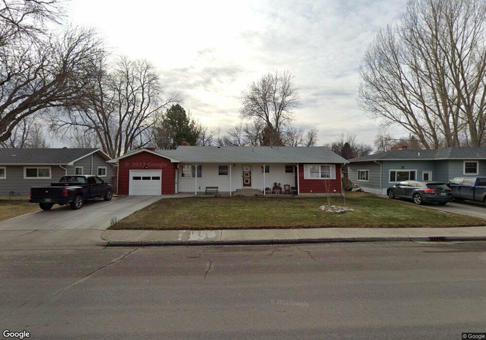
2020 Colton Blvd Billings, MT 59102
North Central Billings NeighborhoodEstimated Value: $310,000 - $371,000
3
Beds
2
Baths
1,244
Sq Ft
$268/Sq Ft
Est. Value
About This Home
This home is located at 2020 Colton Blvd, Billings, MT 59102 and is currently estimated at $333,441, approximately $268 per square foot. 2020 Colton Blvd is a home located in Yellowstone County with nearby schools including Rose Park School, Lewis & Clark Junior High School, and Billings Senior High School.
Ownership History
Date
Name
Owned For
Owner Type
Purchase Details
Closed on
Apr 1, 2019
Sold by
Benoit Bruce A
Bought by
Benoit Ruth E and Benoit Lynn E
Current Estimated Value
Home Financials for this Owner
Home Financials are based on the most recent Mortgage that was taken out on this home.
Original Mortgage
$123,500
Outstanding Balance
$108,578
Interest Rate
4.3%
Mortgage Type
New Conventional
Estimated Equity
$224,863
Purchase Details
Closed on
Aug 30, 2010
Sold by
Benoit Albert G
Bought by
Benoit Ruth E
Create a Home Valuation Report for This Property
The Home Valuation Report is an in-depth analysis detailing your home's value as well as a comparison with similar homes in the area
Home Values in the Area
Average Home Value in this Area
Purchase History
| Date | Buyer | Sale Price | Title Company |
|---|---|---|---|
| Benoit Ruth E | -- | First Montana Title Co | |
| Benoit Ruth E | -- | None Available |
Source: Public Records
Mortgage History
| Date | Status | Borrower | Loan Amount |
|---|---|---|---|
| Open | Benoit Ruth E | $123,500 |
Source: Public Records
Tax History Compared to Growth
Tax History
| Year | Tax Paid | Tax Assessment Tax Assessment Total Assessment is a certain percentage of the fair market value that is determined by local assessors to be the total taxable value of land and additions on the property. | Land | Improvement |
|---|---|---|---|---|
| 2025 | $2,735 | $318,100 | $54,363 | $263,737 |
| 2024 | $2,735 | $282,300 | $51,699 | $230,601 |
| 2023 | $2,740 | $282,300 | $51,699 | $230,601 |
| 2022 | $2,513 | $227,400 | $0 | $0 |
| 2021 | $2,172 | $204,400 | $0 | $0 |
| 2020 | $2,116 | $190,600 | $0 | $0 |
| 2019 | $2,020 | $190,600 | $0 | $0 |
| 2018 | $1,974 | $182,900 | $0 | $0 |
| 2017 | $1,917 | $182,900 | $0 | $0 |
| 2016 | $1,760 | $169,400 | $0 | $0 |
| 2015 | $1,721 | $169,400 | $0 | $0 |
| 2014 | $1,666 | $87,397 | $0 | $0 |
Source: Public Records
Map
Nearby Homes
- 1944 Colton Blvd
- 2124 Dahlia Ln
- 2035 Avenue D
- 1833 Iris Ln
- 1607 21st St W
- 1734 Mariposa Ln
- 2414 Ivy Ln
- 2510 Terrace Dr
- 2230 Avenue C
- 2260 Avenue C
- 2618 Sunnyview Ln
- 2219 Avenue B
- 2020 Plaza Dr
- 2718 Terrace Dr
- 9 Stanford Ct
- 2030 Rimrock Rd
- 2620 Woody Dr
- 2042 Green Terrace Dr
- 2136 Green Terrace Dr
- 2060 Edgewood Dr
- 2014 Colton Blvd
- 2026 Colton Blvd
- 2021 Beverly Hill Blvd
- 2025 Beverly Hill Blvd
- 2008 Colton Blvd
- 2032 Colton Blvd
- 2015 Beverly Hill Blvd
- 2031 Beverly Hill Blvd
- 2025 Colton Blvd
- 2009 Beverly Hill Blvd
- 2019 Colton Blvd
- 2038 Colton Blvd
- 2002 Colton Blvd
- 2033 Colton Blvd
- 2037 Beverly Hill Blvd
- 2003 Beverly Hill Blvd
- 2044 Colton Blvd
- 2011 Colton Blvd
- 2045 Beverly Hill Blvd
- 2117 21st St W