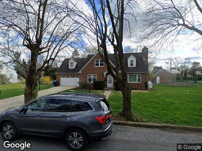
2020 Harold Ave Allentown, PA 18104
South Whitehall Township NeighborhoodEstimated Value: $389,000 - $509,000
4
Beds
2
Baths
1,964
Sq Ft
$215/Sq Ft
Est. Value
About This Home
This home is located at 2020 Harold Ave, Allentown, PA 18104 and is currently estimated at $421,940, approximately $214 per square foot. 2020 Harold Ave is a home located in Lehigh County with nearby schools including Kratzer Elementary School, Orefield Middle School, and Parkland High School.
Ownership History
Date
Name
Owned For
Owner Type
Purchase Details
Closed on
May 31, 2007
Sold by
Smith Bonit Al
Bought by
Tobias Matthew
Current Estimated Value
Home Financials for this Owner
Home Financials are based on the most recent Mortgage that was taken out on this home.
Original Mortgage
$54,000
Interest Rate
6.17%
Mortgage Type
Unknown
Purchase Details
Closed on
Aug 13, 2005
Sold by
Tobias Matthew L and Tobias Pamela F
Bought by
Tobias Matthew L and Tobias Pamela F
Purchase Details
Closed on
Jan 10, 2003
Sold by
Emory Lois R and Roth William J
Bought by
Tobias Matthew L and Reiert Pamela F
Home Financials for this Owner
Home Financials are based on the most recent Mortgage that was taken out on this home.
Original Mortgage
$150,575
Interest Rate
6.18%
Mortgage Type
Purchase Money Mortgage
Create a Home Valuation Report for This Property
The Home Valuation Report is an in-depth analysis detailing your home's value as well as a comparison with similar homes in the area
Home Values in the Area
Average Home Value in this Area
Purchase History
| Date | Buyer | Sale Price | Title Company |
|---|---|---|---|
| Tobias Matthew | $60,000 | -- | |
| Tobias Matthew L | -- | -- | |
| Tobias Matthew L | $158,500 | -- |
Source: Public Records
Mortgage History
| Date | Status | Borrower | Loan Amount |
|---|---|---|---|
| Open | Tobias Matthew L | $130,800 | |
| Closed | Tobias Matthew L | $54,000 | |
| Previous Owner | Tobias Matthew L | $150,575 |
Source: Public Records
Tax History Compared to Growth
Tax History
| Year | Tax Paid | Tax Assessment Tax Assessment Total Assessment is a certain percentage of the fair market value that is determined by local assessors to be the total taxable value of land and additions on the property. | Land | Improvement |
|---|---|---|---|---|
| 2025 | $6,051 | $248,800 | $43,500 | $205,300 |
| 2024 | $5,847 | $248,800 | $43,500 | $205,300 |
| 2023 | $5,722 | $248,800 | $43,500 | $205,300 |
| 2022 | $5,700 | $248,800 | $205,300 | $43,500 |
| 2021 | $5,700 | $248,800 | $43,500 | $205,300 |
| 2020 | $5,700 | $248,800 | $43,500 | $205,300 |
| 2019 | $5,593 | $248,800 | $43,500 | $205,300 |
| 2018 | $5,409 | $248,800 | $43,500 | $205,300 |
| 2017 | $5,222 | $248,800 | $43,500 | $205,300 |
| 2016 | -- | $248,800 | $43,500 | $205,300 |
| 2015 | -- | $248,800 | $43,500 | $205,300 |
| 2014 | -- | $248,800 | $43,500 | $205,300 |
Source: Public Records
Map
Nearby Homes
- 2210 Grove St
- 0 Maria Ln
- 1959 Whitehall Ave
- 1150 N 19th St
- 1825 W Columbia St
- 1813 W Pennsylvania St Unit 1819
- 1590 Abigail Ln Unit LOT 59
- 1590 Abigail Ln
- 2357 Albright Ave
- 1424 Mauch Chunk Rd
- 1134 N 26th St
- 1713-1717 Greenleaf St
- 1319 Overlook Rd
- 2203 W Washington St
- 1735 W Washington St
- 736 N 19th St
- 814 N 16th St
- 1131 N 28th St
- 2820 W Pennsylvania St
- 933 N 14th St Unit 935
- 2020 Harold Ave
- 2030 Harold Ave Unit 2036
- 2010 Harold Ave
- 2036 Harold Ave
- 2015 Huckleberry Rd
- 2025 Huckleberry Rd
- 2015 Harold Ave
- 1608 N 20th St
- 2002 Harold Ave
- 2033 Huckleberry Rd
- 2034 Custer St
- 2005 Huckleberry Rd
- 1624 N 20th St
- 2039 Huckleberry Rd
- 1999 Harold Ave
- 2038 Custer St
- 2045 Huckleberry Rd
- 1998 Harold Ave
- 2019 Custer St
- 2015 Custer St