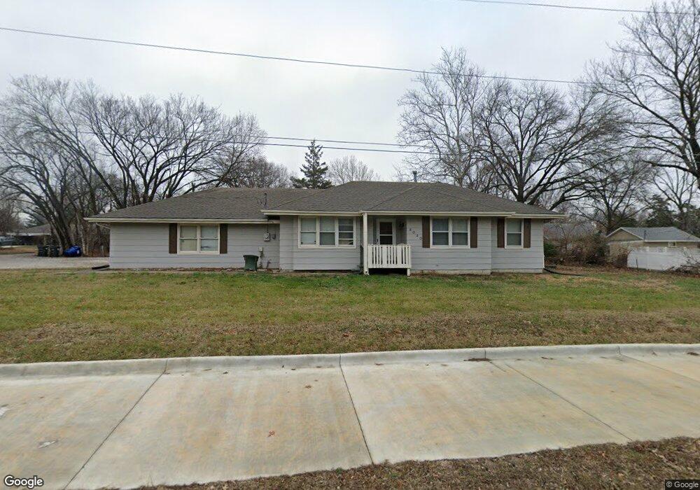
2020 Naismith Dr Lawrence, KS 66046
Centennial NeighborhoodEstimated Value: $281,000 - $302,000
4
Beds
2
Baths
1,150
Sq Ft
$256/Sq Ft
Est. Value
About This Home
This home is located at 2020 Naismith Dr, Lawrence, KS 66046 and is currently estimated at $294,270, approximately $255 per square foot. 2020 Naismith Dr is a home located in Douglas County with nearby schools including Cordley Elementary School, Liberty Memorial Central Middle School, and Lawrence High School.
Ownership History
Date
Name
Owned For
Owner Type
Purchase Details
Closed on
Aug 24, 2007
Sold by
Keating Robert L and Keating Marlene R
Bought by
Keating Joe and Keating Gina
Current Estimated Value
Purchase Details
Closed on
Apr 29, 2002
Sold by
Keating Robert L
Bought by
Keating Robert L and Keating Marlene R
Home Financials for this Owner
Home Financials are based on the most recent Mortgage that was taken out on this home.
Original Mortgage
$53,400
Interest Rate
6.92%
Mortgage Type
Credit Line Revolving
Create a Home Valuation Report for This Property
The Home Valuation Report is an in-depth analysis detailing your home's value as well as a comparison with similar homes in the area
Home Values in the Area
Average Home Value in this Area
Purchase History
| Date | Buyer | Sale Price | Title Company |
|---|---|---|---|
| Keating Joe | -- | None Available | |
| Keating Robert L | -- | -- |
Source: Public Records
Mortgage History
| Date | Status | Borrower | Loan Amount |
|---|---|---|---|
| Previous Owner | Keating Robert L | $53,400 |
Source: Public Records
Tax History Compared to Growth
Tax History
| Year | Tax Paid | Tax Assessment Tax Assessment Total Assessment is a certain percentage of the fair market value that is determined by local assessors to be the total taxable value of land and additions on the property. | Land | Improvement |
|---|---|---|---|---|
| 2025 | $3,993 | $33,925 | $9,200 | $24,725 |
| 2024 | $3,993 | $32,465 | $8,625 | $23,840 |
| 2023 | $3,783 | $29,590 | $6,900 | $22,690 |
| 2022 | $3,533 | $27,462 | $6,325 | $21,137 |
| 2021 | $3,026 | $22,748 | $5,175 | $17,573 |
| 2020 | $2,893 | $21,873 | $5,175 | $16,698 |
| 2019 | $2,756 | $20,872 | $4,947 | $15,925 |
| 2018 | $2,725 | $20,493 | $4,720 | $15,773 |
| 2017 | $2,643 | $19,665 | $4,720 | $14,945 |
| 2016 | $2,412 | $18,768 | $4,025 | $14,743 |
| 2015 | -- | $18,699 | $4,025 | $14,674 |
| 2014 | -- | $18,619 | $4,025 | $14,594 |
Source: Public Records
Map
Nearby Homes
- 1620 W 20th Terrace
- 1807 Alabama St
- 1742 Alabama St
- 1738 W 20th St
- 1800 Mississippi St
- 2439 Jasu Dr
- 1114 W 25th St
- 1639 Indiana St
- 731 W 25th St
- 2234 Tennessee St
- 2045 Massachusetts St
- 2301 Massachusetts St
- 2042 New Hampshire St
- 314 Oklahoma St
- 1613 Vermont St
- 2106 Rhode Island St
- 1824 New Hampshire St
- 1203 W 20th Terrace
- 1214 W 21st St
- 1216 W 21st St
- 1009 W 20th Terrace
- 1206 W 20th Terrace
- 1003 W 20th Terrace
- 2005 Mitchell Rd
- 2005 Mitchell St
- 1200 W 21st St
- 2008 Mitchell St
- 2033 Naismith Dr
- 2039 Naismith Dr
- 1302 W 21st St
- 2027 Naismith Dr
- 2021 Naismith Dr
- 2006 Mitchell Rd
- 927 W 20th Terrace
- 1209 W 21st St
- 1207 W 21st St
- 2006 Mitchell St