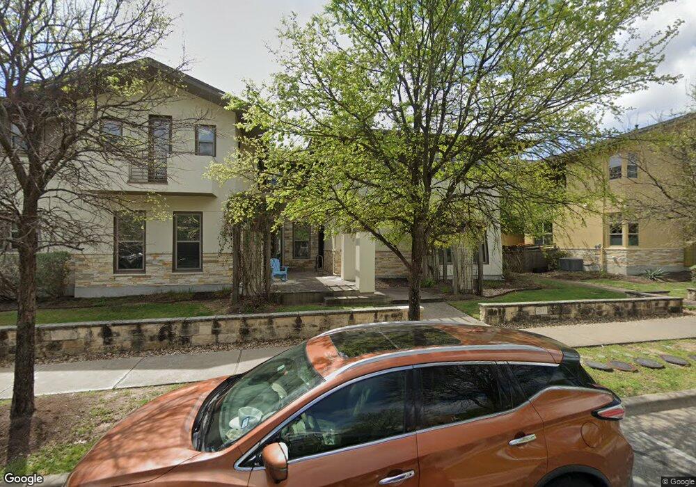
2021 Simond Ave Unit A Austin, TX 78723
Mueller NeighborhoodEstimated Value: $425,271 - $638,000
2
Beds
2
Baths
1,333
Sq Ft
$416/Sq Ft
Est. Value
About This Home
This home is located at 2021 Simond Ave Unit A, Austin, TX 78723 and is currently estimated at $554,568, approximately $416 per square foot. 2021 Simond Ave Unit A is a home located in Travis County with nearby schools including Maplewood Elementary School, Kealing Middle School, and McCallum High School.
Ownership History
Date
Name
Owned For
Owner Type
Purchase Details
Closed on
Nov 14, 2011
Sold by
Standard Pacific Of Texas Inc
Bought by
Guzman Raimunda
Current Estimated Value
Home Financials for this Owner
Home Financials are based on the most recent Mortgage that was taken out on this home.
Original Mortgage
$146,600
Outstanding Balance
$99,822
Interest Rate
3.99%
Mortgage Type
New Conventional
Estimated Equity
$454,746
Create a Home Valuation Report for This Property
The Home Valuation Report is an in-depth analysis detailing your home's value as well as a comparison with similar homes in the area
Home Values in the Area
Average Home Value in this Area
Purchase History
| Date | Buyer | Sale Price | Title Company |
|---|---|---|---|
| Guzman Raimunda | -- | First American Title |
Source: Public Records
Mortgage History
| Date | Status | Borrower | Loan Amount |
|---|---|---|---|
| Open | Guzman Raimunda | $146,600 |
Source: Public Records
Tax History
| Year | Tax Paid | Tax Assessment Tax Assessment Total Assessment is a certain percentage of the fair market value that is determined by local assessors to be the total taxable value of land and additions on the property. | Land | Improvement |
|---|---|---|---|---|
| 2025 | $5,994 | $395,804 | $82,926 | $312,878 |
| 2023 | $5,368 | $380,279 | $0 | $0 |
| 2022 | $6,827 | $345,708 | $0 | $0 |
| 2021 | $6,841 | $314,280 | $36,856 | $346,421 |
| 2020 | $6,128 | $285,709 | $36,856 | $347,957 |
| 2018 | $5,228 | $236,123 | $36,856 | $282,144 |
| 2017 | $4,787 | $214,657 | $36,856 | $263,172 |
| 2016 | $4,352 | $195,143 | $36,856 | $265,970 |
| 2015 | $3,462 | $177,403 | $36,856 | $148,275 |
| 2014 | $3,462 | $161,275 | $0 | $0 |
Source: Public Records
Map
Nearby Homes
- 4301 Berkman Dr Unit A
- 4323 Nitschke St
- 4512 Ruiz St
- 4513 Kocurek St
- 4517 Kocurek St
- 2237 Zach Scott St
- 4533 Mattie St
- 4617 Herzog St
- 1400 Robert Browning St
- 2405 Moreno St
- 4644 Page St
- 2508 Simond Ave Unit C
- 2508 Simond Ave Unit B
- 2517 Simond Ave Unit B
- 2133 Emma Long St
- 2811 Zach Scott St
- 2510 Doc Reeves St
- 2906 Zach Scott St
- 4720 Page St
- 2524 Doc Reeves St
- 2021 Simond Ave Unit C
- 2021 Simond Ave Unit B
- 2021 Simond Ave Unit D
- 2017 Simond Ave Unit C
- 2017 Simond Ave Unit A
- 2017 Simond Ave Unit B
- 2017 Simond Ave Unit D
- 2025 Simond Ave Unit C
- 2025 Simond Ave Unit B
- 2025 Simond Ave Unit D
- 2017 Simond Ave D
- 4440 Camacho St
- 4436 Camacho St
- 4444 Camacho St
- 4432 Camacho St
- 4300 Berkman Dr Unit C
- 4300 Berkman Dr Unit A
- 4300 Berkman Dr Unit B
- 4300 Berkman Dr Unit F
- 4300 Berkman Dr Unit D
Your Personal Tour Guide
Ask me questions while you tour the home.