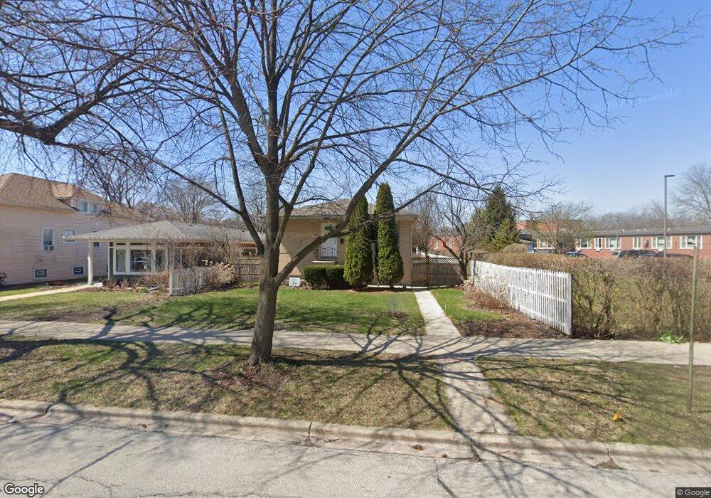
2022 Brown Ave Evanston, IL 60201
West Evanston NeighborhoodEstimated Value: $423,000 - $559,081
3
Beds
3
Baths
1,456
Sq Ft
$324/Sq Ft
Est. Value
About This Home
This home is located at 2022 Brown Ave, Evanston, IL 60201 and is currently estimated at $472,270, approximately $324 per square foot. 2022 Brown Ave is a home located in Cook County with nearby schools including Kingsley Elementary School, Haven Middle School, and Evanston Township High School.
Ownership History
Date
Name
Owned For
Owner Type
Purchase Details
Closed on
Jun 8, 2017
Sold by
V & T Investments Corp
Bought by
Branch Rahim and Branch Riva
Current Estimated Value
Home Financials for this Owner
Home Financials are based on the most recent Mortgage that was taken out on this home.
Original Mortgage
$269,200
Outstanding Balance
$221,628
Interest Rate
4%
Mortgage Type
New Conventional
Estimated Equity
$250,642
Purchase Details
Closed on
Dec 16, 2016
Sold by
Brauer Mccarhy Marilyn
Bought by
V & T Investment Corp
Purchase Details
Closed on
Aug 30, 2000
Sold by
Maroto Enrique and Maroto Sonia
Bought by
Mccarthy Michael D and Brauer Mccarthy Marilyn
Home Financials for this Owner
Home Financials are based on the most recent Mortgage that was taken out on this home.
Original Mortgage
$213,549
Interest Rate
7.96%
Mortgage Type
FHA
Create a Home Valuation Report for This Property
The Home Valuation Report is an in-depth analysis detailing your home's value as well as a comparison with similar homes in the area
Home Values in the Area
Average Home Value in this Area
Purchase History
| Date | Buyer | Sale Price | Title Company |
|---|---|---|---|
| Branch Rahim | $336,500 | First American Title | |
| V & T Investment Corp | $164,000 | None Available | |
| Mccarthy Michael D | -- | Professional National Title |
Source: Public Records
Mortgage History
| Date | Status | Borrower | Loan Amount |
|---|---|---|---|
| Open | Branch Rahim | $269,200 | |
| Previous Owner | Mccarthy Michael D | $213,549 |
Source: Public Records
Tax History
| Year | Tax Paid | Tax Assessment Tax Assessment Total Assessment is a certain percentage of the fair market value that is determined by local assessors to be the total taxable value of land and additions on the property. | Land | Improvement |
|---|---|---|---|---|
| 2025 | $7,428 | $44,001 | $12,398 | $31,603 |
| 2024 | $7,428 | $34,000 | $10,260 | $23,740 |
| 2023 | $7,103 | $34,000 | $10,260 | $23,740 |
| 2022 | $7,103 | $34,000 | $10,260 | $23,740 |
| 2021 | $6,762 | $28,810 | $9,405 | $19,405 |
| 2020 | $6,731 | $28,810 | $9,405 | $19,405 |
| 2019 | $6,764 | $32,299 | $9,405 | $22,894 |
| 2018 | $6,907 | $25,211 | $7,695 | $17,516 |
| 2017 | $5,826 | $25,211 | $7,695 | $17,516 |
| 2016 | $5,748 | $25,211 | $7,695 | $17,516 |
| 2015 | $6,725 | $27,706 | $6,626 | $21,080 |
| 2014 | $6,676 | $27,706 | $6,626 | $21,080 |
| 2013 | $6,507 | $27,706 | $6,626 | $21,080 |
Source: Public Records
Map
Nearby Homes
- 1822 Brown Ave
- 1813 Dodge Ave
- 1811 Hartrey Ave
- 1915 Grant St
- 2017 Jackson Ave
- 1915 - 2 Grant St
- 1813 Lincoln St
- 2356 Ashland Ave
- 2505 Prairie Ave Unit 2K
- 2701 Noyes St
- 2215 Wesley Ave
- 2515 Prairie Ave Unit 1E
- 2043 Asbury Ave
- 1228 Emerson St Unit 304
- 1735 Asbury Ave
- 2810 Simpson St
- 1834 Ridge Ave Unit 102
- 2201 Central St Unit 3N
- 2324 Central St Unit 2B
- 1201 Noyes St
- 2020 Brown Ave
- 2016 Brown Ave
- 2014 Brown Ave
- 2012 Brown Ave
- 2023 Grey Ave
- 2021 Grey Ave
- 2019 Grey Ave
- 2017 Grey Ave
- 2017 Grey Ave
- 2007 Foster St
- 2013 Grey Ave
- 2011 Foster St
- 2021 Brown Ave
- 2025 Brown Ave
- 2027 Brown Ave
- 2019 Brown Ave
- 2015 Foster St
- 2005 Foster St
- 2005 Foster St Unit GDN
- 2011 Grey Ave
Your Personal Tour Guide
Ask me questions while you tour the home.