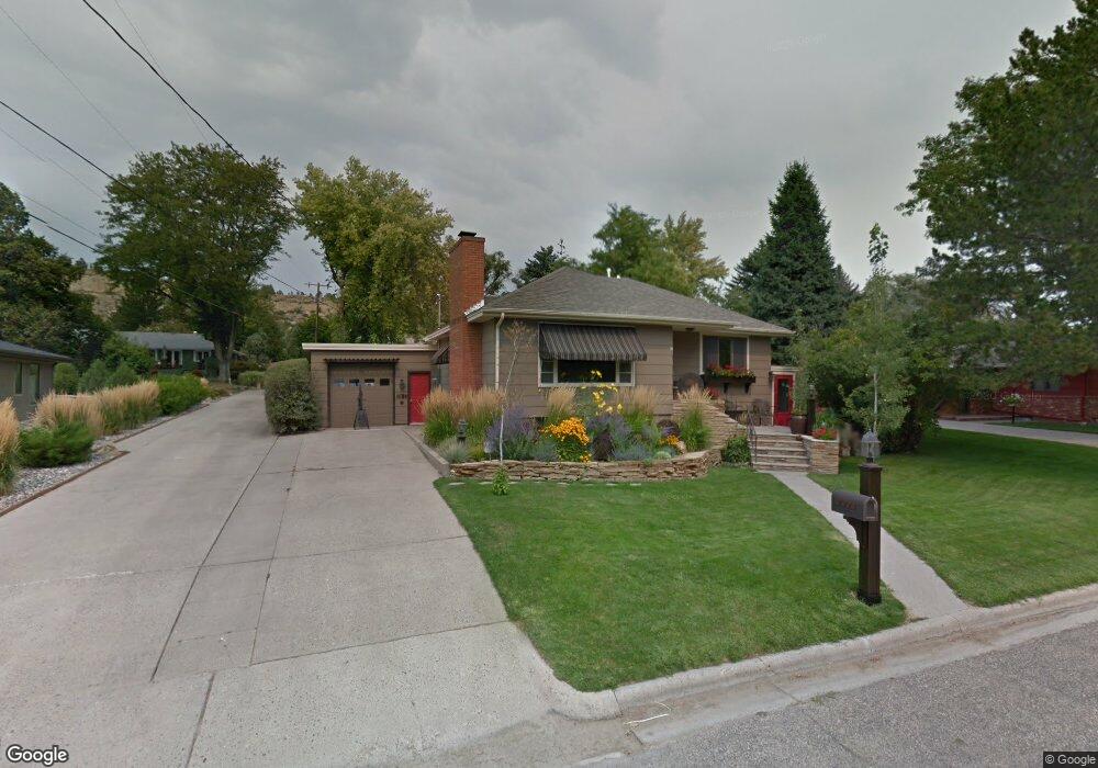
2023 Pryor Ln Billings, MT 59102
North Central Billings NeighborhoodEstimated Value: $304,000 - $392,000
4
Beds
2
Baths
1,824
Sq Ft
$189/Sq Ft
Est. Value
About This Home
This home is located at 2023 Pryor Ln, Billings, MT 59102 and is currently estimated at $344,689, approximately $188 per square foot. 2023 Pryor Ln is a home located in Yellowstone County with nearby schools including Poly Drive School, Lewis & Clark Junior High School, and Billings Senior High School.
Ownership History
Date
Name
Owned For
Owner Type
Purchase Details
Closed on
Apr 2, 2012
Sold by
Cox Thomas A and Estate Of Patrick Cox
Bought by
Eliason Steven E
Current Estimated Value
Home Financials for this Owner
Home Financials are based on the most recent Mortgage that was taken out on this home.
Original Mortgage
$153,900
Outstanding Balance
$105,898
Interest Rate
3.83%
Mortgage Type
New Conventional
Estimated Equity
$238,791
Create a Home Valuation Report for This Property
The Home Valuation Report is an in-depth analysis detailing your home's value as well as a comparison with similar homes in the area
Home Values in the Area
Average Home Value in this Area
Purchase History
| Date | Buyer | Sale Price | Title Company |
|---|---|---|---|
| Eliason Steven E | -- | St |
Source: Public Records
Mortgage History
| Date | Status | Borrower | Loan Amount |
|---|---|---|---|
| Open | Eliason Steven E | $153,900 |
Source: Public Records
Tax History Compared to Growth
Tax History
| Year | Tax Paid | Tax Assessment Tax Assessment Total Assessment is a certain percentage of the fair market value that is determined by local assessors to be the total taxable value of land and additions on the property. | Land | Improvement |
|---|---|---|---|---|
| 2025 | $2,548 | $333,200 | $54,024 | $279,176 |
| 2024 | $2,548 | $260,300 | $51,384 | $208,916 |
| 2023 | $2,557 | $260,300 | $51,384 | $208,916 |
| 2022 | $2,162 | $229,000 | $0 | $0 |
| 2021 | $2,420 | $229,000 | $0 | $0 |
| 2020 | $2,370 | $214,700 | $0 | $0 |
| 2019 | $2,261 | $214,700 | $0 | $0 |
| 2018 | $2,202 | $205,100 | $0 | $0 |
| 2017 | $2,139 | $205,100 | $0 | $0 |
| 2016 | $2,024 | $196,400 | $0 | $0 |
| 2015 | $1,979 | $196,400 | $0 | $0 |
| 2014 | $1,565 | $80,984 | $0 | $0 |
Source: Public Records
Map
Nearby Homes
- 2042 Green Terrace Dr
- 2206 Green Terrace Dr
- 1833 Iris Ln
- 3226 Country Club Cir
- 2124 Dahlia Ln
- 1944 Colton Blvd
- 2021 Beverly Hill Blvd
- 1734 Mariposa Ln
- 2907 Brentwood Ln
- 2422 Brentwood Ln
- 1745 Parkhill Dr
- 2911 E Macdonald Dr
- 3441 Masterson Cir
- 2035 Avenue D
- 3540 Masterson Cir
- 2420 Elizabeth St
- 1921 Eastridge Dr
- 2644 Rimrock Rd
- 2060 Edgewood Dr
- 46 Shadow Place Unit 6B